
You never know where a blessing can come from.
Teena Marie
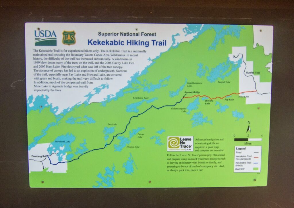
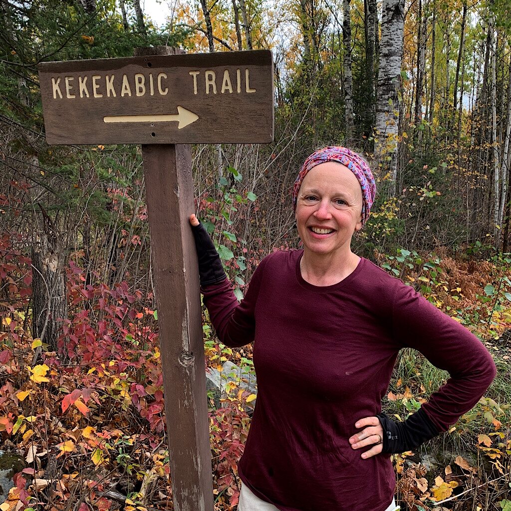
Day One, Gunflint Trail to Agamok Bridge 12.6 miles (plus 1.5)
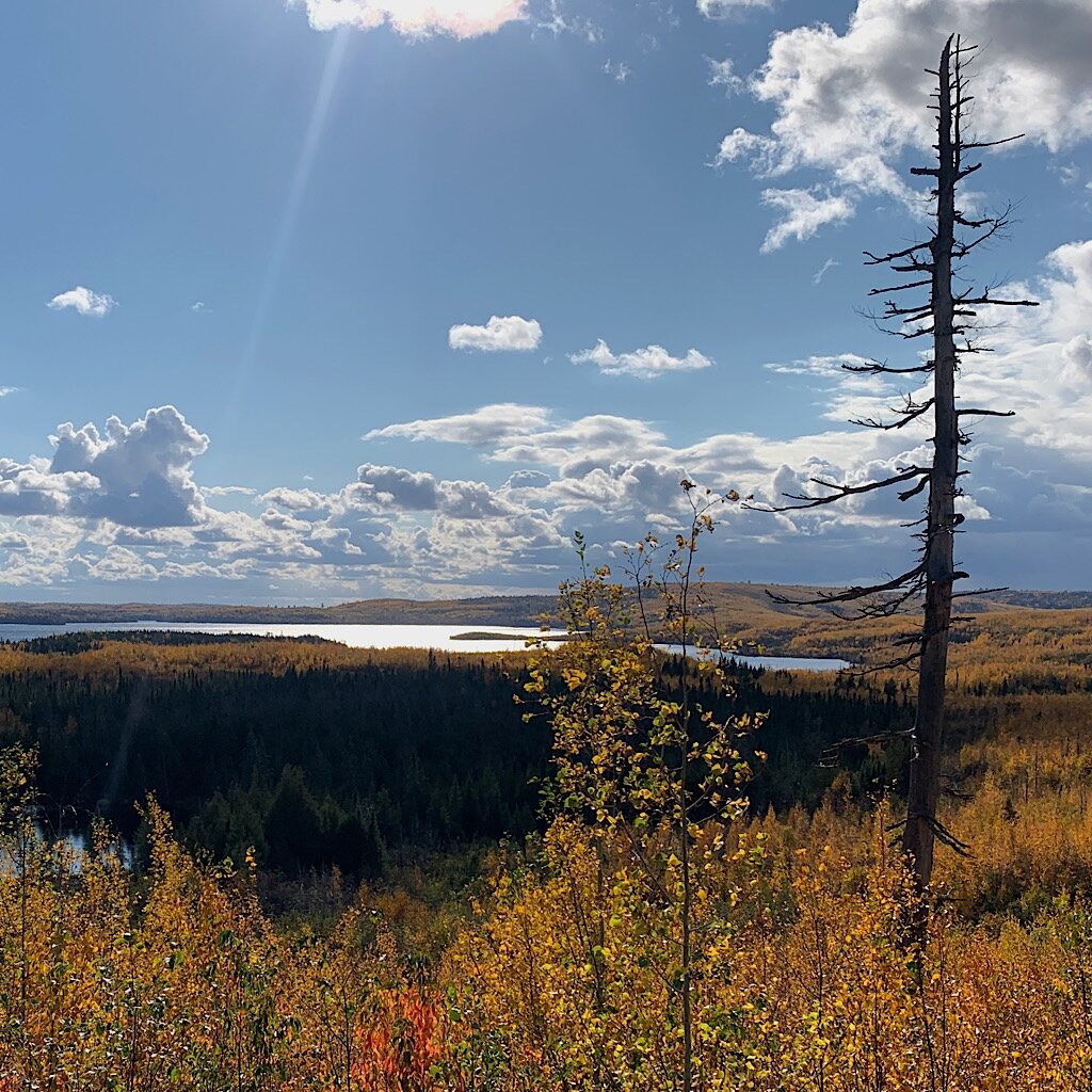
What strikes me at first walking on the Kekekabic, or ‘the Kek,’ is how quiet it is. Wind sets the Aspen leaves quaking, a deep gold against the soft blue sky, gray clouds hanging near the summits, a mosaic of yellow and dark green.
Richard and I drove up in pounding rain and bumper-to-bumper traffic, but we woke in Grand Marais to clear skies above Gitcheegumee and hopped up the Gunflint Trail, an hour’s drive deep into forest and the land of millions of glacier-made lakes begin.
I woke up again in a panic about my future, feeling ungrounded and unsettled, learning just this past week my right hip joint is ground to nothing – and the left is not far behind. A cortisone shot is only going to buy me time until I’m going to have to get new ones.
But I’ll get to call myself the bionic hiker! Turns out it’s genetics and there’s not much I can do about it. Nonetheless, Rich and decide I’ll hike in an hour then send him a message via GPS if I need to turn around.
Only a few miles before a view of Canada, we meet the trailhead and see four cars parked. I wonder if I’ll see many people on Minnesota’s most rugged and remote trail.
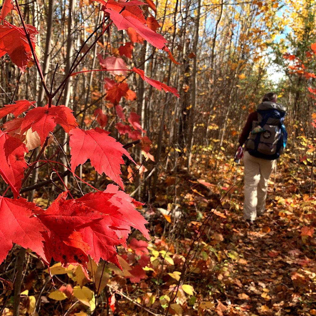
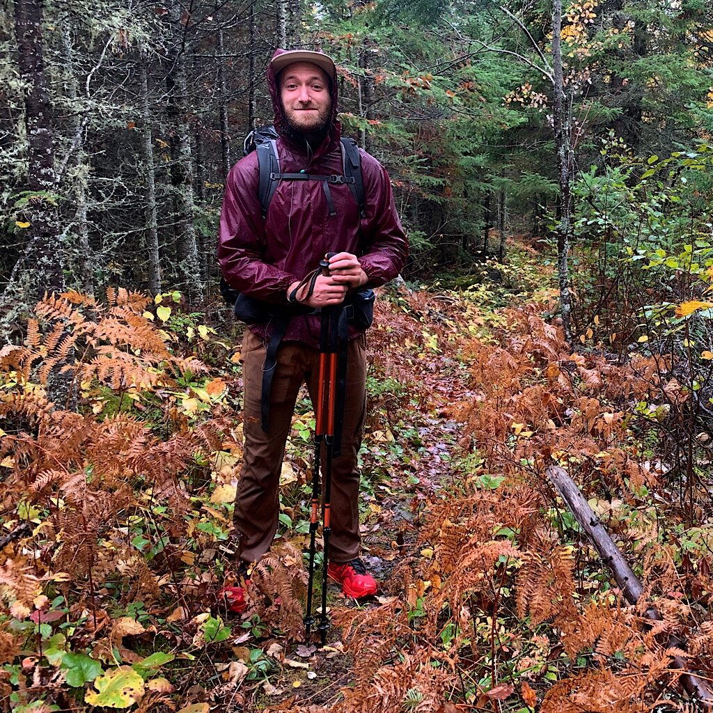
Richard grabs his sticks and a few photos, then starts walking with me up the hill. It feels like the Te Araroa when so many lovely trail angels who became friends got me started on the next section after their town. It gave them a chance to experience at least a taste of what I’ll see, and give me just the right sendoff.
This area was burned to the ground by the Ham Lake Fire and the new growth is mostly Aspen, bright yellow now with a bit of Maple in such a deep red, it could almost be called purple. Nearly a mile in, we take the spur trail for the fire tower, only a stone foundation, its metal housing crumpled in the bushes.
Richard lags slightly behind, due to asthma, and tells me at the top, “Even with gimpy hips, you kick my ass!” We flush two grouse, flapping their wings in a spastic panic that lifts their bodies just enough to clear one side of the trail to the other. We decide that I’m going to go for it. I’ll take my time – and my Vitamin I – then meet him on the other side, about a 4 1/2 hour drive near Ely, Minnesota and three days walking.
It’s always a bit strange to kiss then go in opposite directions, turning our backs, each step pulling us away from each other. What awaits me ahead? When I woke up last night shaky and insecure, something calmed me, a voice telling me to say, “Yes” to all things, including uncertainty. That definitely goes against the grain, but what I believe it means is to accept the challenges I face rather than deny or question them or feel picked on. I think perhaps agreeing instead of arguing with just might give me more power of myself.
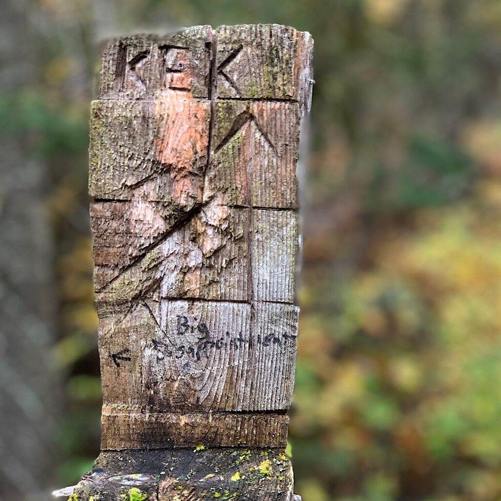
The trail sidles a hill and even after last nights rain the bushes are bone dry. This trail is infamous for being so overgrown with brush, people get lost. In fact, there’s a word to describe this – getting “Kekked.”
Established in the 1930s as a route to a fire tower, the Kekekabic Trail is a 41 mile long trail through the Boundary Waters Canoe Area Wilderness from the top of the Gunflint Trail to Fernberg Road, near Ely. I put it off for years because it’s incredibly inconvenient to get to either trailhead, the Gunflint about an hour north of Grand Marais, which is about four hours north of my home of Saint Paul.
And Ely on the western end is another four and half hour drive from the trailhead. You need a permit to hike in this wilderness of moose, wolf bear and beaver habitat and it is notoriously difficult to follow because its remoteness makes it’s difficult to maintain.
After its heyday in the ‘70s, the trail fell into disrepair until volunteers established a a club in the ‘90s, but severe blowdowns as recent as 2016 with 100 mph straight-line winds took down millions of trees and left the trail a jumble of impassible limbs. Only last year was the trail cleared end to end and I feel confident I can manage it.
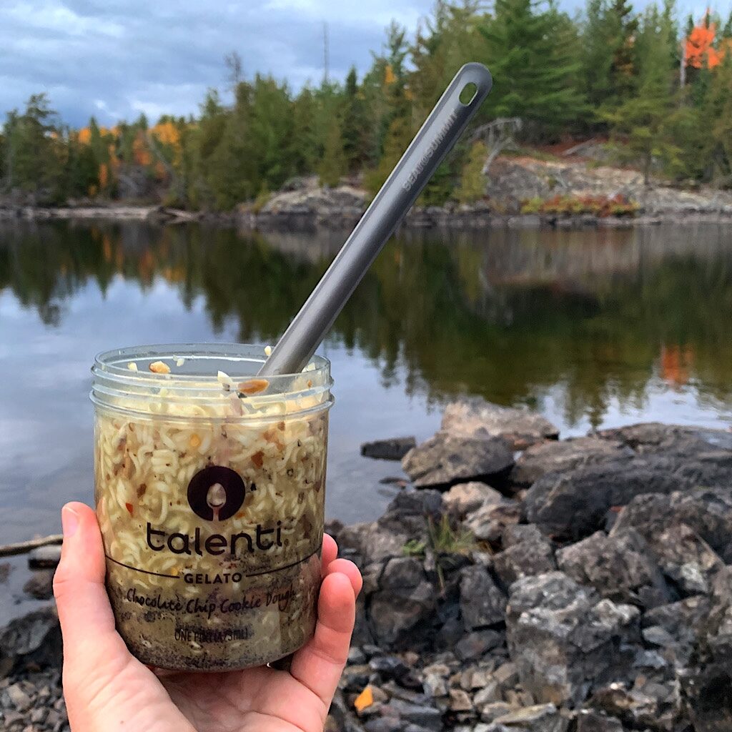
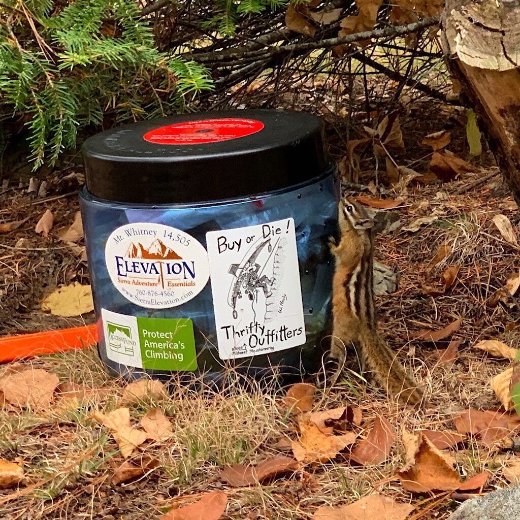
I’m moving well even on rocky and uneven trail, but I’m careful, using my sticks to stay upright and take off some of the stress. And this hike is not just about pushing myself on a deteriorating joint, I’m also experimenting with cold soak food, leaving my stove, fuel and pot at home. The weight and volume savings is eradicated by my half-size plastic bear canister, a bit of gear I thought wise to carry as hungry creatures prepare to hibernate.
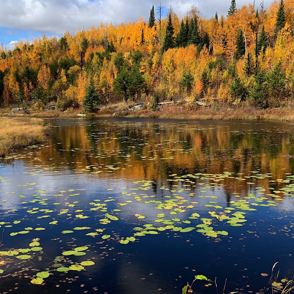
The views are beautiful looking down to a pond filled with lily pads, spruce trees a mirror image on the opposite bank. I meet a day hiker named Wendy, impressed I’m walking all the way. I know I must sound cocky when I answer her question about having picked out all my camp spots along the way. Truthfully, this might be the first hike where I’m not sure how far I’ll get limping along on shorter days.
Yellow birds come when I call, “psh-psh-psh-psh,” but they make no sound this time of year, only the wind whistles in the pines. I pass mines from the nineteenth century, fences in place to keep people from slipping in. At aptly named Mine Lake, trail crews cut a steep detour straight up, then straight down to avoid a notoriously wet section.
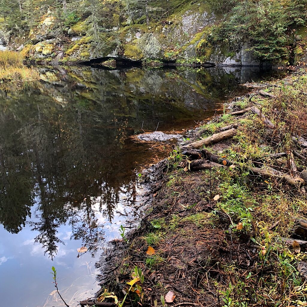
I soon enter the Boundary Waters Wilderness, stopping at the stunning campsite on Bingshik Lake with views on three sides. It’s definitely too early to stop, but I drink a liter of “sweet (electrolyte-fueled) water.” A man passes me totally distracted by his headphones jammed in. I suggest he enjoy nature’s sound. “I’ve heard it for three straight days,” he retorts. I guess not everyone needs the quiet as much as I do.
Quiet except for the wind and a banditry of black-capped chickadees, whirring as they flit from tree to tree. I work my way between a series of lakes – Honker, Glee, Fay, Warclub – and get lost momentarily, shooting confidently right down a portage that ends at the water’s edge and having to shoot right back up. When I return to the intersection and see the blue ribbons pointing the way, I realize everything looks the same making it near impossible to tell which way to go.
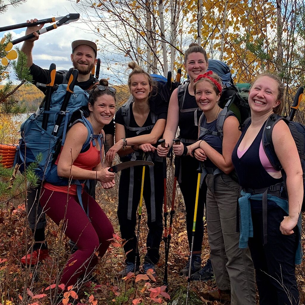
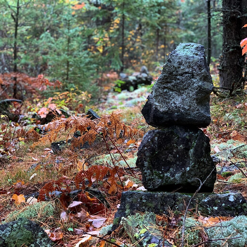
Hooray for the compass which is never wrong. Sure, I know to turn right but I check anyway that I’m headed west, more ribbons and giant rock cairns keeping me on track. Five hikers come my way, joined by a ‘caboose’ of two more – what’s the term for a group of trail crew? They’re all packing loppers and made things passable!
I take a picture and gush with gratitude, one commenting, “I didn’t realize we were celebrities!” Indeed you are. The scrappy opportunists that take over a burn area could potentially erase any hint of trail, and teams like this keep it open for hikers like me from getting lost.
They tell me they’re happy people are walking it and I head on into a mossy area of rocks and sun-dappled light through trees. Massive erratics sit isolated right where they were dropped thousands of year’s ago by a sheet of ice. I cross streams, beaver dams, and step gingerly over boulders. I laugh remembering that I told Richard on our drive up here that I never feel alone hiking anymore. He responded, “That’s good…right?” I guess he thinks I have a stable of imaginary friends.
I am alone and that requires being careful I don’t get into trouble or hurt myself, but I feel full and happy with my own company. And lookie here, I’m definitely not all alone as another young man comes my way. He’s friendly with advice of sites ahead, confident that I’ll make it to Agamok Bridge before dark, my intended stopping point.
I take a pause at the wee campsite at Howard Lake to filter water for a peanut butter/chocolate shake and eat a few dried mangoes. The young man told me I’d have lots of views ahead, and I need to drink up before heading uphill.
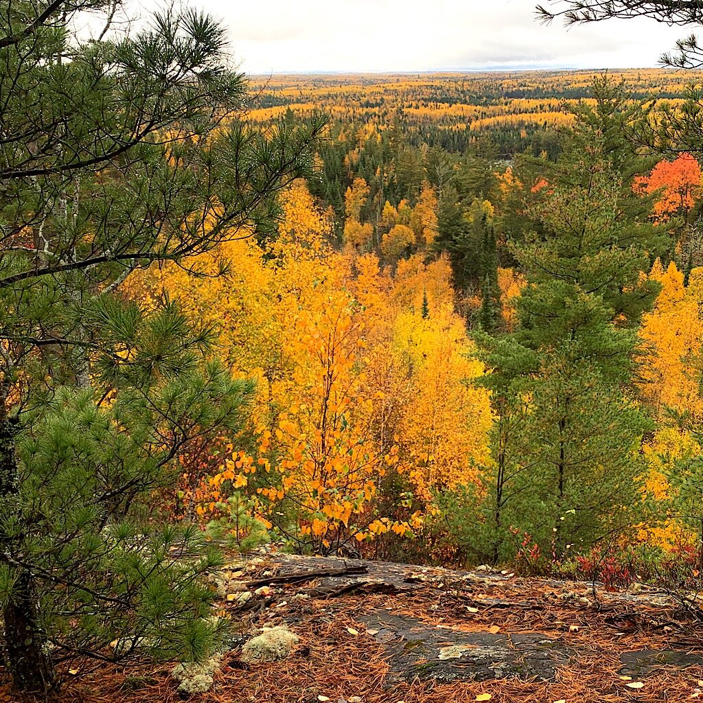
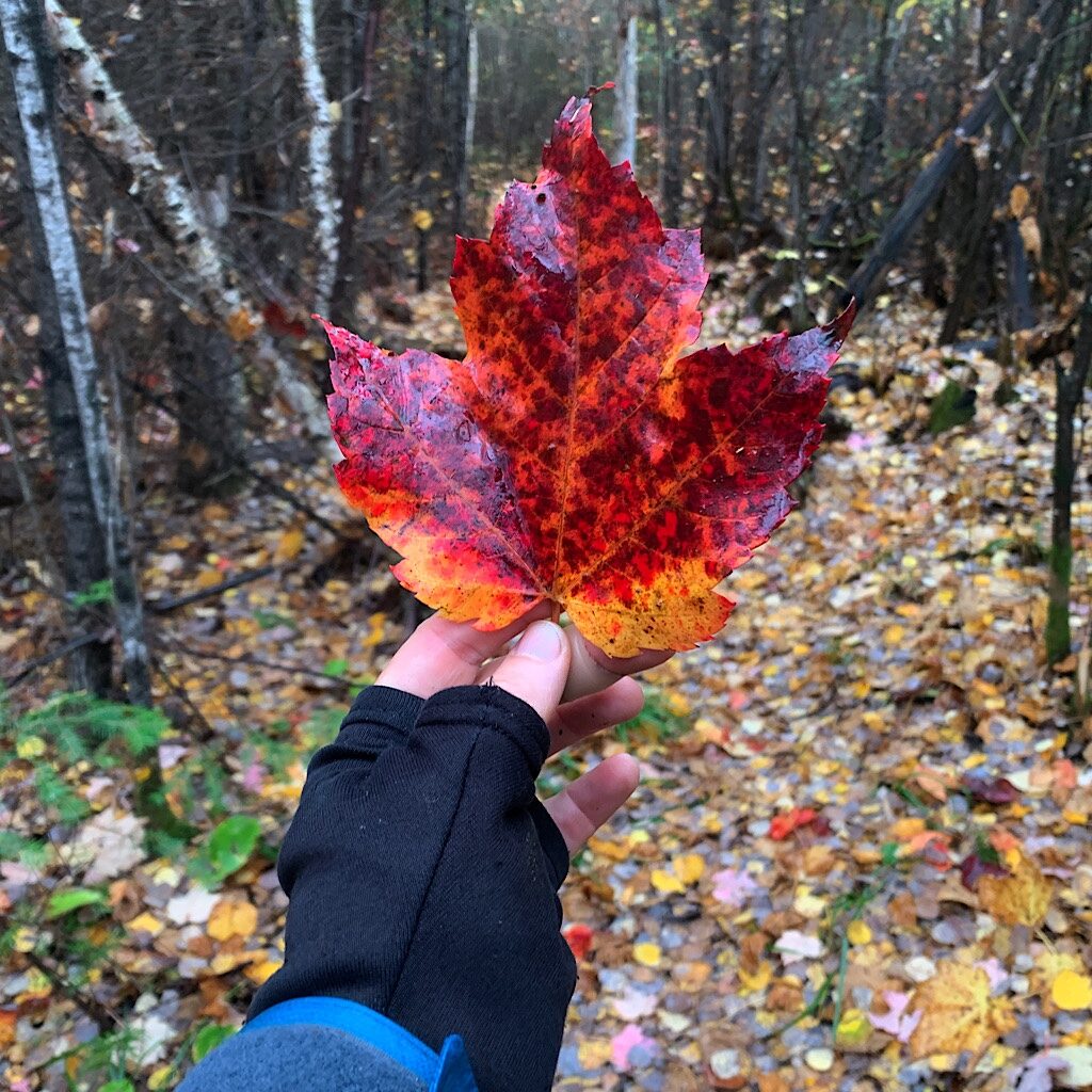
The trail goes up and down steeply, never very far, but enough to get me breathing hard. It’s rugged – rocks, roots and plants obstruct the path and I stay vigilant. To my left are waves of golden aspen glowing in the setting sun above chains of azure lakes. The color is so bright and rich, the air itself pulses with color.
I’m on a ridge, but out of views now, so I press on, the trail obvious though still rough. I just got to have one more of those amazing mangos I dehydrated, so I slip my sticks under my arm and reach in my pocket. At that moment, my foot catches a stump hidden under grass and trips me sending me flying through the air.
It’s true that accidents often seem to go in slow motion. I try to right myself but my sticks are under one arm, my hand stuck in my pocket and I fail, landing with a thud on my shoulder followed by a kind of afterthought of a face-plant.
I stand up and look behind me to see if I had an audience, brushing off bits of dried grass stuck to my blouse. Nope, I’m still alone and not hurt in the least, though from now one, no more walking this trail without a stick in each hand.
Before heading down, I get one last view of golden hillsides, dark clouds forming quickly above. I hear the waterfall below and walk straight into a brief whiteout of rain. But it passes quickly and I don’t bother putting on my raincoat.
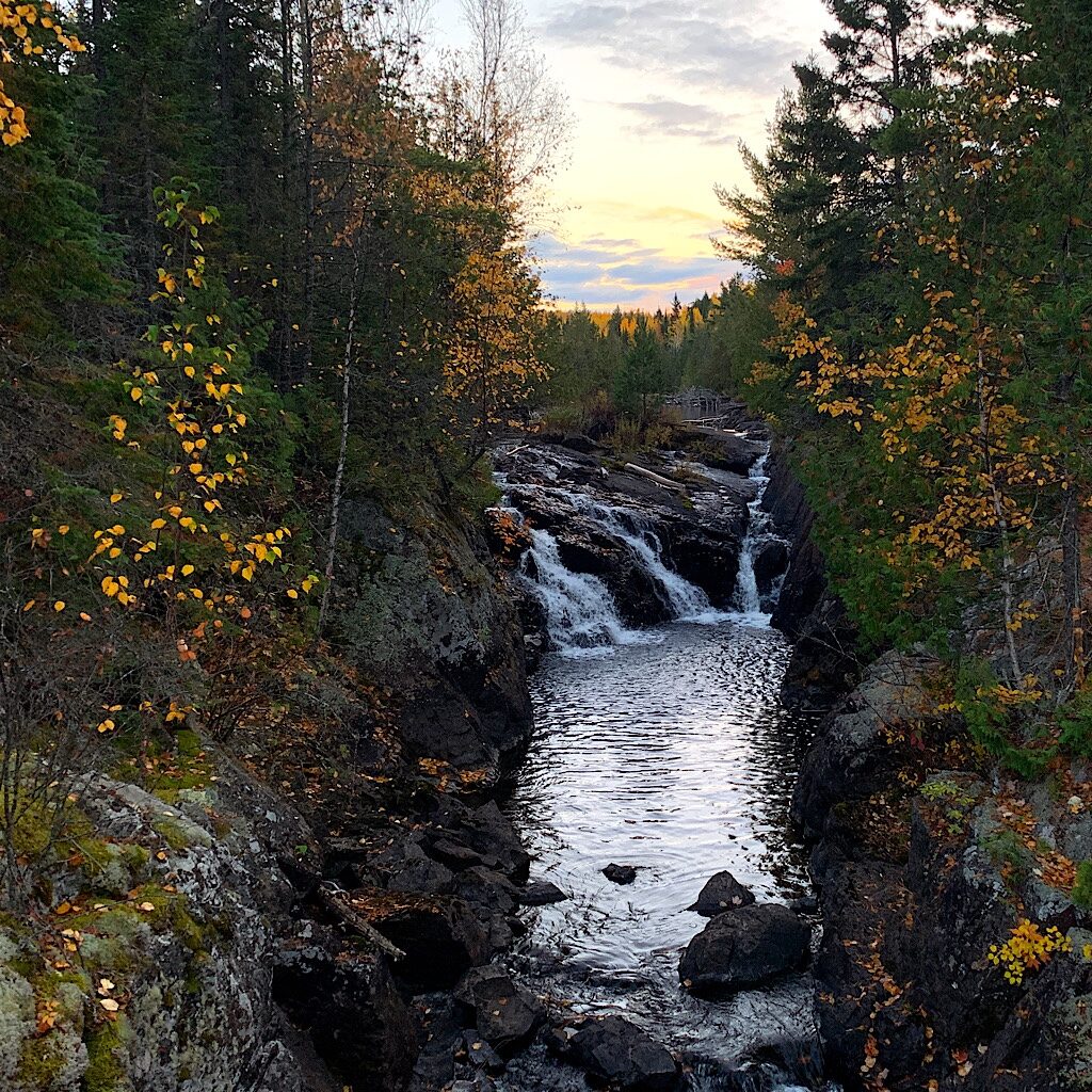
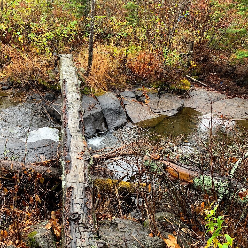
It’s steep now and I pay extra attention to where I put my feet on the wet rocks. I cross a beaver dam, negotiating a few holes in the mud that cements together stacked logs with beaver-teeth sharpened points. Agamok Falls is a cataract cutting through ancient exposed magma, crossed by a splendidly engineered wooden bridge.
I’m slightly disappointed in the site, just a large flat opening in the forest. But I have the bridge, the falls, and two rock ledge verandas on separate bodies of water where I split my time to filter water and soak noodles for dinner.
It’s absolutely deserted, only the susurrus of the falls keeping me company. Suddenly I hear a kind of banging sound followed by yelling. “Henry!” Well, there goes the neighborhood. I stand up and head into the site to ensure I claim the one flat tent spot.
There’s more banging and laughing, but I never see anyone. Aha! That banging is made by canoes! Of course, there’s a portage past these falls and just down the trail a bit more, hidden in the trees. This canoe party likely has no intention of carrying their canoe over here.
And I’m right, as I hear their voices – and the banging – fade slowly before disappearing entirely, leaving me utterly alone with my falls in this magical spot.
And I’m rewarded with a delicious cold soaked meal gobbling it up before it goes pitch dark at 7:30. The moon guides me back to the alicoop just before a light rain patters the tarp. I’m tucked into Big Greenie, marveling at this day of peak autumn colors, beautifully maintained trail, no injury from a wicked fall and this sweet solitude .
My big brother Eric also wore his hip to the nubs and had it replaced a few years ago. When I called to ask for advice I admitted I was feeling down. “DON’T BE DEPRESSED!” he emailed me in all caps. “Life is a stokeathon,” – I should point out that Eric lives in a beach town in Southern California – “It’s a bag of blessings.”
Eric’s absolutely right. Safe and warm inside the ‘coop, I’m counting those blessings before my eyes get heavy and I rest up for tomorrow’s edition.
Day Two, Agamok Bridge to Strup Lake 8.9 miles
Should you shield the canyons from the windstorms you would never see the true beauty of their carvings.
Elisabeth Kübler-Ross
A gibbous moon shone into the alicoop creating a spectacle of leaf shadows. But it didn’t last long before it started raining – on and off all night. I’m cozy warm, but everything is damp when I wake up. I drink up a peanut butter/chocolate shake and put on all my rain gear. I scored bringing my bear vault on this hike as here comes a chipmunk looking for handouts.
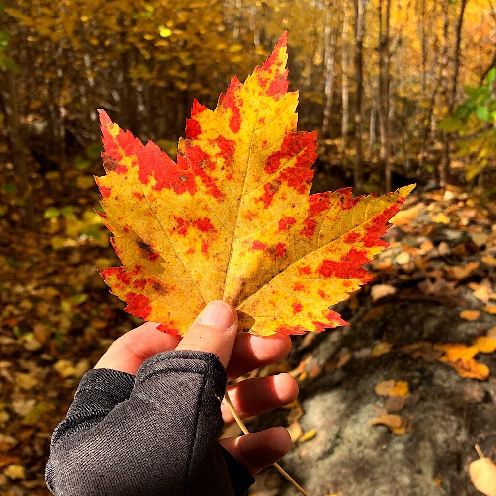
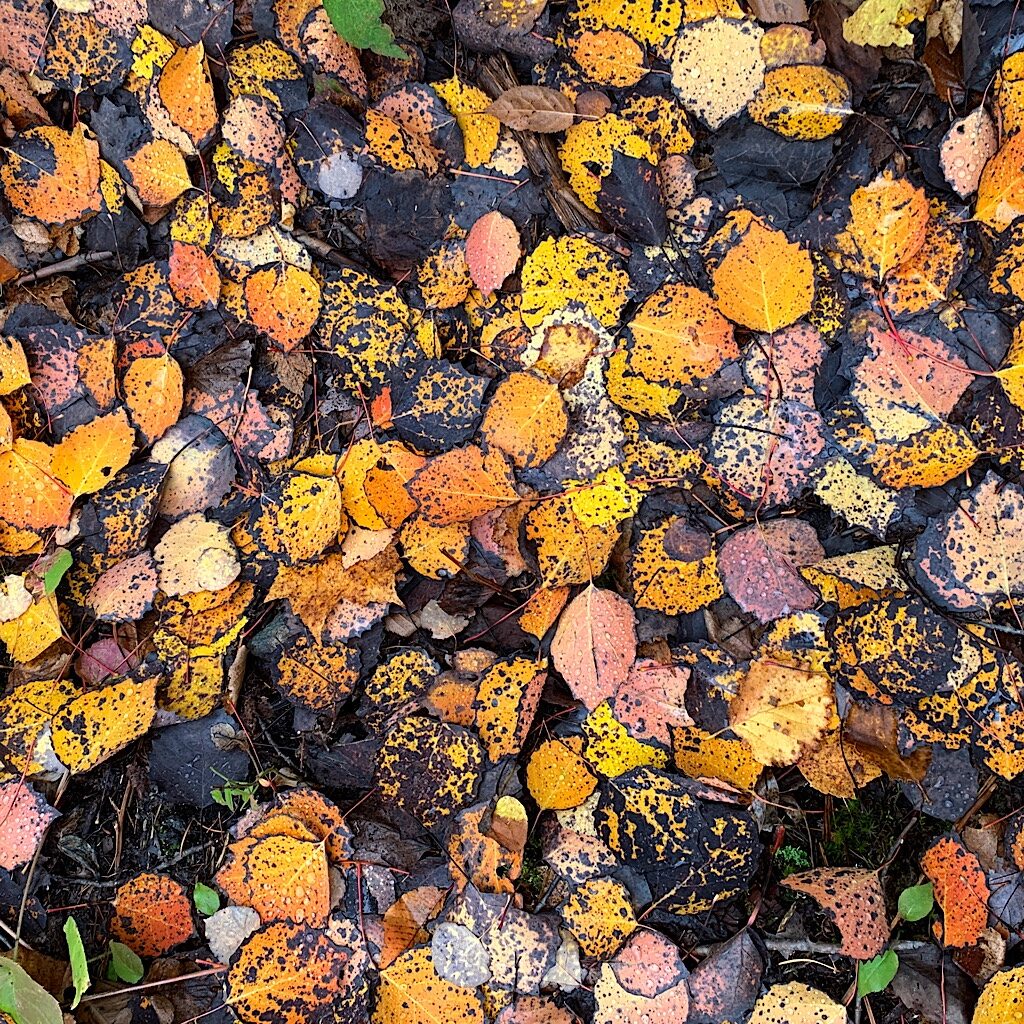
The trail leaves the lakes behind and heads directly into forest, dark, wet and slippery, the rocky path hard to negotiate. Now my sticks are firmly in hand and stab bright red maple leaves like an old fashioned receipt spindle.
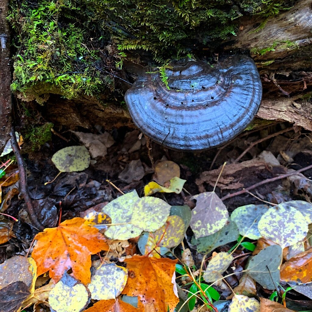
The brush acts as a carwash and I sweat under my jacket, out of breath on a steep undulating track. I’m supposed to come to a view, but every time I ascend to what looks like a clearing, I go right back down again. The trail is obvious, but it’s hard walking and starting to look, as my friend Neil in Christchurch would say, “samey.” It’s so silent in here, like I’m inside, though a few chickadees chip as a woodpecker knocks. Massive black fungi cling to trees, now all conifers as I pass out of the burn zone.
I unwisely step directly on a root and wipe out fast like I’m wearing roller skates. I’m ok and thankful I’m geared up for the wet leaves that break my fall.. The forest is pungent with a spicy freshness mixed with a thick but fleeting balsam that portends life rather than decay, the moist air magnifying the sweetness.
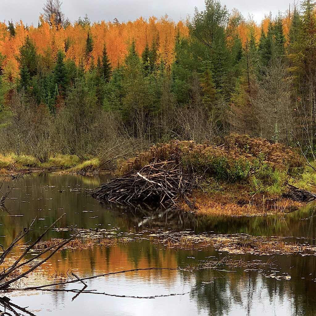
Ahead is a pond with a giant beaver house, so old, half of it is sporting grass. The only way through this wetland is over a dam, a fifty foot serpentine pile of pointy logs. I step carefully, not wanting to repeat my latest wipeout especially here where a fall could launch me into the water or onto one of those spikes.
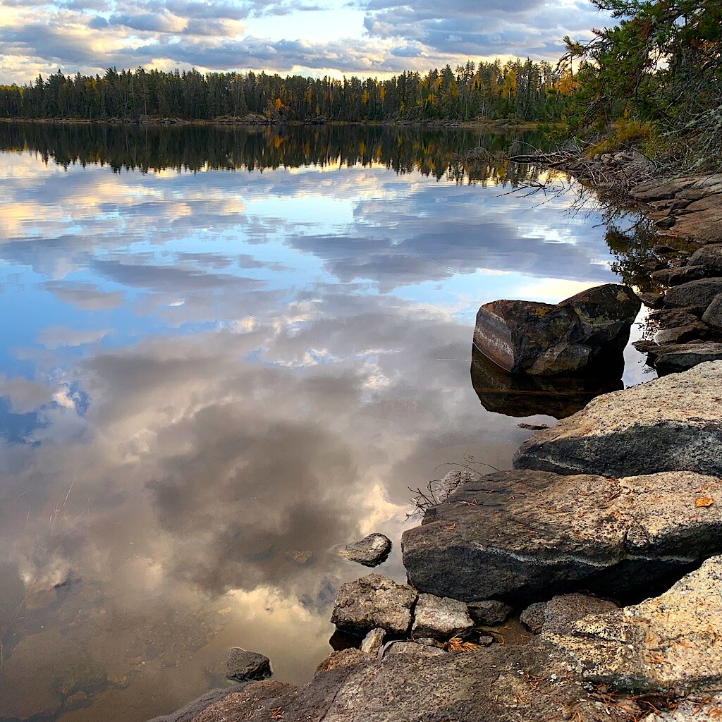
It’s not so hard, and I love the openess to the sky for a change even if a flat gray. Just around the corner is Harness Lake, a rock slab veranda sloping to the water’s edge. I stop for a snack looking out into white pine twisted like palm trees high above perfect triangles of spruce, and bright yellow aspen.
It begins to rain, and I shiver in the damp cold, shoving off. It’s up steeply now towards views out to big lakes, including this trail’s namesake. It’s hard to know how far I go before taking a sharp left. Judging from my map, it’s up, down then up again. But the trail is not as clean as topographical lines and after an hour – even on this ankle twisting, Blissful tripping terrain – I’m fairly certain I’ve walked the two miles to the junction.
But I never see it. Lost in thought, I begin heading steeply down, careful on slick rock hidden by autumn leaves. A bit of view to a massive lake opens to my left, and then an even bigger lake to my right. Wait a minute, this trail is heading steeply down to that massive lake – and the two lakes are actually one and the same.
I pull out my compass and see I’m heading directly north now. Maybe the trail turns west? Not on your life! Somehow, I missed the intersection and just kept going.
It’s a big climb back up, but I am naturally gifted for up – and tend to wipe out less often. It’s up and up, but where the hell is the intersection? F-bombs drop from my mouth as a raindrops join in. I come upon a few blue ribbons I hadn’t noticed before, so I guess I’m back on trail. But which way am I going, and why am I not seeing a junction?
I check the GPS, which shows me connecting with my trail and seemingly heading the right way. But with no sun and everything looking exactly the same, walking the wrong way is an easy mistake to make. So forget the GPS, let’s take another look at the compass. I set the dial to north, then spin the baseplate so my direction of travel is heading southwest and hold it up to the map. Yup, this is the right way.
But how in God’s green earth did I miss the intersection, not just coming, but going?!

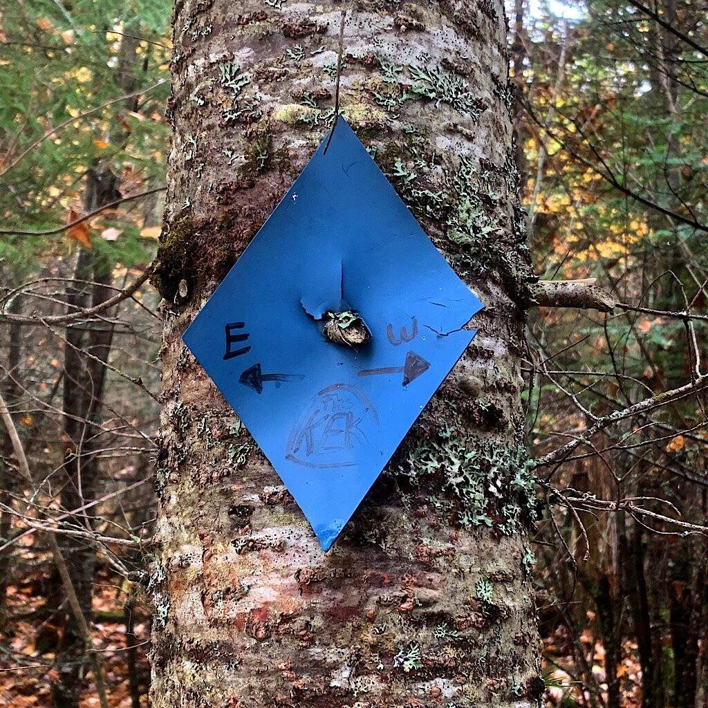
The answer to that question is never forthcoming, and maybe it doesn’t matter even if it puzzles me. I start to feel more confident when I pass a tree taken over completely by stacks of white fungus. There’s no way I would have passed this without stopping for a picture. A few more minutes walking and I come to a blue triangle nailed to a tree reading, “Kek” with arrows pointing east and west. I really could have used that sign back a few yards, guys, but at least now I’m heading the right way. Late’s better than never.
I think back to the Guest Post by my friend Alison Heebsh, warning us backpackers that day two always sucks. It’s wet and dreary, the views are obscured and I got “Kekked.” But c’mon, now, Blissful, there’re views coming up and you’re back on trail.
As I get closer to a burn area, I see a pile of moose poop, but never come upon one, more elusive in the vastness of the Boundary Waters than on Isle Royale. Young Aspen in showy yellow flutter like thousands of jazz hands.
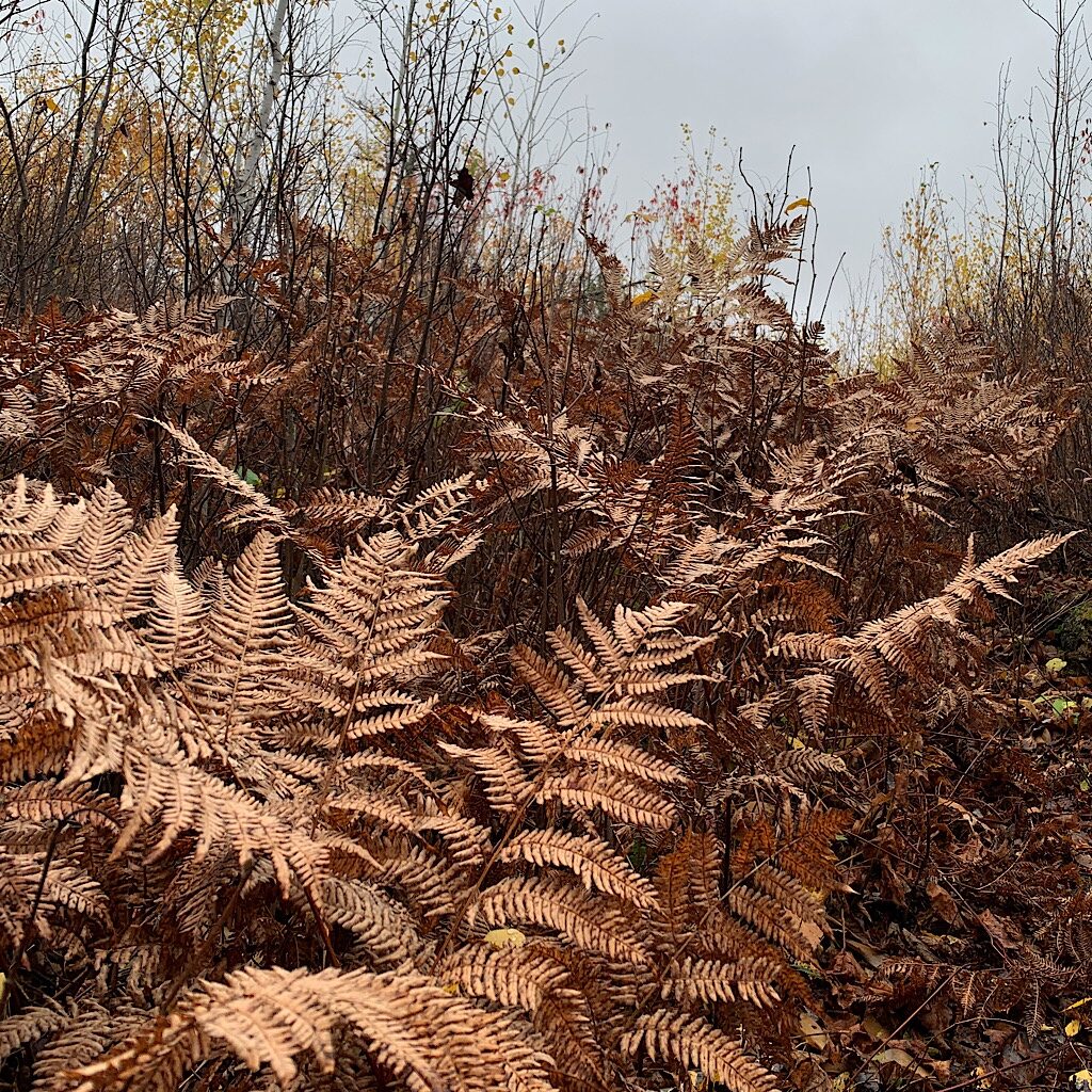
My path is overtaken with massive ferns, dried tan and crumbling. A few white pines survived the Cavity Lake fire, which must have burned hot, leaving several towering sentinels, blackened and solitary. But the fire opened the view of sprawling blue lakes below cliffs of gold. A wood pecker pounds into one of the towering trunks.
The path leaves the ridge and returns to thick boreal forest and its intense autumn bromide. I cross a stream carefully on rock rather than the slippery boards and take a spur to Strump Lake. On the way in, I spy the throne toilet, sitting right out in the open below a tiny rise to the camp spot, an apron a granite dropping into the tranquil water, white oak and aspen beyond.
I set the alicoop soaking wet, but it quickly dries in the wind. I change into dry clothes and hang the wet ones on branches away from sticky sap, then head to the water for another cold soak meal. It’s quiet and perfect, the sun trying to peak out just as two hikers wander in.
OK, so obviously when hiking, we have to share, but what is it with people? It’s like they’re annoyed I’m here and rather than engage, don’t say a word and begin searching for a place to set.
Finally I say hi, and the man says, “How are you?” Now, why exactly does this annoy me? Don’t get me wrong, I understand sharing, but there’s an art to it. Rather than barge in all assuming and aggressive, how about a more deferential tone, “Hi! Would it be ok if we shared tonight? We’re really quiet and we’re really tired and…we’ve got chocolate!”
No, that did not happen.
So it’s up to to me to introduce myself and welcome them, which finally softens the edges. Anna and Sam. They give me campsite beta, admire the view, pull out some food and relax on the rocky apron. They then tell me about coming upon an occupied site, where “the people took the best tent pad and didn’t seem to want us there.”
Right, pal, that’s because there’s an art to sharing.
Well, they turn out to be pretty nice, really, and quiet as church mice, their exceedingly low voices just a mumble under the wind as I take a wee nap in the ‘coop after an early dinner. I’m awakened by a cocky camp chipmunk standing right on top of my bear canister.
I head back to the water’s edge with my book as Chippie hoovers up leftover crumbs. The clouds part in a burst of sunshine, but close after only a few minutes.
My neighbors are in bed by 6:00.
Day Three, Strup Lake to Benezie Lake 13.3 miles
The only thing that makes life possible is permanent, intolerable uncertainty: not knowing what comes next.
Ursula K. Le Guin
It rained all night, sometimes just loud pingy drips shaken from the trees, but mostly a steady pattering that left me feeling down and damp.
I had a dream mixing my former boss and my flute playing. Obviously it left me anxious at 4 am when I woke with a start. The book I loaded in my Kobo reader helped, “The Great Influenza,” though maybe a bit of a sick joke at this particular moment in time.
I’m glad I brought it anyway and sat out reading on the rock veranda looking out to the row of rocks – a humpback whale and shark fins – until it was almost too dark to find my way to the tent.
I’m warm inside even a few stray drips hit the sleeping bag. My chipmunk – or one of his friends – is creeping through the dried leaves looking for crumbs. I fall back asleep awakened by a cannonball beaver tail splash and the sky lightening. The rain’s let up for a few moments, so time to move while it’s relatively dry.
The air is thick and gray, almost making it too dark to see. A light drizzle follows me onto the trail, all ‘flat and easy’ today, which is just fine. My hip is making fewer protests and I move along smoothly on a wet carpet of yellow, orange and red. I pass a beaver pond misty in the drizzle, black stumps reaching into the gloom.
Ducks quack loudly, not bothered at all by a little moisture. Ahead, dozens of chickadees flit from branch to branch, noisily chattering. One lands right near me for a better look.
The trail is easy, though I still need to watch my step to avoid wiping out on moss-covered rocks or oily roots. I straddle one blow down after another, then crawl on my hands and knees under a few more. I notice hundreds of trees today brought down by a massive windstorm in 1999 followed by another in 2016.
The trail crew has worked mighty hard to remove the mess, and it’s especially incredible the work they do, since only hand tools are allowed in wilderness areas. I wonder how they moved some of the biggest as I bounce along a tunnel of sawed trunks.
At the falls between Hatchet and Thomas Lakes, I gingerly cross on rocks to avoid the slippery log bridge. I hear canoeists on the portage. Moose tracks are everywhere, but I never see one, just chattery red squirrels.
I cross a spectacular beaver dam of mud and humpy grass. I am exactly at the level of the water with a healthy drop to my right. I can’t see a house but I hear a huge warning splash. A vole peaks out of the sticks as I pass.
The trail heads on through alder turning yellowish-green and spruce in perfect Christmas-tree shapes. A man comes towards me. “James!” I yell. “Bliss!” It’s the young trail worker from two days ago now starting his journey of the Kek, the Border Route, and finally the Superior Hiking Trail.
We share beta and commiserate about the weather just as it begins to rain hard. He ensures I’m ok and tells me tomorrow the weather will be worse, so I decide to keep moving and walk as far as the last of the sites before the short walk to the end.
I take lunch at Moiyaka Lake, my view a perfect rectangle of rock with a brilliant yellow aspen growing out of a chink. The sun peaks out from the clouds as I sit next to a gigantic downed white pine. It would be hard to get water here, so I press on.
A coiled up bit of saw marks the turn off for Drumstick Lake where I need the privy. Again, the site seems an awkward distance from water. But no matter as I have my eye on a site down a side trail James told me about. The sites on Benezie and Becoosin Lakes are not on canoeists’ maps, in fact I don’t think there’s any portage to them at all. Hopefully that means I’ll find my own private nook.
The sun comes out strong now and I stop to take off my rain coat and put on my hat. Leaves twirl as they fall like glittery gilt snow. The turnoff is marked with a pink ribbon and takes me on an undulating and recently cleared path. The first site is ideal, the actual tent pad above the lake, but a glorious rock veranda next to it.
I set the alicoop to dry in the sun and filter water for dinner, watching the clouds change shape in mirror reflection. Thunder rumbles in the distance and even as the sun turns clouds pink, droplets fall in absolutely silent rings. I stay for the show until they pelt down harder in a ricochet of ‘plinks’ and ‘plunks’ causing me to race up the hill and dive into the ‘coop.
But it doesn’t last long and I return to Maxfield Parrish colors, the clouds seemingly lit from inside. To the south, an enormous thunderhead in the shape of a wise woman in a billowing blouse glows orangey-pink. Lightning zig zags out of her followed by menacing rumbling.
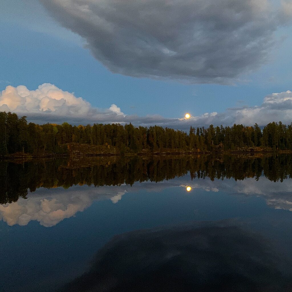
A duck quacks and fusses his feathers. A small fish jumps and a beaver splashes in the distance. In front of me are rock cliffs studded with spruce and aspen. To my left, sherbet clouds float past, a large white head riding atop. I spy the first twinkle star of the night, though I’m pretty sure it’s orange brightness means it’s Mars, joining the clouds in reflection.
Just then, as if to cap off an extraordinary day, a gold orb sneaks out of hiding behind gray clouds. I realize I’m facing east and don’t even need to turn my head to see the full moon rising.
I greet her and remind myself that just because I hadn’t seen her, she is always there. Her regal self reflects in the lake before disappearing behind a cloud only to shine more brilliantly as she’s expelled from a silver cushion of light. Just a few months ago, the Boundary Waters was named a Dark Sky Sanctuary, one of only thirteen in the world.
And it’s getting dark now, though clouds are bringing rain. As my moon moves towards a thicker cloud, I say goodnight, and head back up to my perch for my last, solo night on the Kek, the rain falling hard on the ‘coop.
Day Four, Benezie Lake to Snowbank Lake 6.2 miles
The key to abundance is meeting limited circumstances with unlimited thoughts.
Marianne Williamson
Today was supposed to be worse and yet after the heavy rain just as I cuddled in, the night was dry and the morning, clear. I’m on the trail fast sending Richard a message I’m ‘starting my trip,’ though unsure if he’ll see it with the forest making connection to a satellite difficult.
It’s just a mile to Becoosin Lake up and down through brushy trail, mostly cleared of fallen logs. The sites are not so great and neither looks east. I scored at my little spot last night where I looked directly at the rising moon.
James told me about these sites on this little loop, but he didn’t come down the trail because of a mossy mini rock cliff I have to descend. Even this young man with good hips didn’t want to take chances on twisting an ankle at the beginning of his thru-hike.
When I arrive, I decide to slide down safely on my wet behind. A beaver dam holds back a small pond right at the trail intersection, where I take off my rain gear, tempting the skies to stay clear until I’m off the trail.
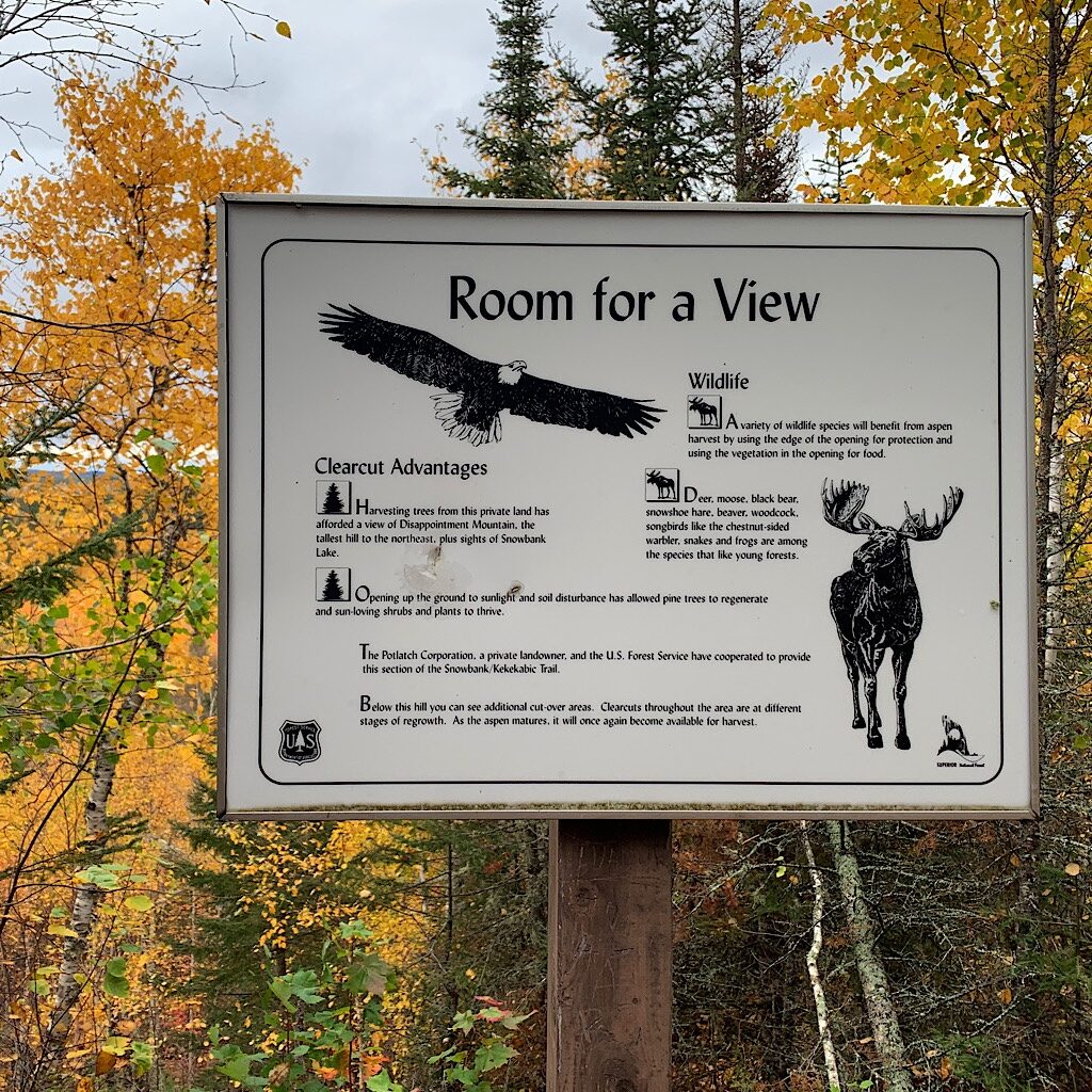
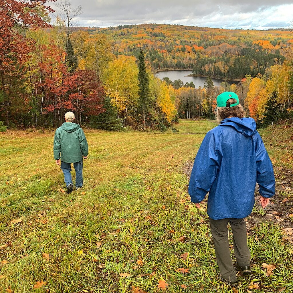
And they do, a cool breeze leading me up steep climbs to views of Snowbank Lake, one more dam and one more view with a sign explaining the benefits of forest clearcutting for the wildlife residents. In my final descent and deep again into the forest I come around the corner and there’s Richard followed by our good friends Debby and Todd.
I can’t tell you how wonderful it is to be met on the trail by loved ones. We chit chat the mile and half back to our cars, arriving just in time for a few photographs before the rain starts up again and we drive back to their home in Biwabik, and even before I can change out of my clothes, head right back out and up to the top of Giants Ridge for a last look at autumn’s splendor.
Having checked off one of just two trails I’d planned for this season, I muse on the panic that still overtakes me – trying to very literally get a foothold in my career during a pandemic-fueled recession and now facing surgery and a recovery that will hopefully allow me to continue being a Blissful Hiker.
Remember that message I received just before I started this trip to simply say “yes” to all things, good and bad? Well, there’s a lesson in this hike. It rained and I somehow managed to say “yes” not allowing it to wreck my mood. I chose an attitude of abundance, that things will change, and there’s no reason to let the fact that it’s less than ideal to ruin my trip.
And it’s not like I just sit back with a dopey grin on my face. It’s more like I’m prepared for the problems that will inevitably come. I accept them with grace and that gives me the power to decide how I will react, freeing me to plan and then to act.
And at this moment the action I will take is to head into a sauna – and as my big brother Eric would say, life’s a bag of blessings, a “stokeathon.”

19 Responses
Hi Alison,
Thank you so much for sharing stories and pictures of your adventures. What fun to learn that we share some overlapping exploits : ) although my first wilderness experiences in the Boundary Waters occurred 50 years prior to this Kekekabic hike!
I look forward to reading about all of your adventures.
thank you, Bob! The hikes in the BW were such a revelation, especially the Kek which felt very remote and wild. Kia kaha and happy trails, alison
Hi, Ruby!
As someone who loves the Kek and long distance backpacking, but like you undoubtedly has joint replacements in her future, your story was such an inspiration! I’m amazed by your courage and determination to keep on keepin’ on. Thank you for the lovely picture and excellent writing.
Hike on!
Allison. Sorry! Where did I get Ruby?! 😉
HA! I thought of that Dion hit. “Ruby, Ruby, Baby!” https://www.youtube.com/watch?v=JUQEMb1ALz0
hi Lucie and thank you! I feel so lucky to live in an age when we can get our worn out joints replaced. There’s nothing like taking yourself to a remote spot in utter natural beauty through your own locomotion. Good luck to you and keep in touch! blissful