
One day, if I go to heaven… I’ll look around and say, ‘it ain’t bad, but it ain’t San Francisco.
Herb Caen
An urban thru-hike
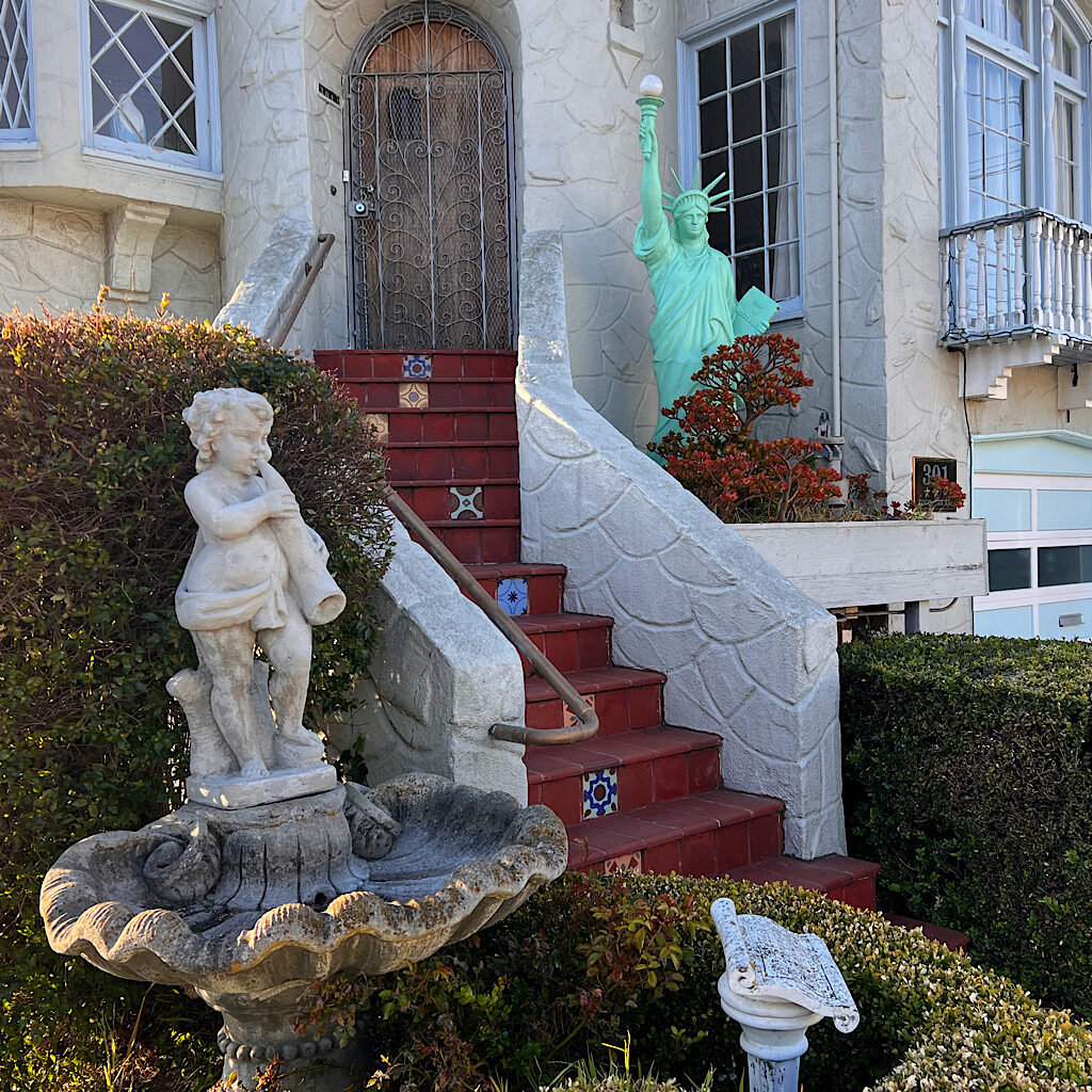
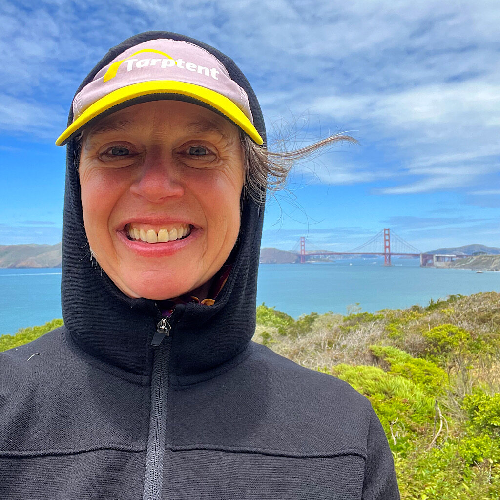
A week ago Thursday, I was visiting my dad and his wife Ding for the week in the city, and thought I might squeeze in a bit of walking since the weather was unusually wonderful. I headed up Telegraph Hill and down Lombard Street; through Fisherman’s Wharf, China Town, Crissy Field and the Castro; across the Golden Gate Bridge from Marin Headlands then all around the fantabulous mansions of Pacific Heights that look right down upon a row of tented homeless in the Filmore.
But nothing felt quite as much like real life in the city-by-the-bay as a “thru-hike” from end-to-end.
The San Francisco Crosstown cuts a diagonal from southeast to the northwest, almost purposely avoiding the biggest hits and instead sharing hidden gems well-known to the locals. Urban greenways, mosaicked stairs, deep ravines and stunning views characterize this 17-mile walk, one imagined by an avid group of volunteers in 2012, recognized by the city in 2014 and finally, opened to the public in 2019.
Oddly, no signage marks the way. But there are three options for staying on track – paper maps, downloadable GPX or my favorite option, the Outer Spatial app which partners with your phone’s GPS and keeps you from taking too many wrong turns…
Stats
- Length: 17 miles
- Trail grade: 45% roads and sidewalks, 15% paved off-road paths, and 40% trails
- Mode of transport: hike, run, or roll (some variation for wheels, obviously due to stairs)
- Elevation gain: 2,600 feet
- Sections: five
- Public transport: plenty
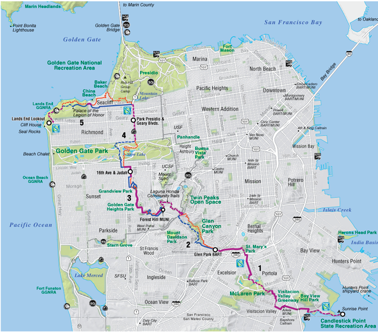
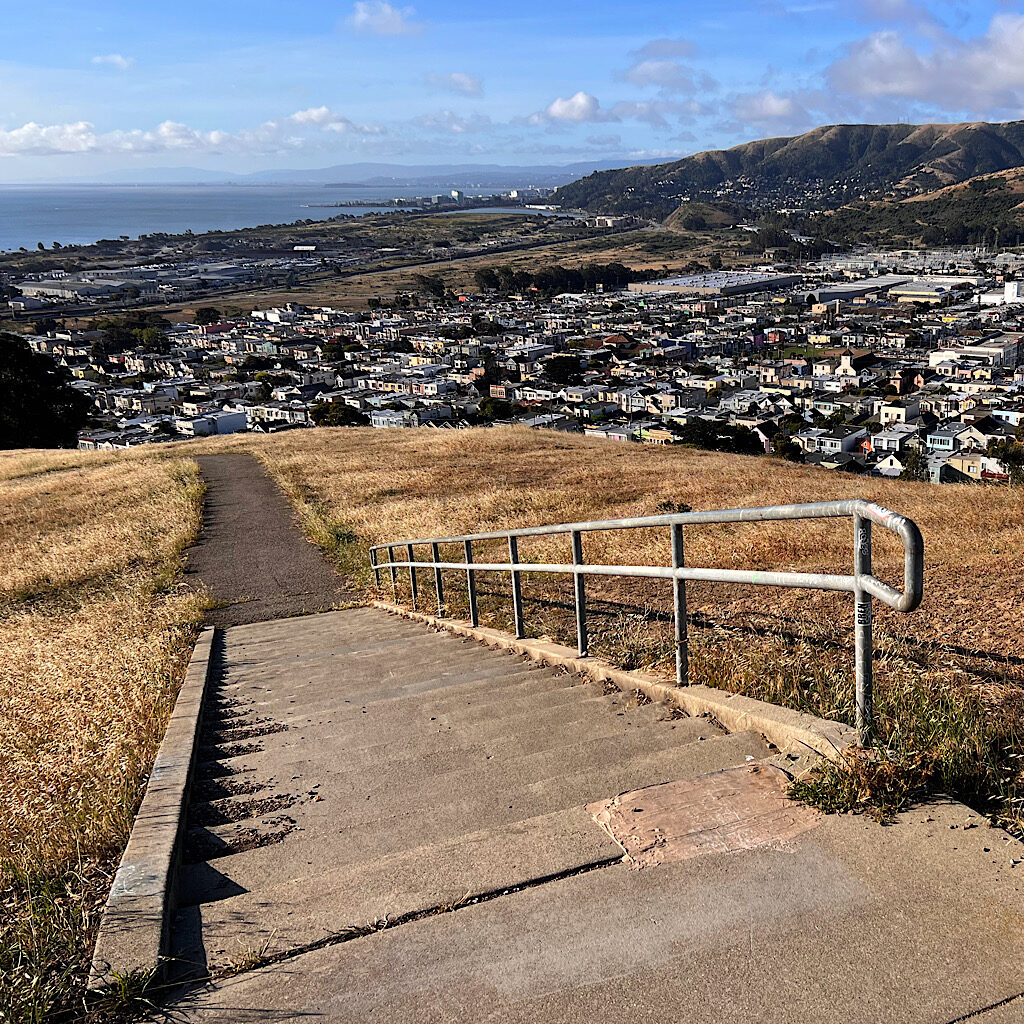
Section 1: Candlestick Point, Visitacion Valley, McLaren Park (5.2 miles)
Carlos picks me up at the Towers around 6:30 am and races me across town. It’s mostly freeway to the start and I feel a knot tightening in my stomach. This is so far…how does one walk through this concrete jungle? The driving app breaks the mood, singing out bossily, “In one mile, drop off Alison.”
I was warned about that this area, Bayview Heights, might be a bit sketchy, but so early in the morning, it’s quiet, even a little ghostly.
Named after a long-billed curlew with candlestick-length legs, this piece of land was the only one large enough to house professional sports in the 1970s. Both the Giants and 49ers played at Candlestick Park well into the 21st century, even if they wanted to move out the minute they started playing there.
The reason being, its location right next to the bay was often the victim of strong winds that would pick yo and swirl around the field. Needless to say it created adverse playing conditions. The entire park was demolished in 2015 including 10,000 parking spaces.
Right now, it’s empty. Just a stretch of road stopped short by a chain. I tip Carlos and head out into the early morning light. “I’ll pray for you!” he yells. Of course I have to wonder what I’ve gotten myself into here. The pockmarked road is relatively free of garbage, but signs loom above pointing the way to the highways and home.
I walk along the water, then turn abruptly uphill. Is that how I get out of her, I wonder, uphill?
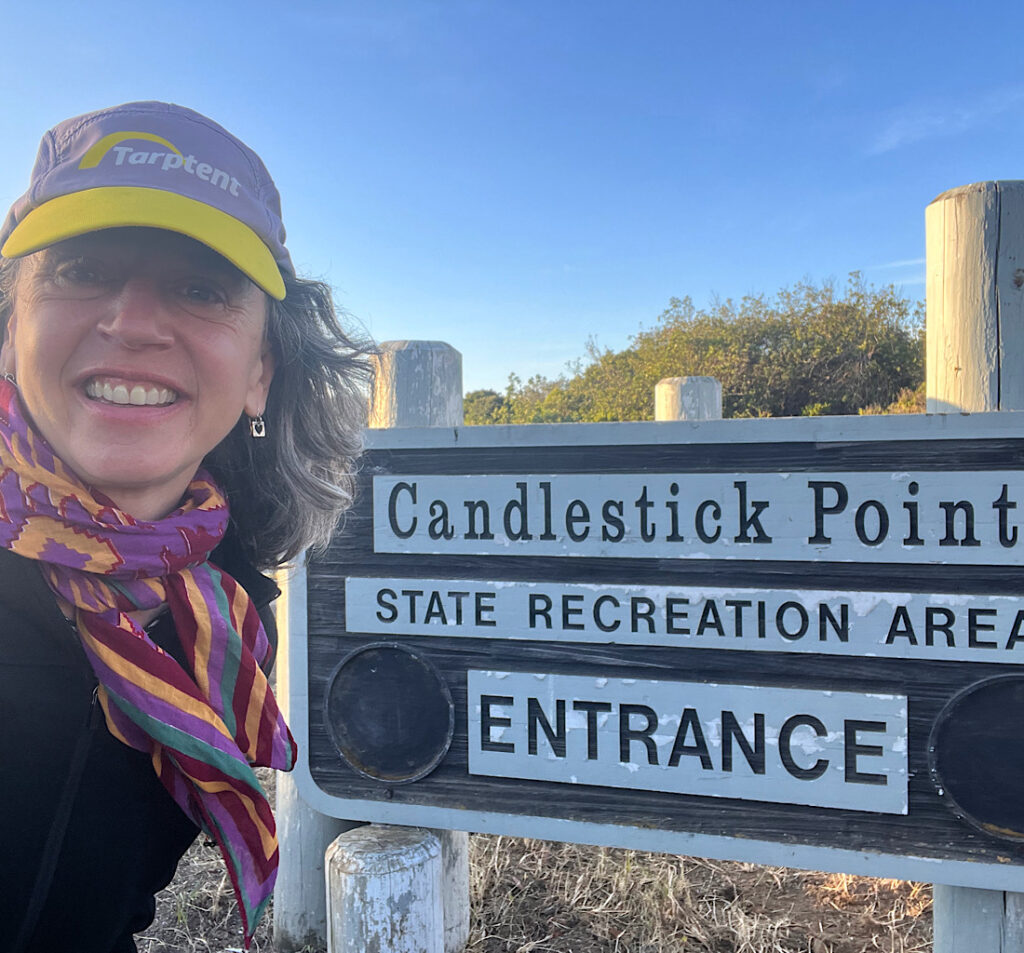
The road leads to the official start, though no sign indicates it. So I walk on without fanfare in the ornage light, Sunrise Point Fishing Pier absolutely empty. Restoration of native plant life has started, so I’ve been told, and redevelopment will start…someday. Still I find it in its limbo state, full of hope and promise before I leave the road and meet a trail that fronts an apartment complex.
I’m officially walking in a State Recreational Area. Picnic Tables are set at jaunty angles inside wind blocks taking in million-dollar views of the bay as two impossibly huge container ships head out to sea. Animal-proof garbage receptacles offer a choice of landfill or recycle. A sign tells me the willet is the largest and most common of in the Aves family, Shank.
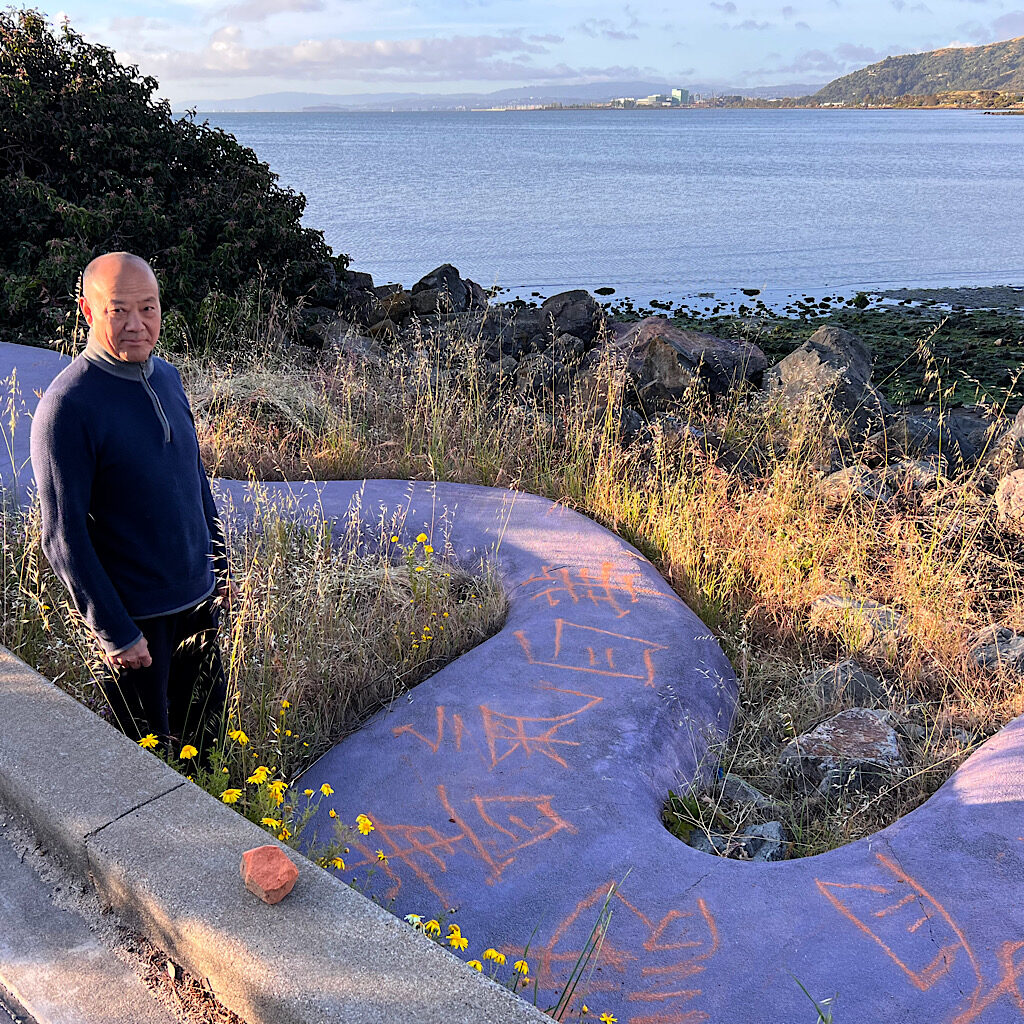
A Chinese Man uses a fist-sized piece of orange chalk to scrawl characters on a snaky piece of concrete before doing deep knee bends looking out towards San Bruno and Oyster Point. Here I cross the road and leave the shore behind, duck under Highway 101 and enter a working class neighborhood of stucco row houses in lavender, lime, rose and teal.
A woman washes her second story windows with a sprayer, but stops when she sees me coming then wishes me a good morning. A group of Chinese men confer in guttural exchanges. Fanciful paintings adorn the buildings.
It’s steep walking on sidewalk until my app points me across the middle of a street and up into a garden. This is the Visitacion Valley Greenway, a set of six slender parks snaking up the hill. In one, there’s a profusion of flowers before I cross a road and enter another with individual raised beds of vegetables behind chain link fence.
Still another brings me through whimsical wrought iron gates where Chinese women gather to stretch, all of them slapping their thighs. Each smiles and says, “Good morning!” before I head to the final pocket park up a twisting path with an overlook framed by columns.
I’m sad to leave these lovely parks behind, ones well cared for and often used by local residents. Up and up I go to an empty expanse of hill, gold now too early in this season of drought. It’s McLaren Park, the third largest at 313 acres and the largest grassland in the city. As far back as 1905, this mound was set aside for recreation, though it soon got a bad reputation as a prime location to dump bodies.
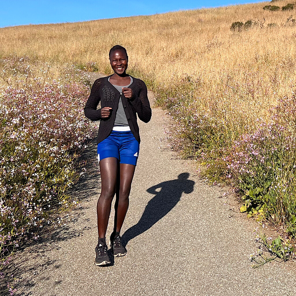
The only body I see if alive and well, sprinting up the path. She proudly tells me she trains every day and was part of the Sudanese National Team. I wish her luck joining her adopted country’s team, then walk to the lookout where I meet another group of Chinese women, slapping their thighs in the cool shade of eucalyptus.
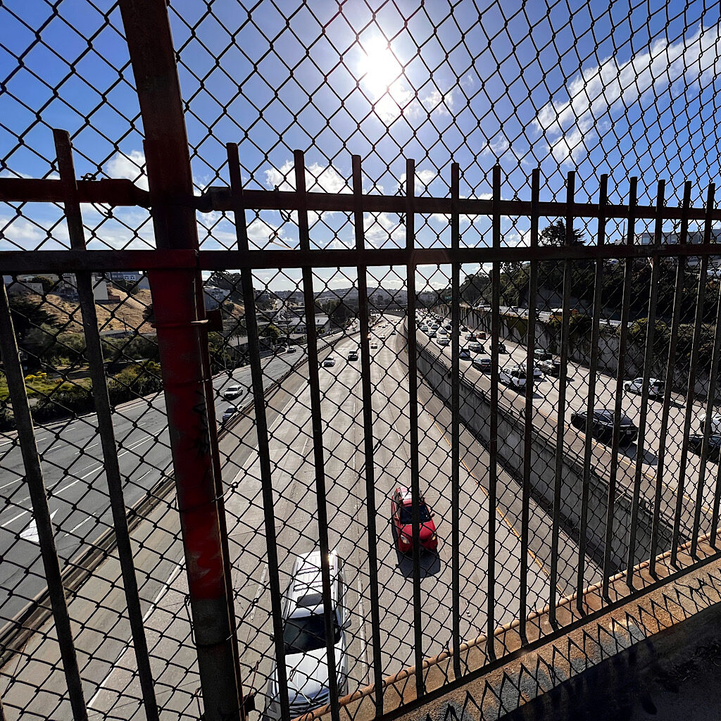
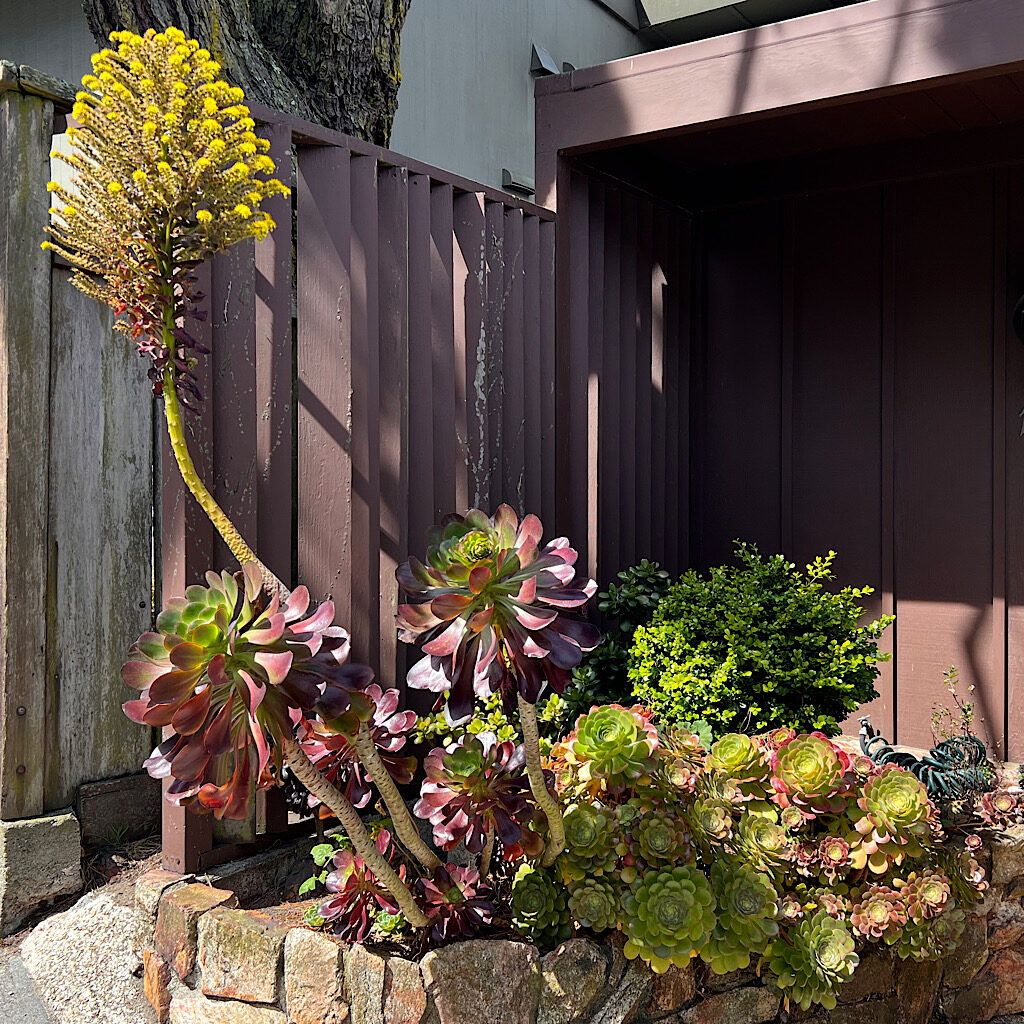
Philosophers Way drops me past Yosemite Marsh into Excelsior where I walk for a fair piece on concrete passing numerous front yard gardens full of succulents and roses as big as softballs. A man on his hands and knees digs weeds out of cracks in the sidewalk. I lost the traffic in the park, but now I’m next to it, bumper to bumper. I remember living in California and the narrow freeway entrances taking far too many commuters onto far too crowded highways.
I move faster than the cars towards a fenced-in pedestrian bridge that looks out on four lanes of Interstate 280 in sequential stair-steps, loud and fast. And with that, I enter Section 2.
Section 2: Glen Park Greenway, Glen Canyon Park, Laguna Honda Trail (3 miles)
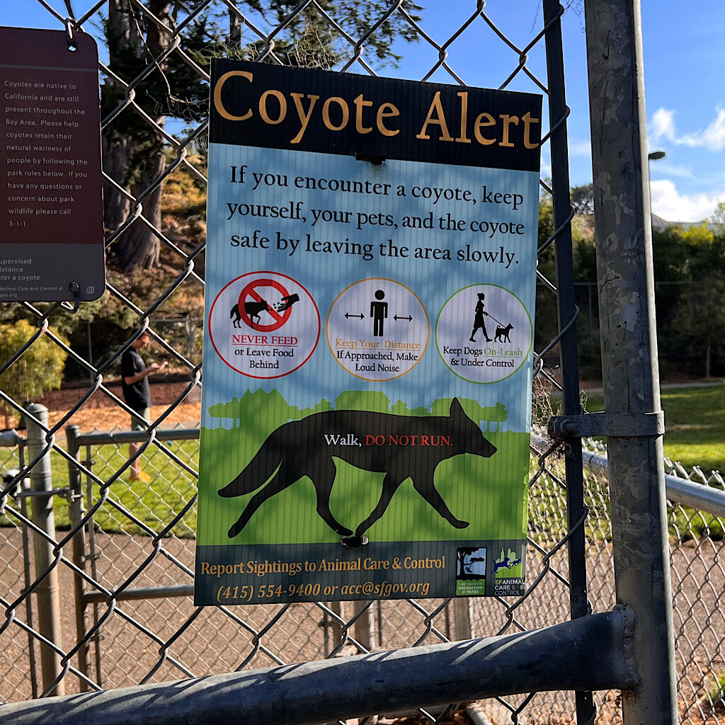
It’s steeply up past St. Mary’s Playground. A man launches a ball for his off-leash dog next to a sign warning of coyote activity. The trail keeps me, for the most part, off major roads and I enter a quiet residential street, the houses slightly larger, looming over garages and a square of lawn.
I don’t carry a backpack and instead cram a wad of bills, my lipstick and phone in my pocket. There are plenty of food choices along the way. This is a terrific article that lists a bevy of options, though I don’t agree with them on their assessment of the trail itself, so be warned!
I grab a drink at a corner store in the confusing section near Glen Park where the sidewalk dips below San Jose Avenue. At no point do I feel nervous or afraid. The sidewalks are full of people and I use the map app to find my way even as I cross Diamond street twice heading the wrong way.
Tip: Here, I’ll pause to make the suggestion that you take a battery or paper map backup. I used my phone for navigation, and the GPS drains the battery fast!
Once I find my way, I again enter a greenway in the process of being restored with native grasses. The park serves its purpose well, blocking out the sound of cars, many with mufflers removed to make their presence even more annoying.
Honking, in my experience, is de riguer in the City by the Bay, and who can blame them? At only seven square miles, San Francisco is the second mostly densely populated city in the United States. (New York is number one). It’s beautiful, desirable and crowded. My 91-year-old step mother drives like Steve McQueen on these tightly packed roller coaster hills and is too polite to allow expletives to fly from her lips, though more than a few stopped cars and illegal U-turns warrant it.
The aggressiveness is on display when walking and another tip would be to ensure you clear the intersection before proceeding. That being said, Californians stop for peds in crosswalks with unusual patience. I never at any time felt at risk for getting whacked.
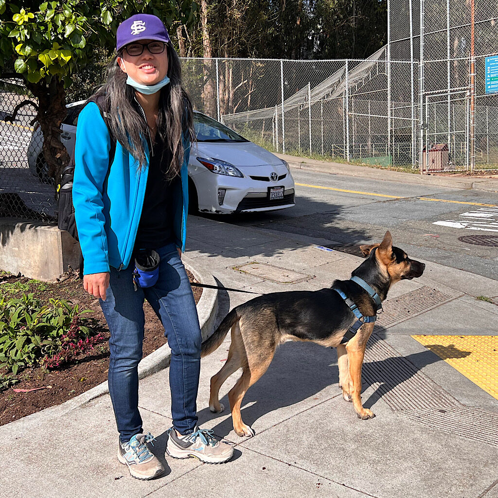
The short, thin greenway spills into a neighborhood where I meet Belinda walking her beautiful German Shepherd, or rather he walking her. The dog park is only a block away and he’s on a mission to see his pals and smell the smells. She’s excited I’ve walked so far already and that I’ll head into the canyon ahead, a real treat in this teeming neighborhood, described less as a city and more a village-within–a–city.
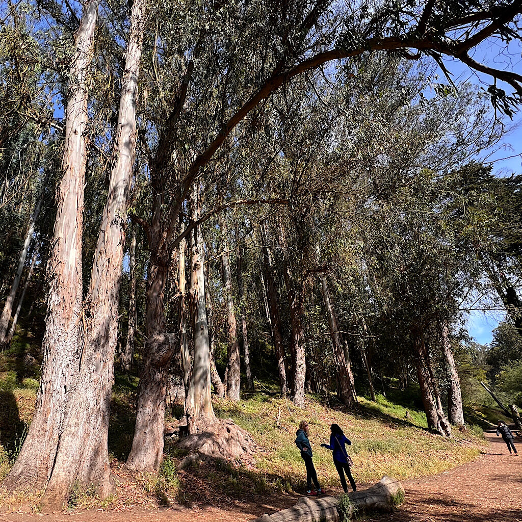
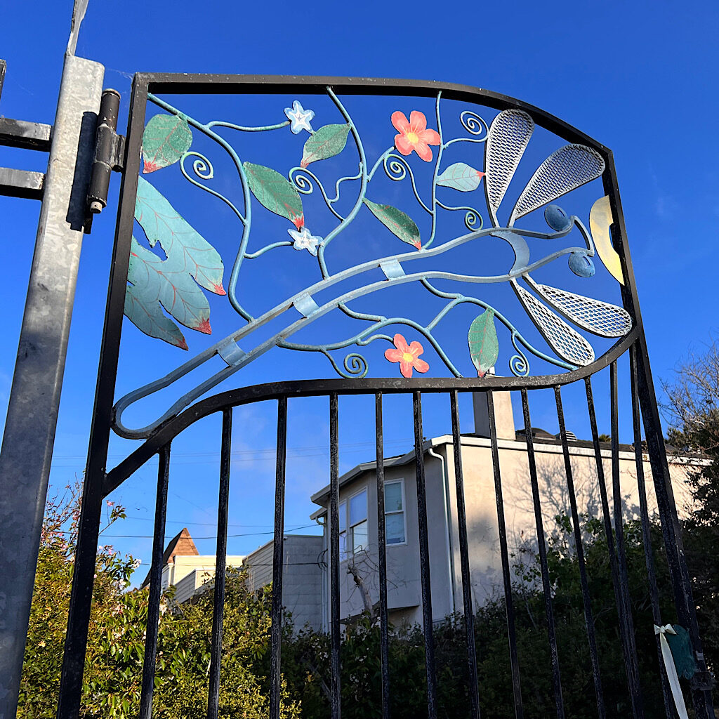
I wave goodbye at the dog-park and pass a soccer field next to the public art fronted Wild Roots Forest Playschool, where a group of children are being prepped by their adult chaperones for a walk. Soon, I’m surrounded by the sweet, menthol fragrance of massive eucalyptus trees, shedding their bark in long strips.
Eucalyptus are not native to California, but were planted here early in the last century in the hopes of making a quick buck. Sadly, speculators knew only that the eucalyptus is a principal hardwood tree for the timber industry – not which variety of eucalyptus. The Blue Gum planted in every spare pocket of land in the Golden State isn’t really good for much of anything. So they were never harvested and grow on in their ubiquity.
It should be no surprise that the name of the tree was attached to three activist women who tried to stop a freeway from cutting through this very canyon back in 1965. A city engineer used “Gum Tree Girls” derisively but they loved it, using it as a rallying cry for all sorts of acts of civil disobedience.
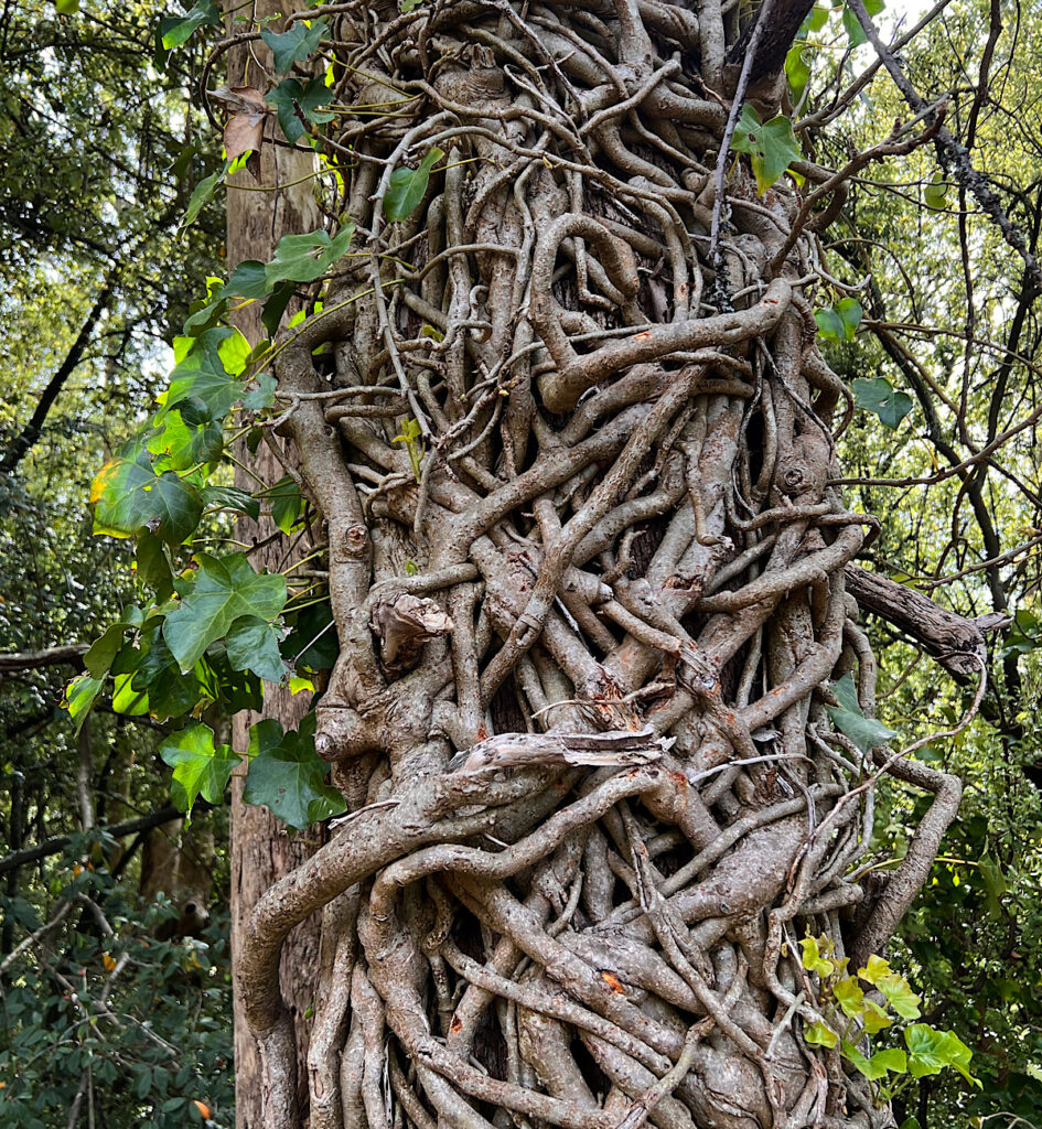
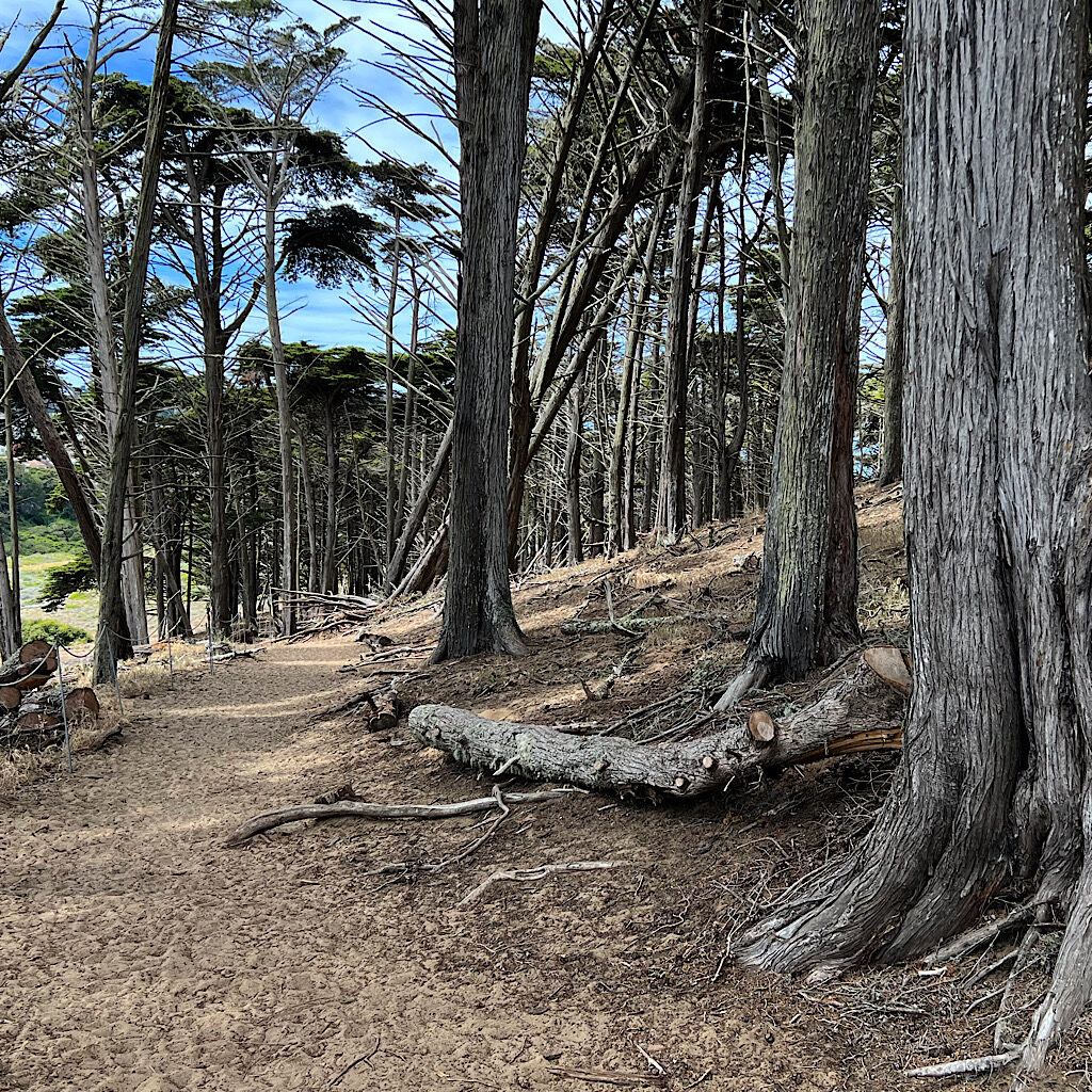
It would take a dozen years for the battle to end in their favor, and here I am in a natural setting, crunching through bits of bark, leaves and nuts, a gentle sawing in the distance. Houses loom over me above bouldering-worthy rock outcroppings. I lose my fellow walkers as I duck into a tunnel of overgrown vines and bushes. The trail is dry and dusty, but a stream gurgles nearby.
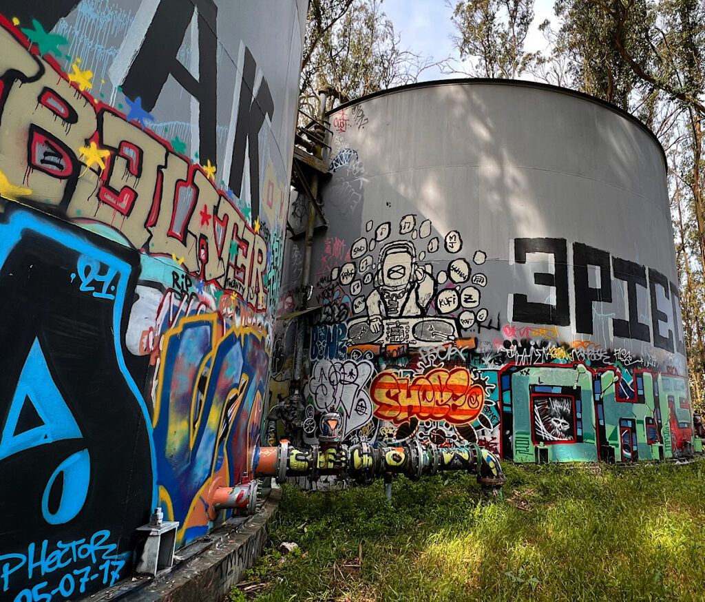
This bit of trail was created for the SFCT to keep it a continuous path, hacked out bit by bit much to the dismay of the neighbors. I don’t see a soul though pass by an abandoned basketball court slowly being swallowed up by foliage. A concrete structure tagged with graffiti towers over the stairs. Ruth Asawa School of the Arts looks empty but I hear voices.
I pop out onto Portola Avenue, the houses crammed in rows with fanciful gardens filled with succulents. I’m excited to see Twin Peaks Boulevard and start flying up the mountainside towards 977-foot Sutro Tower. Red, white and three-pronged, the tower is used by 10 TV and thee radio stations.
I may not go so far as to call it an icon, but it’s certainly recognizable. The peaks themselves were colorfully named by the Spanish as Los Pechos de la Choca (maiden boobs) and I’m excited for the spectacular views from above.
Of course, that’s not at all where the trail goes.
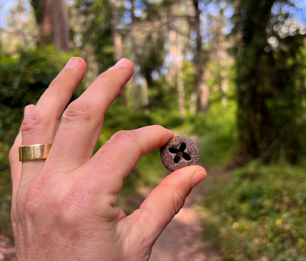
Instead, they wander below the towers into a recently resurrected trail system through Laguna Honda. Affectionately known as “Bedpan Alley,” the Steep Ravine Trail was also one hacked out of bramble right next to the hospital by a group of bikers who kept their work a secret before the staff embraced their work.
The trail takes a dog leg through an area once used as the hospital dumping grounds – for old, useless items, not dead bodies! It’s a magical spot of shade under magnificent trees, and a warm up for the series of stairs to come. I pick up a gumnut and breath in the freshness. I’m so lucky the day isn’t warm and there’s still a breeze, because next, I’ll be all out in the open.
Section 3: Golden Gate Heights Park, Grandview Park, Tiled Stairways (2.1 miles)
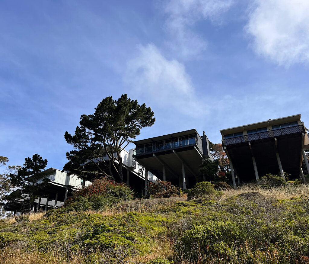
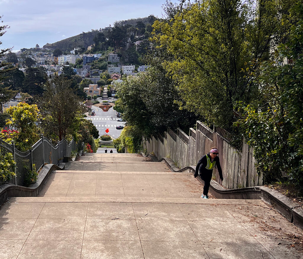
I come back onto sidewalk and head into of the most stunning neighborhoods in the city – Forest Hill. As it sounds, it’s a hill and requires climbing, first up the wide and gracious Pacheco Stairs. There are 116 of them, but who’s counting, right?
It draws me into a series of steps that cut switchbacks in the road. The homes are stunning, perched on the side of the hill with a 180-degree view toward Ocean Beach and the Pacific beyond. Each street has a flight fancifully tucked in about midway and I zigzag higher and higher.
Surprisingly, as I rise towards Grandview Park, the houses become more tightly packed and slightly shabbier. It makes no sense. It is a bus thoroughfare and I take care crossing the street before I hit the Moraga stairs, over 100 leading to the tip top.
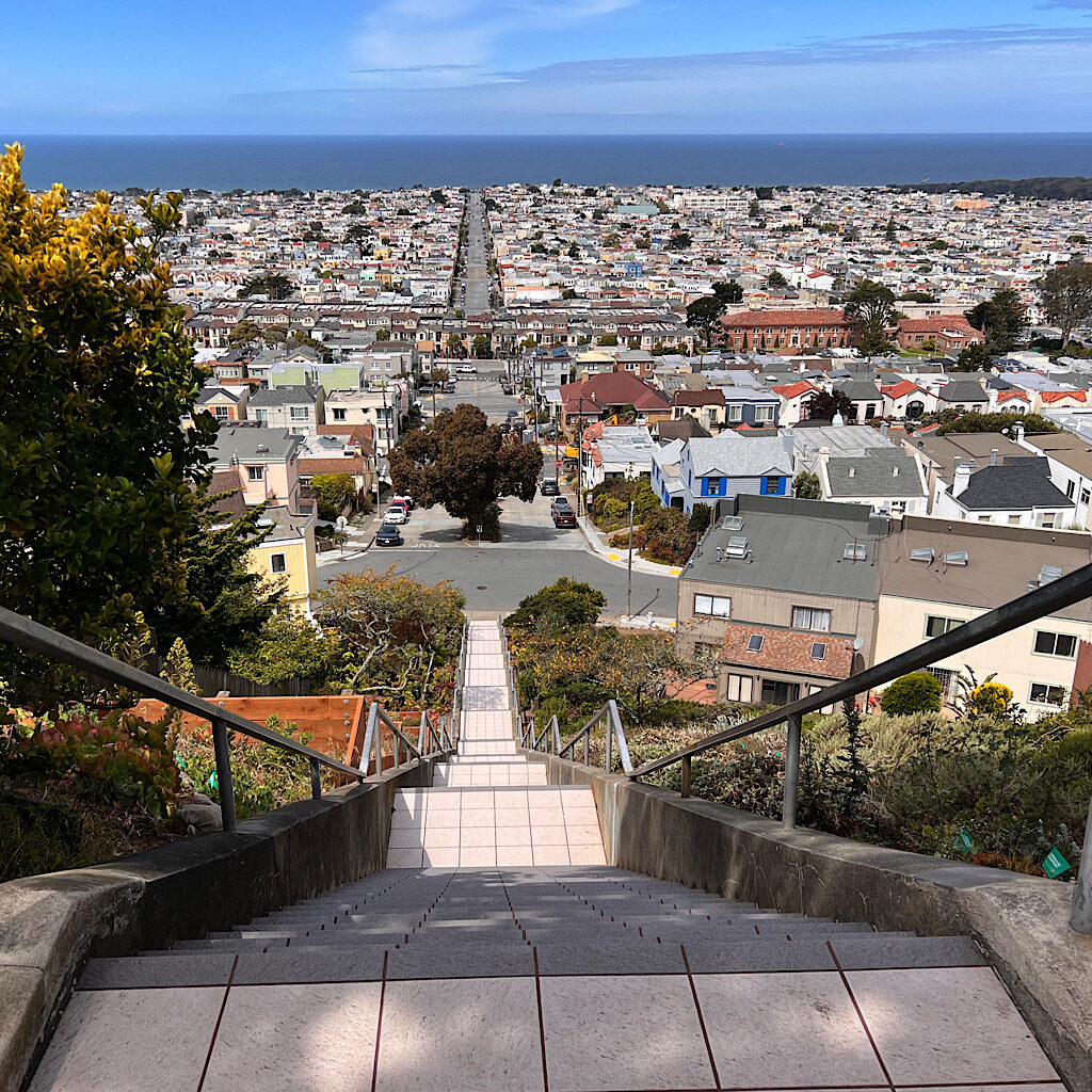
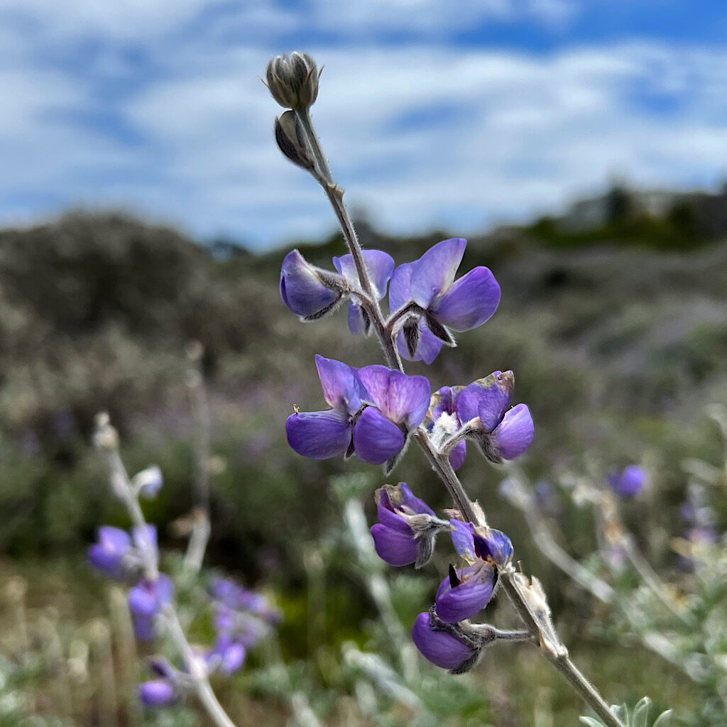
It may be a tiny space of just an acre, but Grandview – known by locals as Turtle Hill – is incredibly special. A mound of sedimentary chert, it’s crowned by glorious Monterey cypress and filled with native plants. I’m surprised by the sandy trail, perfect habitat for coyote bush, bush lupin and dune tansy.
The views are superb all around. Downtown sprouts up over the green hills of Golden Gate Park. The green of the Presidio give way to a tiny glimpse of the Golden Gate and the houses of Inner Sunset pour out, bleached by the intense sun.
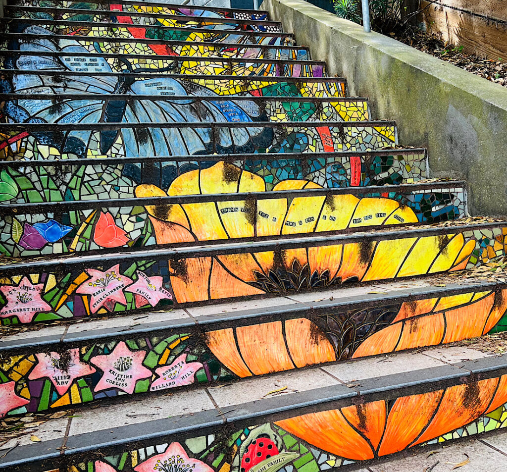
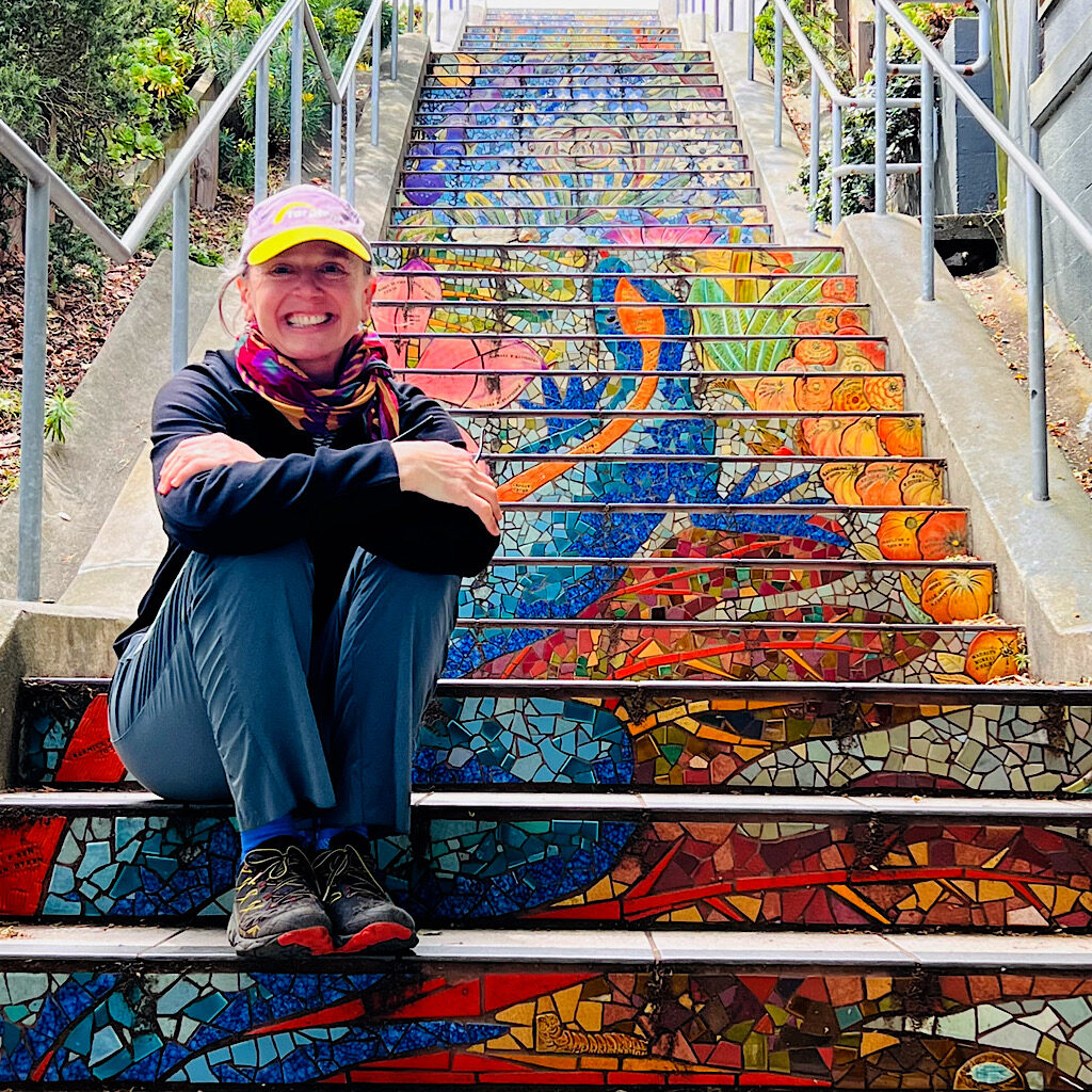
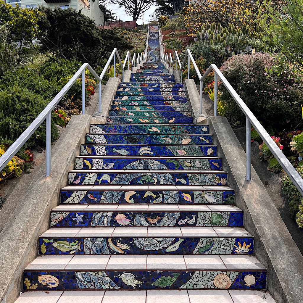
I pop up and over then head steeply down a winding set of stairs that eventually take me to the more famous side of Moraga Street. Inspired by the tiled steps of Rio de Janeiro, a local group of artists created hand-painted tiles to adorn the risers of 163 steps. They tell a story in each flight, revealing daytime and nighttime, the stars and the sun, fishes and flowers.
I walk atop 2,000 tiles made of 75,000 fragments and am filled with wonder that this spot is so hidden from the typical tourist jaunts. In all the years I have been connected with San Francisco since first coming at the age of 13, I never knew about them.
But wait, there’s more!
A few blocks north as I work my way towards the park, is another set of stairs – Hidden Garden Steps. Filled with vibrant colors, and perhaps a bit more whimsy, the risers reveal butterflies, flowers, mushrooms and a newt, whose tail lays languidly along one flat concrete section.
A tour works its way up and seem a bit put off by my presence, although the guide offers to take my picture, tapping his foot when I pause to look at each tile. I eventually lumber on and stop for a take out sandwich and chips from a goofy corner store where the proprietress plays ’70s funk and laughs non-stop. From here, it’s only a few blocks to Golden Gate Park.
Section 4: Stow Lake, Rose Garden, Park Presidio Boulevard (2.2 miles)
Competing with New York, San Franciscans as far back as 1860 knew they needed a spacious public space comparable to Central Park. Originally called the “Outside Lands” because it sat outside the city border, the area was made up mostly of dune and deemed utterly useless. Over a million trees were planted to stabilize the land by none other than John McLaren, whose namesake park I walked through earlier in the day.
A music concourse including the Spreckles Temple bandshell was added as well as the De Young Museum, California Academy of Sciences, a Japanese Tea Garden and Conservatory of Flowers plus a series of Dutch windmills along the beach to send fresh water back into the now thirsty park.
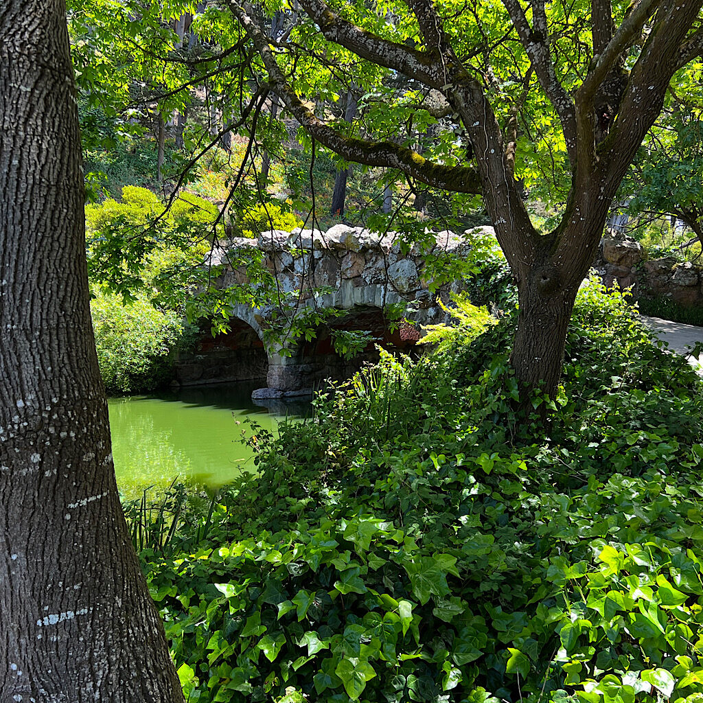
The trail misses all of that, sending me instead over a stone bridge onto an island in Stow Lake where I find a log in the shade to sit on and eat my lunch while. Paddle boats and ducks ply the calm surface and birds sing loudly. When I finish, I pass a cafe and enter a forest filled with some of those original million trees.
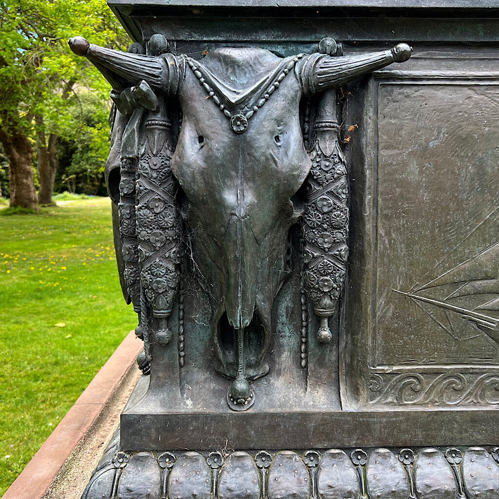
Along a lawn, I come upon a bronze statue, the only one of a women in a park full of statues. It’s a pioneer women in requisite bonnet and long skirts, holding out her arms in a motherly gesture to two naked boys. Created for the Panama-Pacific International Expo in 1914, it’s a tribute to women of the Oregon and California Trails and represents the hope that was carried by those who risked everything for a better life out west. Highly decorated buffalo skulls and, oddly, a two masted ship decorate her stand.
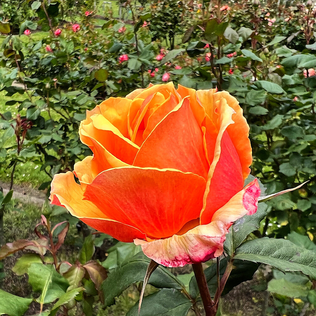
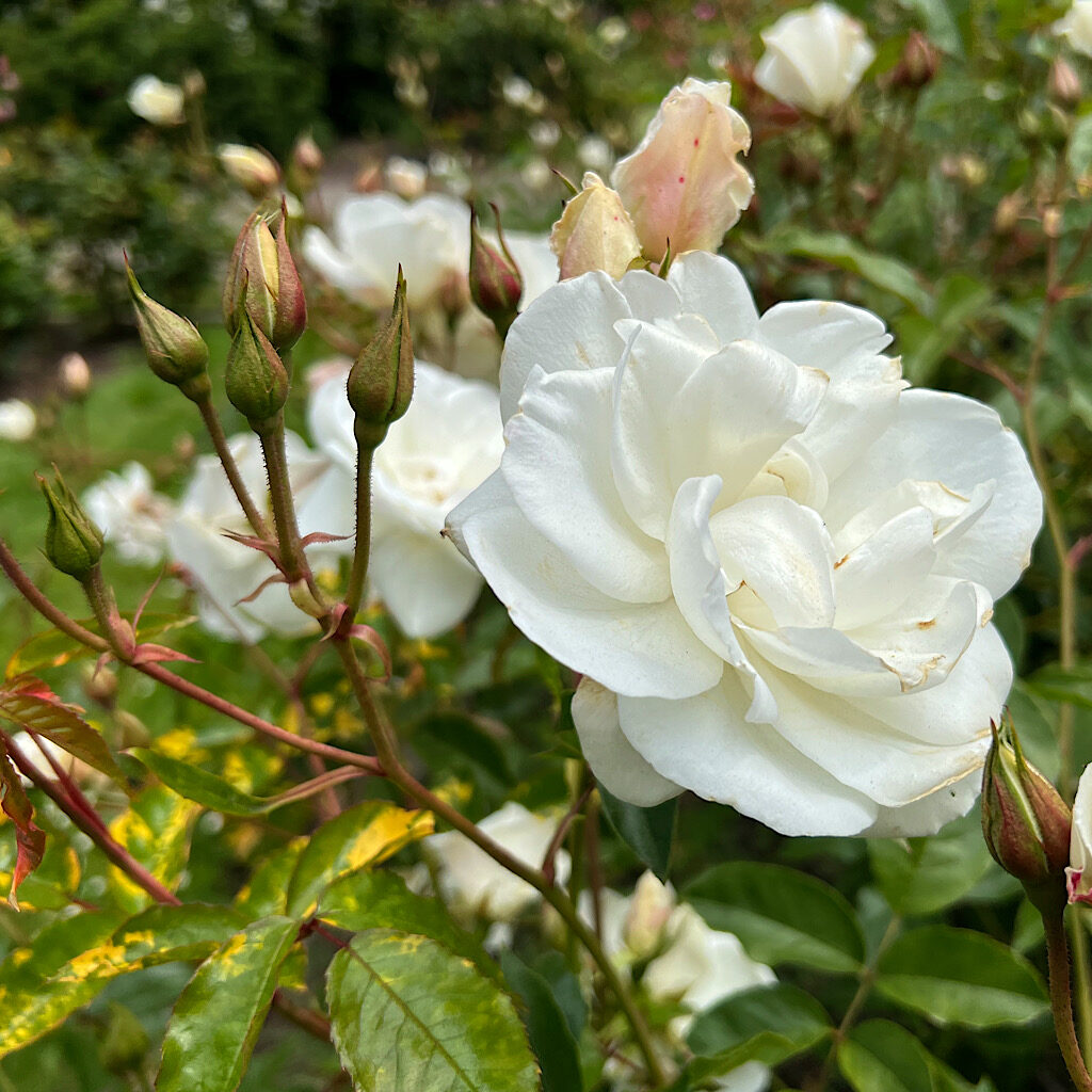
I can’t help but feel a whiff of patriarchy as I snap her picture, then join skaters and bikers on JFK Drive before taking a sharp left into the Rose Garden. I must be here at peak, as blossoms explode in all colors and sizes. This spit was chosen as a testing ground for new varietals and each bed is lovingly cared for. I quite literally take time to smell the roses.
As I leave the park, I follow Park Presidio Boulevard through the Richmond District. The path winds through a wide greenway under tall trees. It’s the first time on the trail I see homeless people, sitting amidst trash bags and shopping carts, maybe a small dog. One man leers at me and seems to want to approach, but mostly they appear harmless, part of a complex sociological problem no one seems to have a clue about how to resolve.
There are approximately 8,000 people living on the street in San Francisco, though the number declined some during the pandemic. Organizations have bought up unused motels to try and help these unfortunates find dignity and safety, but the problem is so entrenched and acts as a tragic reminder of widening inequality.
I leave the boulevard and walk into the Presidio proper, a stretch of land rising above the inlet of the golden gate that served as an army post for three nations. I immediately leave the historic section to begin the Anza Trail, named for Juan Bautista de Anza who sited a fort here for the Spanish in, ironically, 1776.
Section 5: Presidio, Sea Cliff, Lands End (3.8 miles)
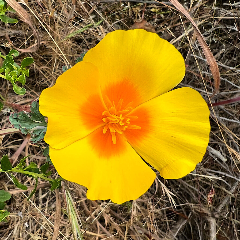
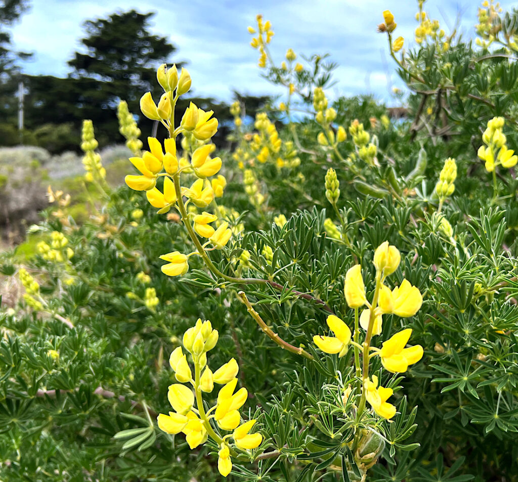
Heading west through Monterrey Pine, I again take a wrong turn into thick sand when I follow tourists heading deeper into the park. I backtrack to Lobos Valley and come upon a magical restored area of dunes and beach plants. Lizards do pushups in the sun before scurrying out of my way on a boardwalk through chamisso’s lupine, coast dandelion, dune gilia, yellow sand verbena, Indian paintbrush. San Francisco wallflower and cobweb thistle.
The lupine are in bloom, both purple and yellow plus California poppies, the state flower. I cross Lincoln Boulevard then head deep into forest again along a creek. A house abuts the ravine along with small decorative pagodas.
A fence keeps me hemmed in through a narrow path that suddenly opens out on Baker’s Beach and my first full view of the Golden Gate Bridge. The wind is up and most people wear jackets. I don’t see any fog, but I hear the horn anyway helping guide ships around the point and through the gate. A squadron of brown pelicans fly past, low and slow, their heavy wings lightly tipping to steer, heads tucked in and beaks in Buddha-like serenity.
I walk back up a stairway towards Sea Cliff, expansive houses lining immaculate streets. At one street, a colossal crane is at work. I joke with a few tourists that he’s in place to change a lightbulb. It’s beautiful here, but I’m aware this spot gets far more fog than the rest of the city and can be rather depressing. I remember that Robin Williams lived here and it send shivers up my spine.
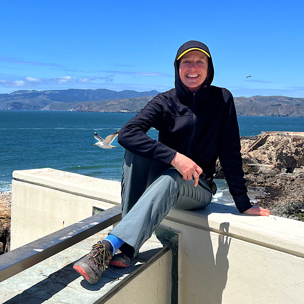
Soon I reach a sign for Lands End and the coastal trail. It’s packed with tourists for obvious reasons – its outstanding location perched 200 feet high on cliffs above an azure sea, with a view back to the city, the Golden Gate and the Marin Headlands. I stop often to take selfies trying to line myself up just right with the view. It never occurs to me to ask someone to take my photo.
Framed by windswept cypress, the trail heads up and down on stairs and packed dirt. There are numerous alternate paths to take including one down to Seals Rock Beach though I’m getting tired and my parents will soon be picking me up. I take in the view including to the ruins of Mile Rock Lighthouse, now a bird sanctuary of their own choosing.
At Eagle Point, visitors crowd in for an Instagram-worthy shot and I catch up to a dog walker playing a podcast at full blast. Somehow, even pulling back, I catch him up over and over, especially when his dog stops to sniff. He passes me and I begin making a kind of “blah, blah, blah” robotic sound at the same pitch as his phone. Am I being a complete jerk?
Up and over I go, the stairs steep but well used. He moves ahead quickly but I catch him at the bottom. The podcast is off finally and he very politely asks if I have the time. “My phone died, so I don’t know what time it is,” he explains, much to my amusement. He thanks me when I tell him it’s a-quarter-to-2 then adds he has time for a bit more walking. When he leaves, he smiles and wishes me a good afternoon.
Well, ok, I guess he got the point.
I soon lose the view of the bridge and look straight out to sea, passing under the USS San Francisco Memorial and above ruins of the Sutro Baths. The baths were a fantasy project of a mega-millionaires in Grecian style filled with slides, trapezes, high dives and 1.7 million gallons of sea water. All that remains of that era is the restored Neoclassical Cliff House, which sadly is permanently closed but marks the end of the Crosstown Trail.
At the lot, my dad and his wife await me, their Welsh Terrier Tammi Two poking her furry snout out the window. They’re full of questions about the neighborhoods I visited, my favorite moments, if I had enough to eat. In answering, I realize this was one of the coolest things I’ve done in San Francisco.
But would I recommend it to everyone?
Yes, thought a qualified yes.
San Francisco is filled with beauty and spectacular sites. This trail touches upon a walker’s need to feel the heartbeat of a city away (for the most part) from tourists and souvenir shops. It offers one a chance to see the city in a kind of total way, though I would suggest that it’s important to ensure you see some of the other famous neighborhoods to the east of the trail in addition to walking the Crosstown.
And how would you accomplish that?
You’d walk.

3 Responses
Yes! On our list now; had no idea this exists. Sounds like a great day in a wonderful city.
awesome! it was really cool and different.
Well THAT was fun! I’ve never been there and probably never will be . . . .unless it’s on the bucket list to do exactly what you did. Of course I love the mosaic steps the best! Did you say how long it took? I know you meander and stop to smell the roses, so not looking for a record breaking time. Just curious.