
I added six days to the C2C by wondering through the Lake District to bag peaks and climb a few walls.
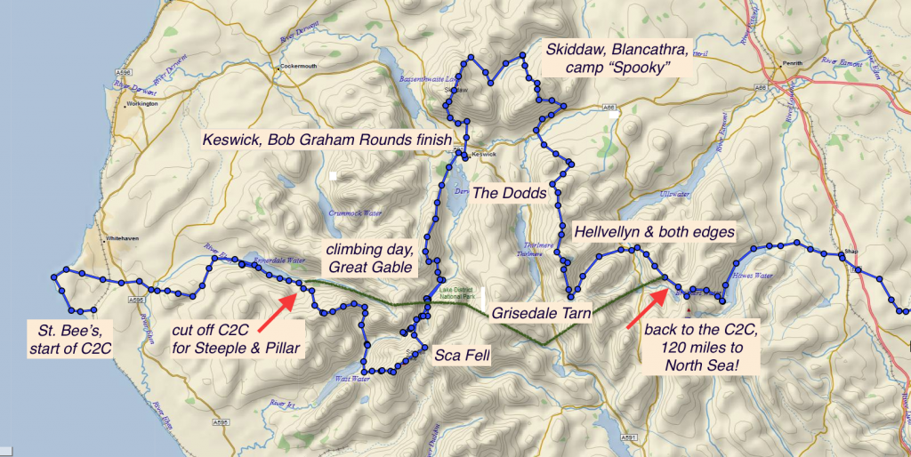
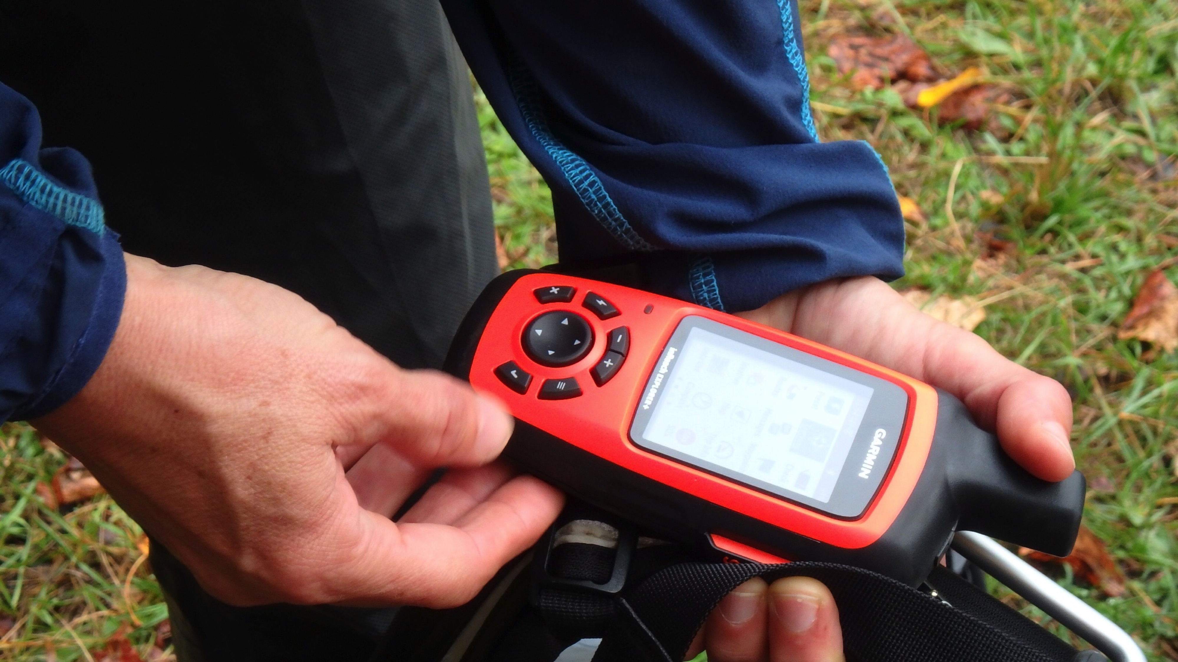
When I set out to walk Wainwright’s Coast-to-Coast, I had an idea to pick up more of the big peaks in the Lake District. So – with the help of map, compass and my Garmin GPS – I left the C2C at the end of Ennerdale Water and headed south, cracking straight up a steep ascent towards Steeple and Pillar.
It was here I saw the mist flying up over the cliffs in fingers of white, fell runners barely dressed in floppy shorts, a thin mac and camelback, as well as sheep parked in meadows leaving me wondering how they managed to get there at all – isn’t the grass good enough at more reasonable elevations?
Ticking off my first Waingrights of the trip, I worked my way down to the famous climbing Mecca of Wasdale, camping in a field and treating myself to another first; a splendid serving of lamb rump – sorry, friends, but you taste so good and this tired and damp hiker could not resist.
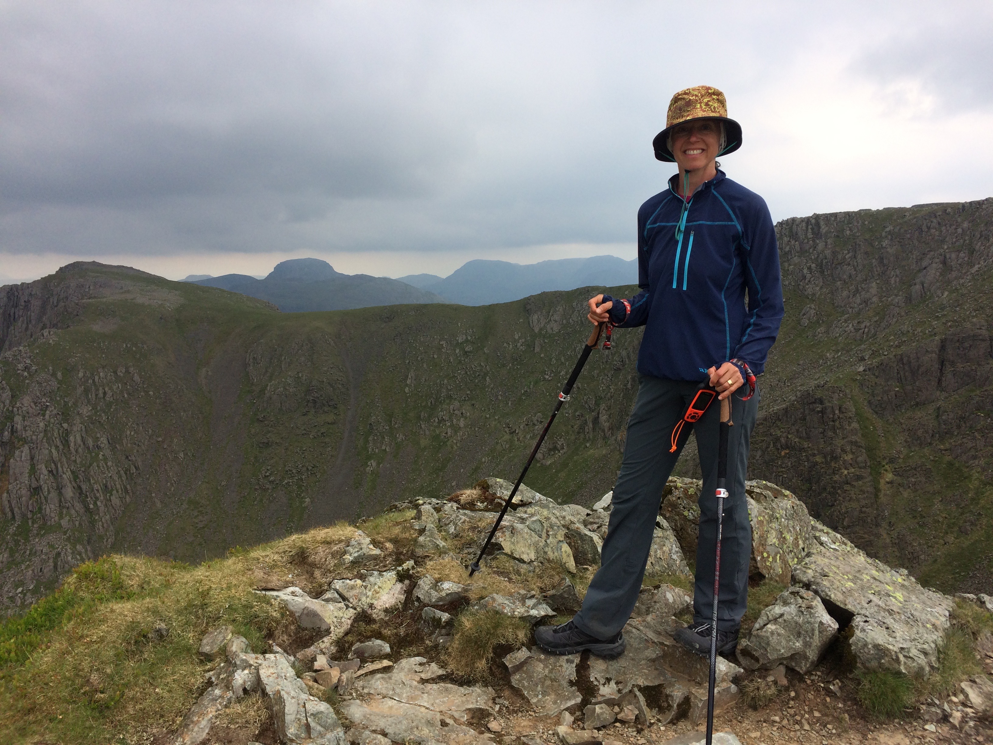
The next morning saw me contouring up towards Sca Fell relying on my Garmin to allow me to cut off some zigzags and march straight to my destination just like the runners do. And it was a good thing I had the Garnin as the mist came right down to only a few inches visibility. Fickle as can be, the sky cleared up at Sca Fell Pike and the lovely ridge descent to Seathwaite.
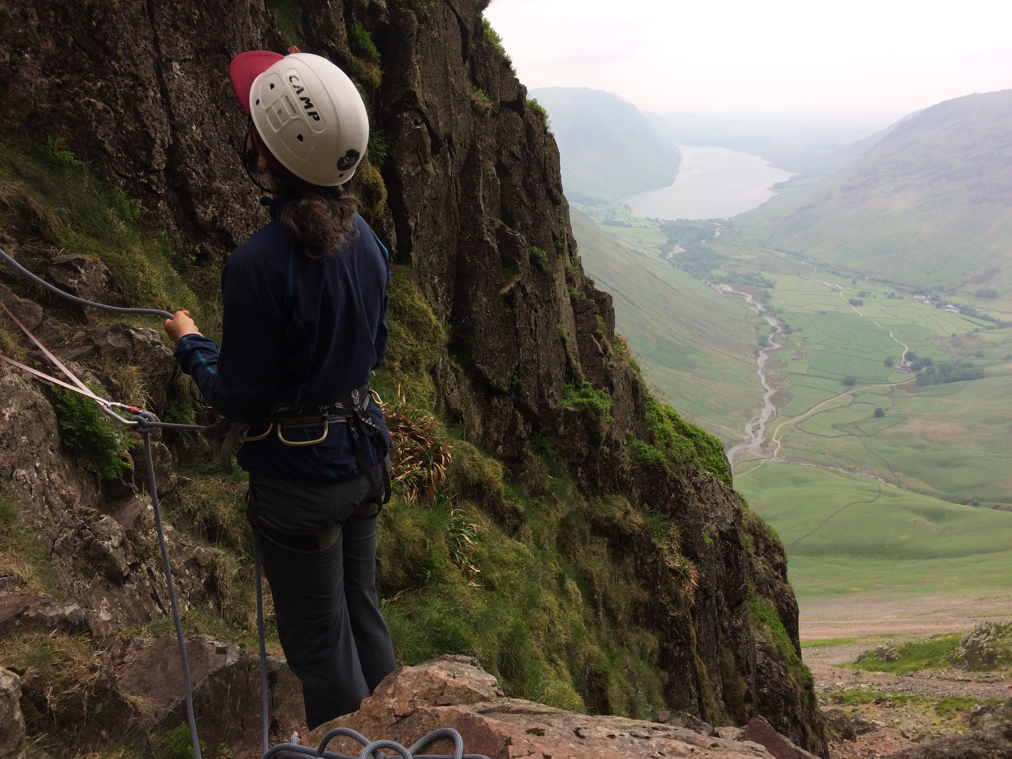
Though it was intended as a “rest day” I was out early for some rock climbing with guide Tom who leads trips in the Himalaya – and England. Many of my climbing pals would have winced at the two-hour approach right back up the track to the base of Great Gable. It was a day of both personal and physical discovery and we got off the face just as the thunderstorm approached.
Tom left me at another camp spot in Seatollar where I headed back into the hills, walking along a high ridge towards Cat Bells and the lovely tourist town of Keswick. Decisions had to be made at the misty top to forgo a long day in white-out conditions and rather drop down towards Derwent Water. My timing was spot on as I was there when a Bob Graham Rounds finisher arrived at Moot Hall after running up and down 42 Lakeland Fells in under 24 hours. That’s more elevation gain – and loss – than Everest. Big smiles from this hugely impressed hiker.
Clear skies all around when I set off for Skiddaw, but the peak “tends to attract cloud” and the day was socked in all the way to one of my favorite spots I named Camp Spooky. Again, my Garmin kept me on track hiking overland towards Blencathra, which remained in mist and dampened my spirits. She only showed herself at sunset from my tent far across the dale.
Waking up in a damp tent and overcast sky nearly broke me before I decided to give the weather one more chance and pushed up again without a clear trail towards the rolling peaks of the Dodds. By the time I reached the ridgeline, I could see where I was going and my Garmin lived up to its other very useful purpose of tracking my course and pinging Richard every half hour with my location.
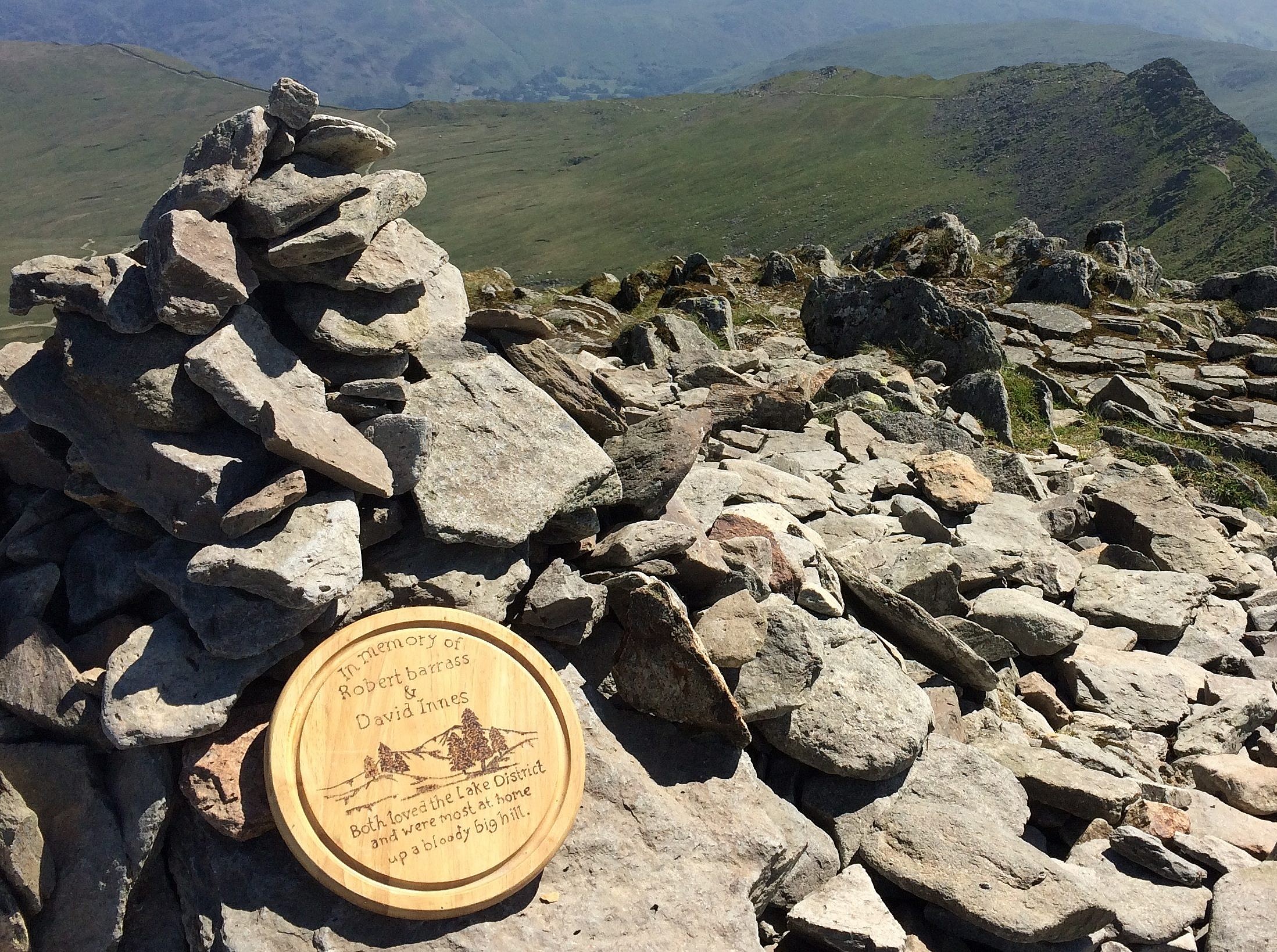
The map above is what he could see as I crossed Northern England. He followed my every step as I circled England’s second highest peak, Helvellyn, by walking down one knife edge and back up another – wisely leaving my backpack behind and picking it up before heading down towards Grisedale Tarn (lake) and setting up camp high above her banks for my final day before meeting up the C2C again in Patterdale and following the “proper” route to the North Sea, 120 miles away.
If you want more details on my route and/or the Garmin breadcrumb, don’t hesitate to contact me. This extra 40 miles or so really made this an unforgettable hike and quite unique to the mostly plodding course in the valleys. With some alteration, it would be possible to plan your stops at B&B’s or huts and not wild camp as I did.
And remember, Not all those who wander are lost – J. R. R. Tolkien

2 Responses
So interesting. I love following this.
Thanks, Mom! It made the hike so much better to loop around the Lakes before heading towards the Moors. Where – you guessed it – I yelled “Heathcliff” once or twice 😉