
The Colorado Trail, or CT, passes through 567 miles of the Rockies from Denver to Durango and shares half of its length with the Continental Divide Trail. Through the Sawatch Range, there are ample opportunities to bag 14ers (peaks over 14,000 feet.)

going backward
I wanted to walk another long trail, but I didn’t have quite the time for 500 miles. So, I decided to give the Colorado Trail a try, but start at the end and tick off as much as I could of the most spectacular scenery first before having to head back home and back on air.
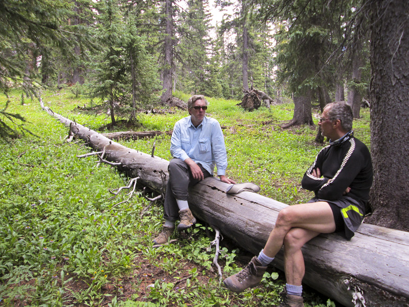
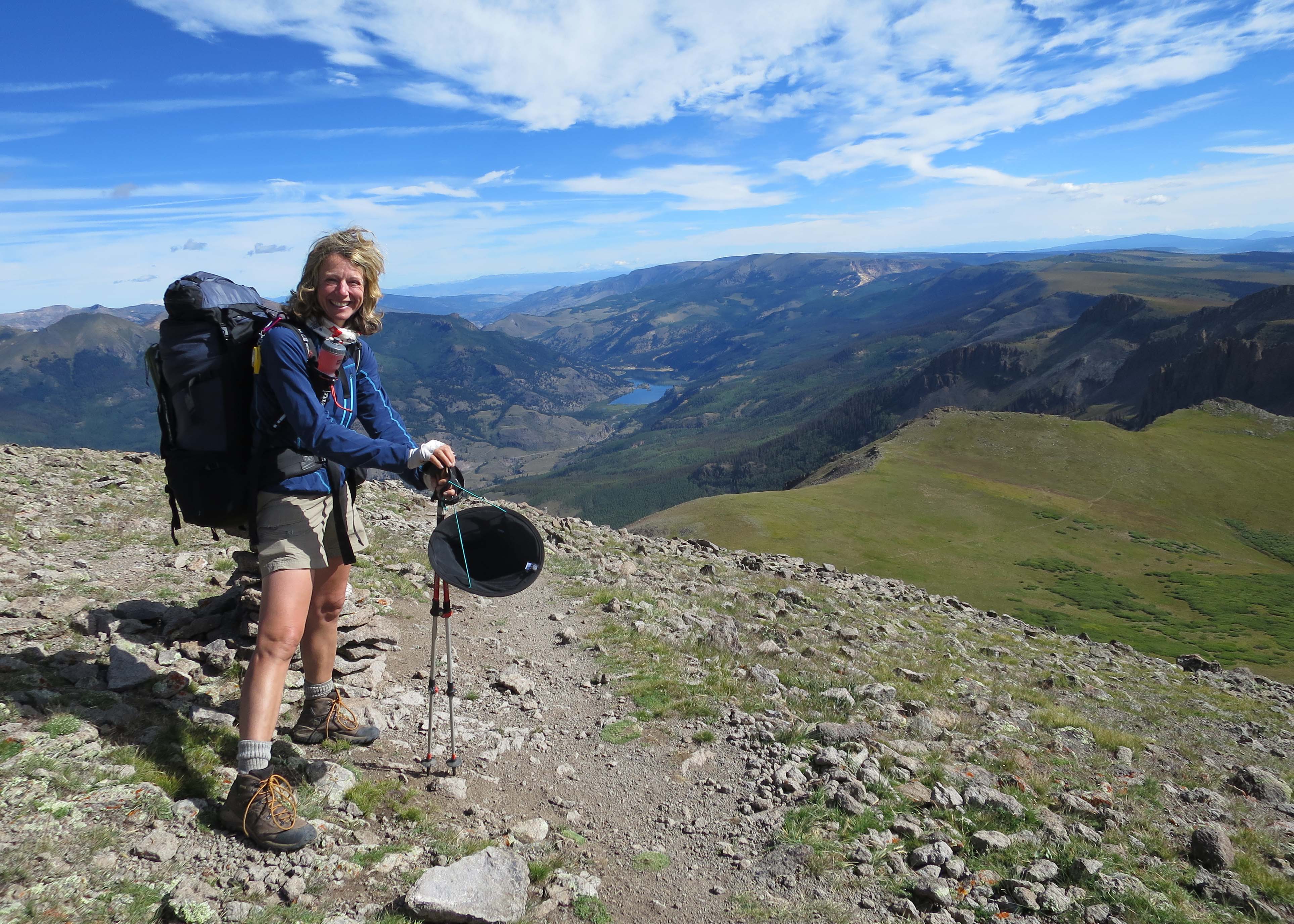
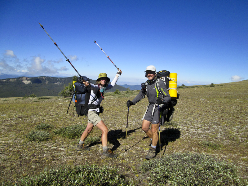
My hiking friend from England, Ted, joined my husband and me in Denver and we drove to Durango for the start. We had a little joke about our crew; as the trail heads above 11,000 feet in the first 20 miles, we knew we’d need to go slow to acclimate. But that was mainly for my benefit as I take longer than average to settle down in the mountains. Richard has asthma and Ted is 17 years older than us, so in some ways, we were all at a disadvantage and a moderate pace wouldn’t crush anyone’s spirit.
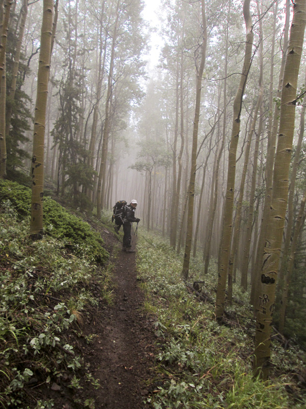
Sadly, the altitude wasn’t our only problem. That August, a monsoon settled over the Rockies and wouldn’t let us out of her grip. We had days on end nearly completely socked in by constant precipitation, both rain and mist. Some days, there were no views at all, so when they finally opened up, we were on our knees with gratitude.
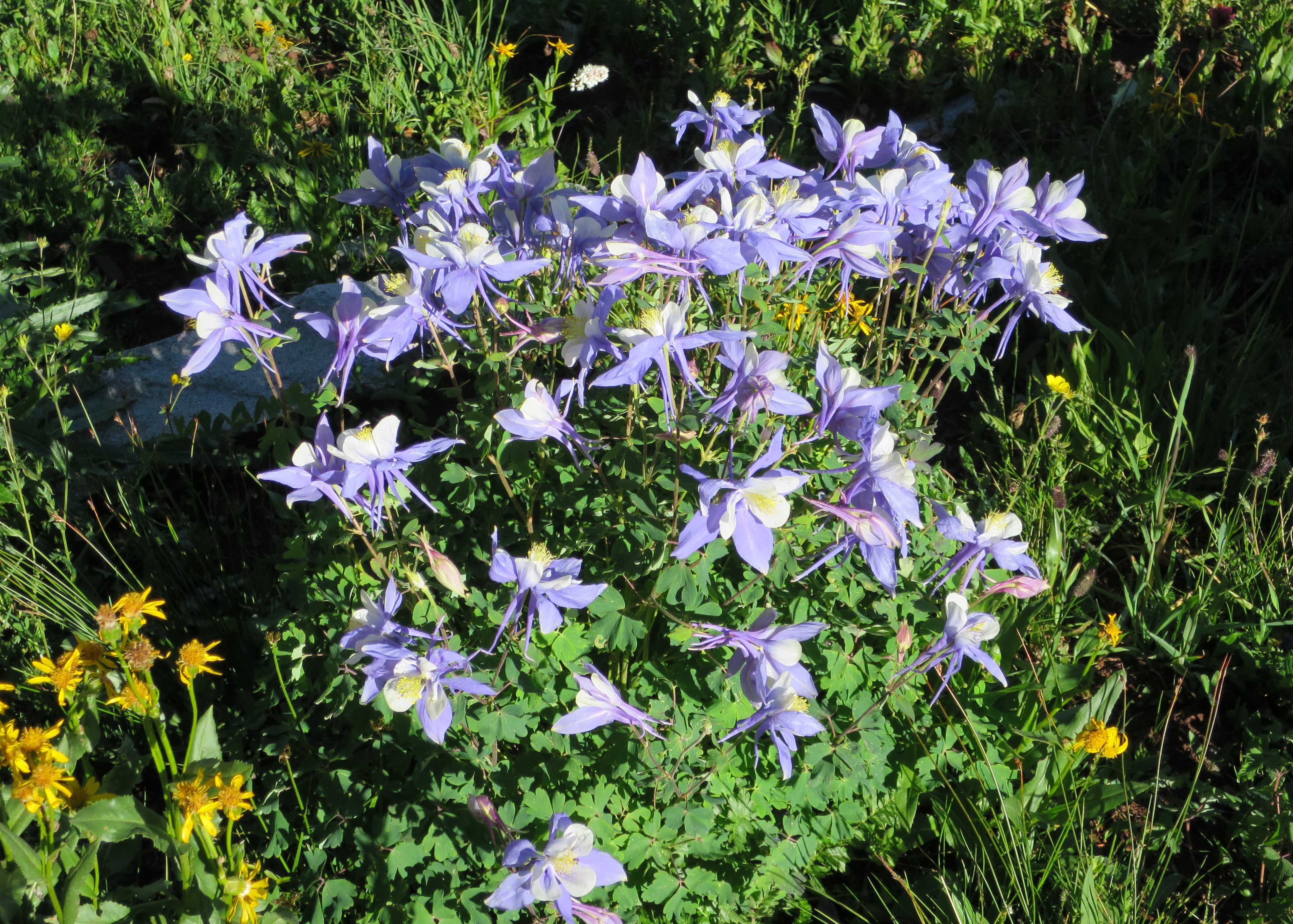
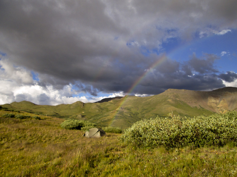
Wild flowers proliferated, including the state flower of columbine, which grew in huge bushes as we came off Blackhawk Pass. We camped below the pass the night before, with all of it to ourselves in dry conditions. The previous night at Taylor Lake was also deserted and filled with flowers as the storm clouds moved away, but someone left us a gift of their poop under a rock right at the campsite. Nice work!
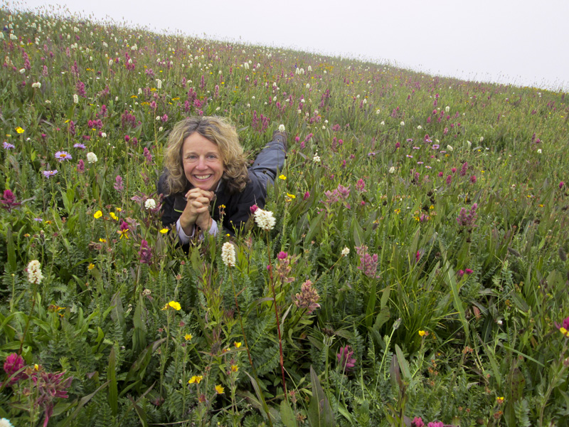
showers bring flowers
It seemed every time we were certain the rain was moving on and we had clear sailing, clouds would develop and quickly turn ominous. We did all we could to avoid ridges and mountaintops in the afternoon, but the pattern was confusing even in the light – but thoroughly soaking – rain.
And that brought up the issue of how to stay dry when backpacking. Sure, we had rain pants and raincoats, but inevitably we’d sweat inside the coats and feel clammy and damp. We came across people wearing umbrellas as hats and they seemed to be doing fairly well, but only in the woods. Once out in the wind, the hats lost some of their covering power. I have yet to give umbrellas a try and I welcome your feedback on that. My Kavu hat was brilliant with its wide brim keeping at least my face totally dry.
One particularly long day of lots of rain and no views, we met a couple wearing giant mittens. They were all smiles, happy to be walking in whatever weather came their way – or just too much in love to notice much else. They told me they picked up these mitts made of eVent fabric from Mountain Laurel. I am now a proud owner and swear by these miraculous pieces of gear.
The mitt fits over your hand – plus any glove you might want to wear for warmth – and cinches tight around your jacket. If you have your hand up in front of you on walking sticks all day, you stay absolutely dry. I highly recommend them.
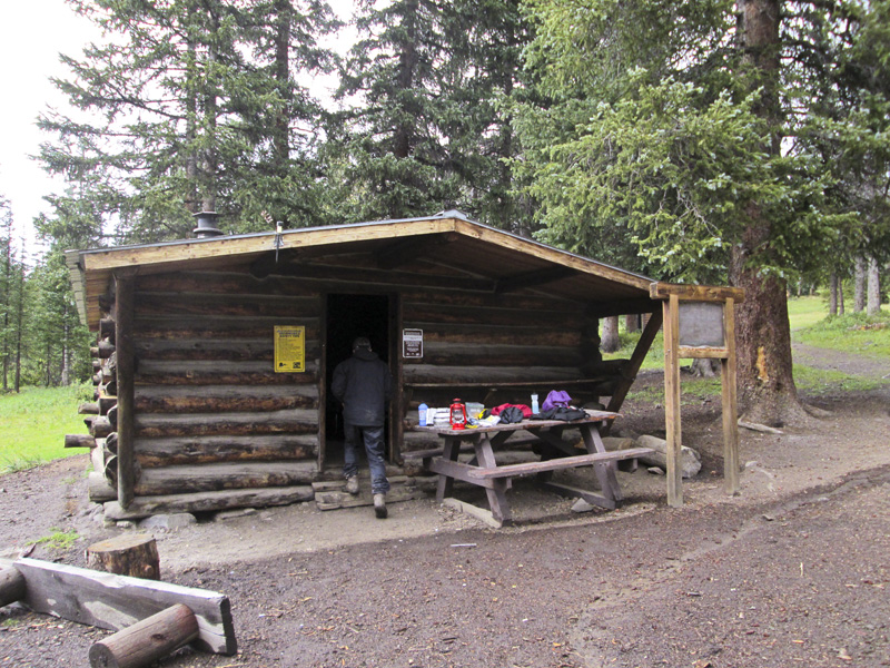
They also gave us beta on a snowmobilers hut ahead that might make a nice place to stay rather than set up the tents. We found it and claimed the little log cabin for ourselves, never quite figuring out how to start a fire in the stove, likely because the flue was stuck closed. We also noticed the rattraps around, so put one crumb in and set it just in case. Sadly, it was a matter of minutes before it sprung on a poor little beast.
gear for staying dry
But this was days away, below Monarch Pass and after Ted and I bid farewell to Richard who finds a week’s hiking – and shitting in the woods – enough for him. We made a good team that first week, acclimating together and passing the time all crammed into our Big Agnes talking up a storm while I cooked in the vestibule and the rain lashed down.
I was always on the lookout for a site with a view but the boys won out when they convinced me not only would we have no view in non-stop mist, but also, out in the open, we’d be soaked through and through. The tent worked well, as did packing the things that needed to stay dry – like clothes and my sleeping bag – in separate Granite Gear eVent stuff sacks. (Noticing a pattern here?)
I have never been a big fan of pack covers, which tend to blow off, rip apart, or cover only part of the rucksack. I also find simply lining the bag inconvenient, because you might want to remove contents and set them in the elements until you’re ready for them.
Things I did not do on this trip that have now become part of my routine is to wear trail runners rather than boots. If the sole is rugged and the toe box protected, mesh shoes dry faster than boots and are close to the same in protection. Gators help to keep water out of the shoe, but in constant rain, an ankle-covering boot will take in water just as easily.
We had an actual river form on the trail one day, rushing, pulling sticks and muck with it and creating its own powerful force to sweep us off your feet. Fortunately, the maintenance crew created exits for the rushing deluge and it plunged down a ravine off-trail.
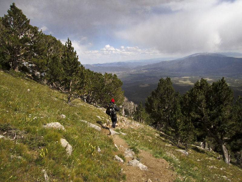
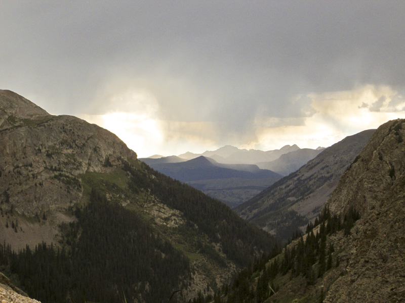
While the rain was our nearly constant companion, there were plenty of sparkling clear days of long views, fields blanketed in wildflowers and superb walking. The three of us found decent sites near water and with terrific views (if clear) for six nights as we worked our way towards Molas Lake Campground, where Richard would take the historic Silverton narrow gauge rail back to Durango and the car and Ted and I would push on as far as we could get in two weeks.
Rocky Mountain high
I was disappointed that swimming was prohibited in Molas Lake, but delighted with the little store that we cleared out of its junk food. It’s rare when planning a hike that I remember how famished I am on the trail – or that I sometimes lose my appetite entirely and only want salt and sugar. Sated and rested, Ted and I left earlier than Richard to get a good start on a day that took us down massive switchbacks to 8900 feet and right back up to 12,000.
Richard tells us that all he needed to do was stand on or near the tracks and wave down the train. He reports it was a blast to ride back, though tourists gave him a funny look kitted out in backpacking gear and reeking after a week on the trail.
Ted and I had smashing weather all the way to Mine Camp, where we looked out on an approaching storm that thankfully fizzled while I made dinner and promptly spilled it all over the ground. Like good hikers, we just took our sporks and grabbed the clean bits.
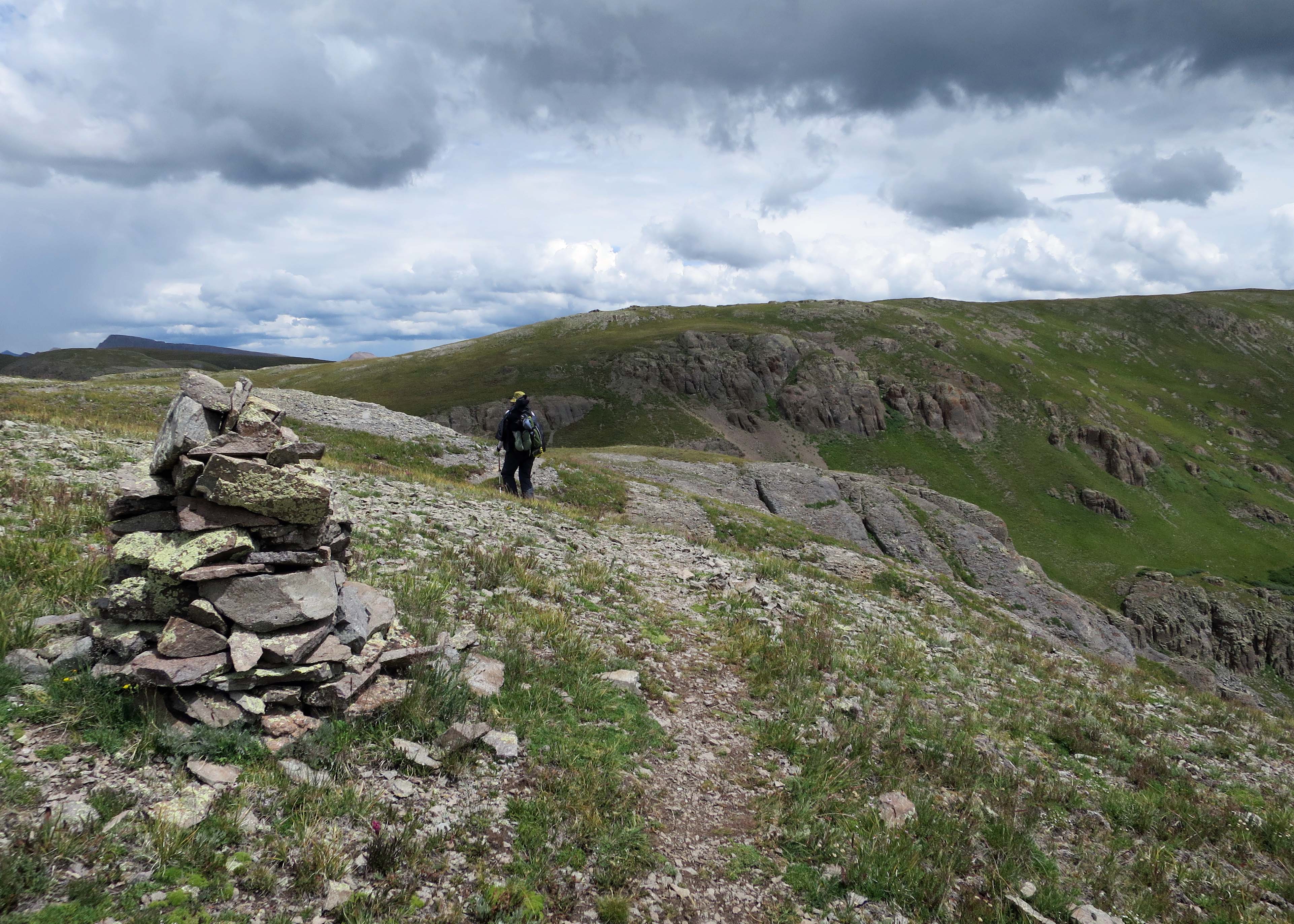
The next days were the most spectacular, keeping us above 12,000 feet for a few days with wild, expansive views. We found great sites close enough to water and with plenty of solitude. It was spooky to cross a bowl and pump water from a trickle of creek, the headwaters of the Rio Grande.
zero day in Creede
The CT high point at 13, 271 was totally shrouded in cloud, but that didn’t keep me from snapping a picture. Likewise, Snow Mesa was completely obliterated, but as an exposed ridge that oftentimes attracts some of the most savage lightning storms, we felt safe in rain, if not a little cranky and cold.
The trail meandered on and on, and up and up. As we got closer to the cut off for Creede and our resupply, I saw cairns marching up the mountain and out of sight into the clouds. “I can’t go up that!” But Ted urged me along and we popped up and over and into a long valley on a rutted rocky road.
Five miles to town, but this isn’t such bad walking, I thought, just as it started to really piss down. Conversation stopped and it was as if each of sucked our necks back into our shells to press on. We saw a car, but it was parked with a sun screen on the windshield, likely a hiker far away now.
Then rounding a bend, I spotted a truck – and the doors were open. I began running. “Wait! Hello! Wait!” I yelled. I must have looked like a crazy person. Two fellows were loading in some gear and gave me a languorously long look. “Who are you?” they asked.
I told them we had been hiking and needed a ride into Creede. What they were loading in their truck turned out to be gold mining equipment, but when it became obvious we had zero interest in their claim, they were all smiles and gave us a lift down, even helping us find a place for the night at the height of tourist season.
Of course, the weather cleared and we had a lovely night of food, showers and laundry. But we were up right when the post office opened the next day and back on the trail, the sky, of course, clouding back up.
thirsty hikers
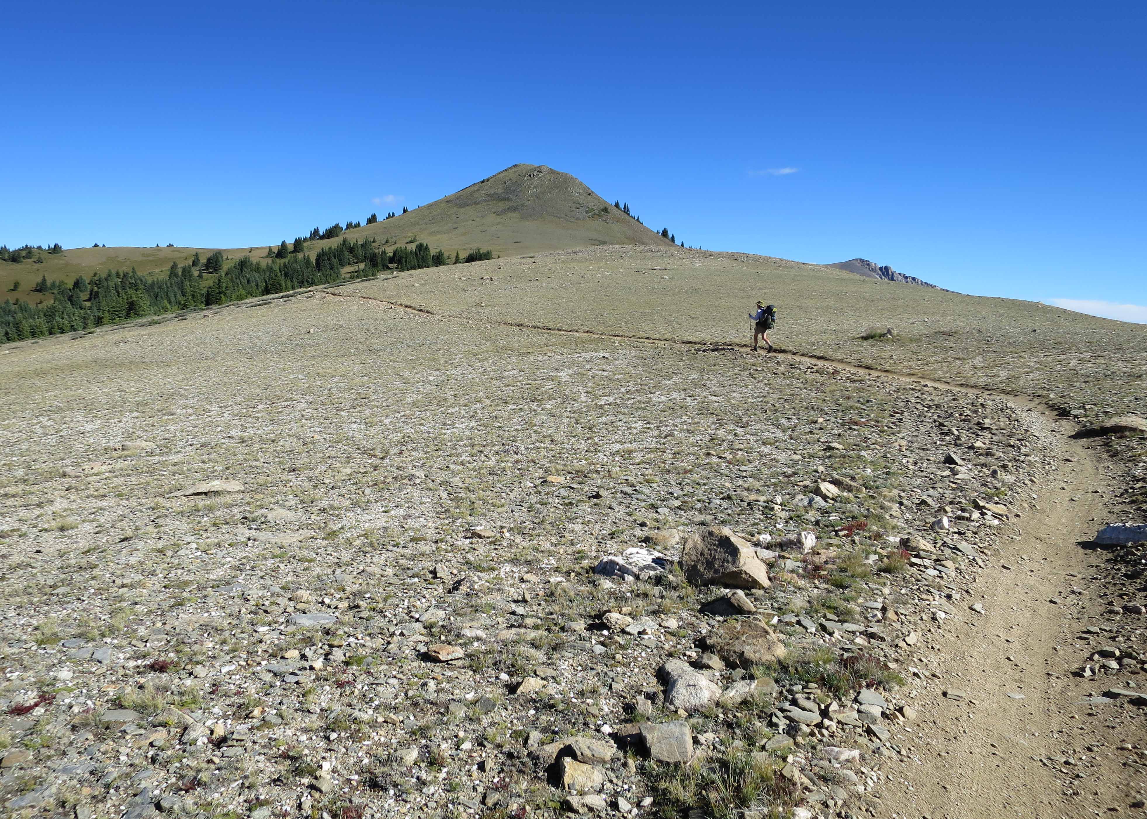
Things changed after Creede, with long stretches on high plateaus. The big mountains were behind – and ahead – but for now it was a new world. I liked it, but I imagine if you were really limited on time, you might want to avoid the flat parts – and the parts where you briefly walk on road. But as a thru-hiker, I love taking it all in, the good, the bad and the ugly.
Crossing Seargent’s Mesa was a favorite as it opened out with views to the peaks far in the distance, the ground crowded with fancifully weathered logs. We camped below at Tank Seven Creek when the wildest storm seemingly came out of nowhere. I raced to bring in my drying clothes before diving into the tent, a bolt striking far too close for comfort.
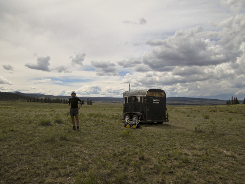
Later, on one long lonely section, a trail angel parked a horse trailer and filled it with sodas. Ted and I grabbed a couple of Fantas and he poured grape pop right into his water bottle. Of course it exploded a few minutes later as the pressure built up, a cause for much teasing.
As we approached Monarch Pass, we were delighted with views opening up of the spectacular Sawatch Range, one huge humping 14er after another in an elegant line. It was here that we met mountain bikers – and a group with special mountain motorcycles. I was impressed with their consideration. Signs on the trail tell wheels to yield to two legs – and wheels and two legs to yield to four-legs. From what we saw, everyone was accommodating. Nice work, Colorado!
peak baggers
By the time we crossed US-50 – where a motorcyclist’s chick took my picture crossing the highway and I gave her a one-fingered wave for the scrapbook – we knew peak bagging was in our future. There were a few days left before Richard would return to pick us up. So we thought why not hit two at once and the first ones on the trail, Shavano and Tabeguache. Our supplies were dwindling and we were pretty wrecked by that point, but we pushed our bodies to the trailhead, a spur off the CT, and planned to get an early start.
I’d like to mention one thing here about the map we used. The Colorado Trail Datebook put out by the CT Foundation coupled with Eric the Black’s CT Pocket Atlas. Combined, they provided all the information needed including the estimated state of the water supply, whether a trusted creek was full all season or only partially or – my most favorite – whether to expect only a “seasonal seep.” The areas where water was absolutely not available is, of course, critical. I am indebted to these people for creating such good resources.
But there was no definitive answer on water near the trailhead. We knew about a mile further was a good source and we also looked for steams along the way, but we saw nothing. And then, just as we passed the cut off for Shavano, running right across the trail was a little burbling spring! Praise the goddess, we were good to go. The tent went up in the woods and we prepared for our first day hike in three weeks. Ted even tried a bath right there on the trail. Thankfully, no one was walking by at that moment.
It’s tough work getting up a 14er. The trail junction is just under 10,000 feet so it was all up through bristle cone pines to an eroded saddle, then rock hopping in high winds. The place was packed and it only took a little coaxing to get Ted to continue on to bag two peaks in a day. But once we came down, we could see the storms raging over the distant peaks and so picked up the pace. When it hit us, it was ice pellets in the face all the way to the tree-line, then thunder as we descended through the woods.
CDT shares the trail
Having a little taste, we wanted more, so arranged a ride up Mount Princeton’s rutted road and took in another 14er before giving up the trail and awaiting Richard’s arrival. We then rounded up the trip with the little gem of Mt. Huron which the boys allowed me to run up as they kicked back at the meadow. It was there that Ted and I agreed next summer, let’s do ‘em all.
And one day, we might finish the CT. Or who knows, maybe go back and do it all over again and hope for clearer skies. NOTE: I’m hoping to repeat it all next season on the Continental Divide Trail, which splits off before Durango to head into New Mexico.
A quick shout out to Princeton Hot Springs resort. They offered to hold a resupply box for us for as long as we needed at no charge. They’re located directly on the trail and it’s worth a stop for at the very least a beer and a meal. You have a view in the shade of Mount Princeton and even though we were smelly and dusty, they let us hang as long as we wanted on their beautiful veranda.

7 Responses