
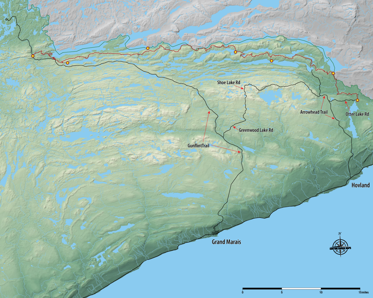
The Border Route Trail is a 65-mile-long hiking trail that crosses the Boundary Waters Canoe Area Wilderness in Minnesota’s Arrowhead and follows the international border between Minnesota and Ontario.
 Last autumn, I went on my first thru-hike with a chick.
I mostly like to hike alone or with my husband or with guys who go fast and don’t mind how bad I smell after being on the trail so many days.
There wasn’t really any particular reason I hadn’t invited a woman to backpack, but the longer time passed, the less likely it seemed it would happen.
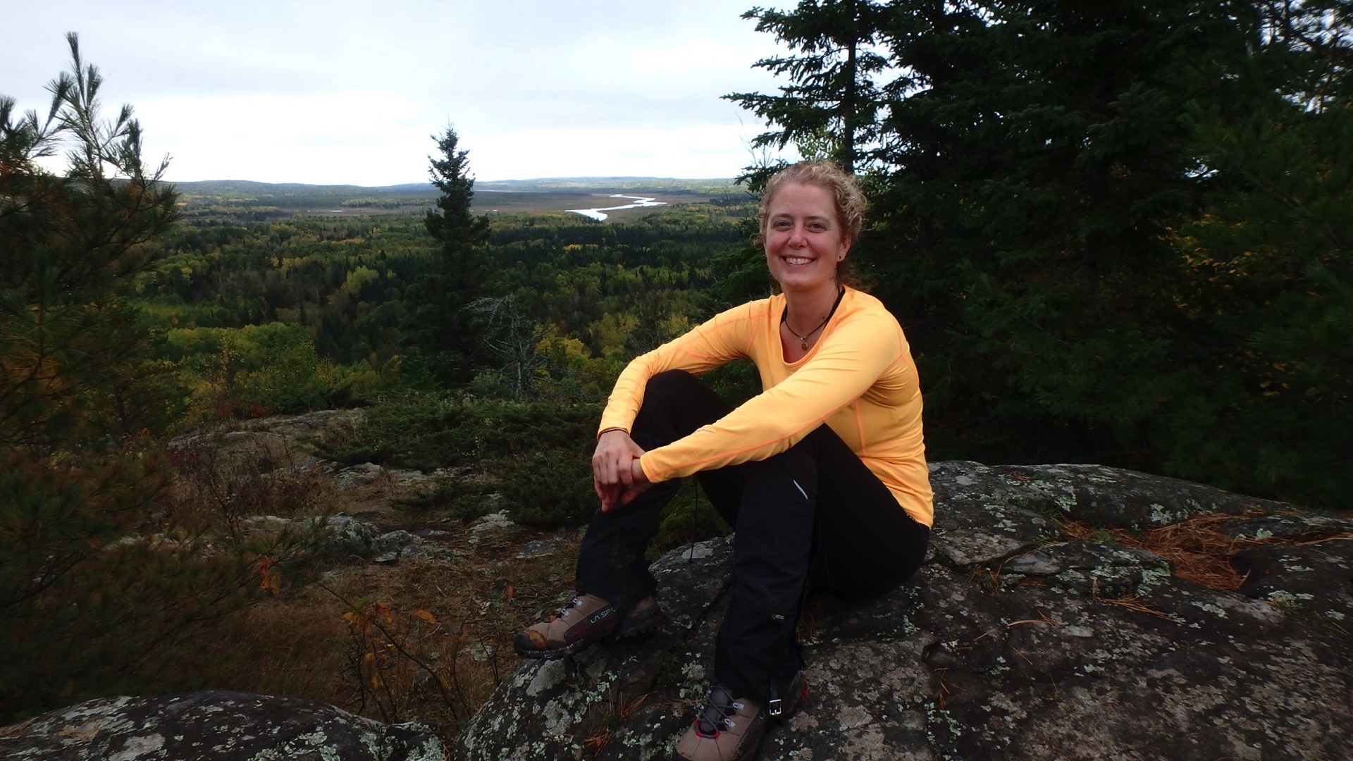
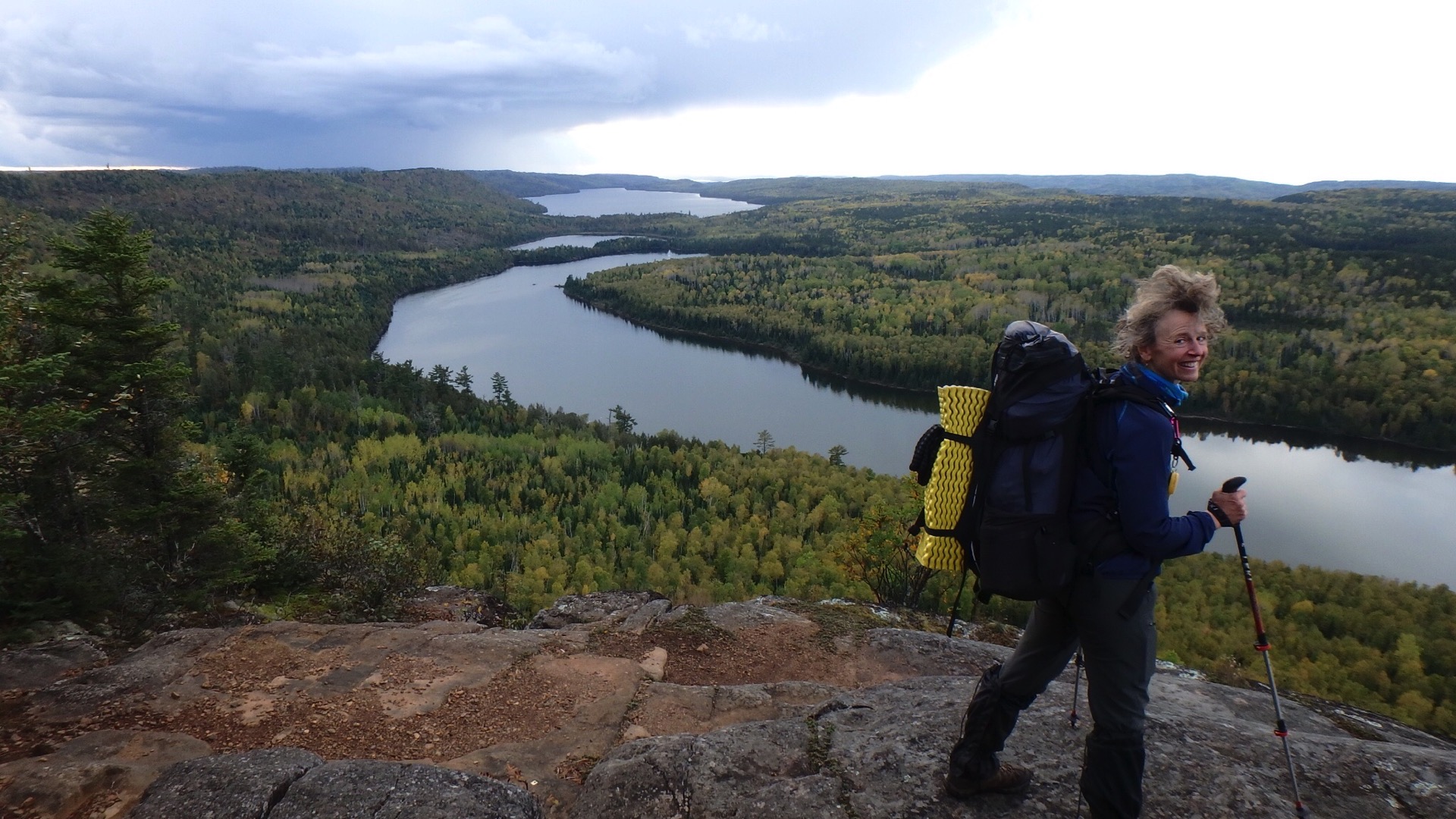
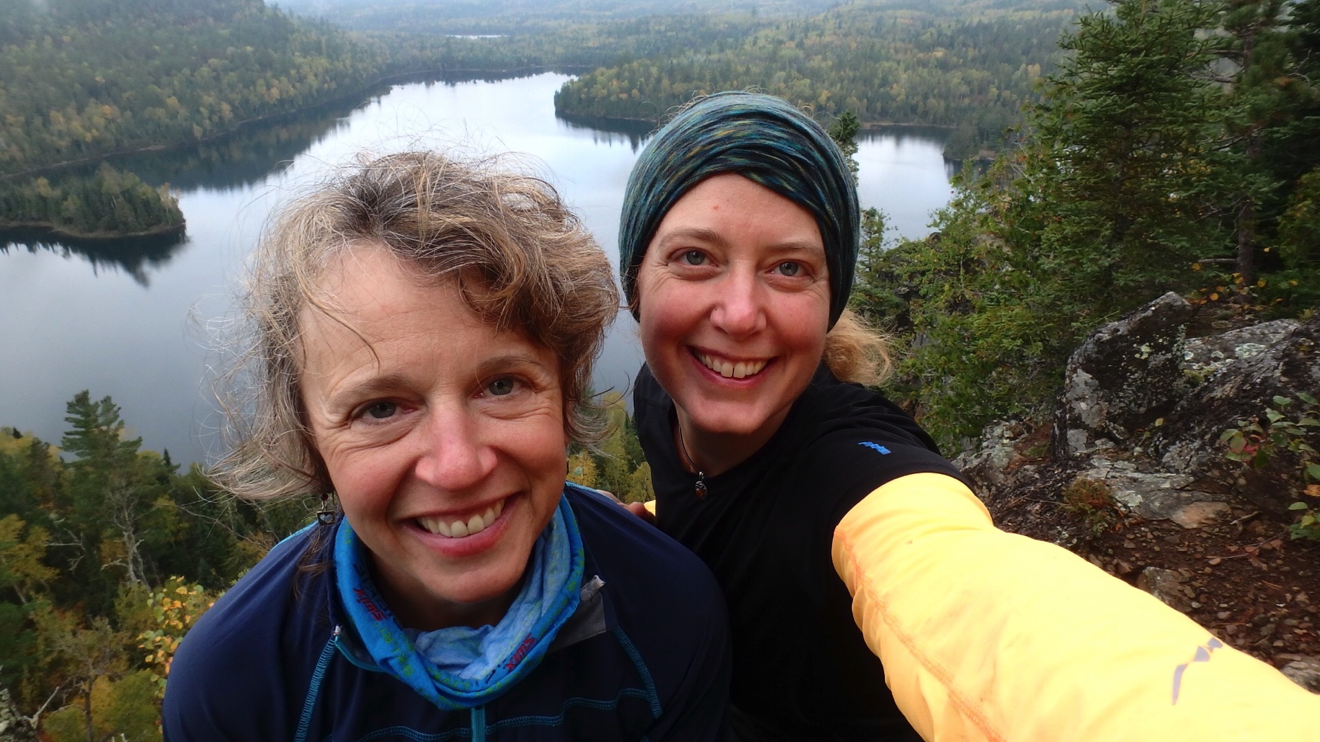
Until I met Brenda. Brenda is a super woman of the outdoors. She grew up in northern Minnesota exploring the back woods by four-wheeler before getting her drivers license. She rock climbs, paddles, bikes and makes wonderful films about people like us finding adventure in Minnesota.
When I mentioned I had hiked the Superior Hiking Trail and wanted to continue another section from the end of the SHT to the Gunflint, she said let’s make it happen. And in no time, we picked a date, called ourselves HikerA and HikerB and began to plan. We chose fall for fewer bugs, fewer people, gorgeous colors and clear blue skies.
As they say, hope springs eternal.
What makes this hike so special and why do it? Well, it’s remote and aside from one boat we heard wheezing away on the edge of the wilderness, it’s absolutely silent. There are fewer people walking the BRT. You feel like you’re truly in the wilderness.
But remoteness is remote. It’s a four-hour drive to Grand Marais from The Cities, then another 90 minutes to the end of the Gunflint. There’s a short-cut about half-way back, but it’s still another hour after leaving a car to shuttle to the eastern trailhead. By the time you start walking, half the day is gone.
Pro tip 1 : You’ll need a boundary waters wilderness permit and you have to pick it up in person in Grand Marais between 8:00 and 4:00.
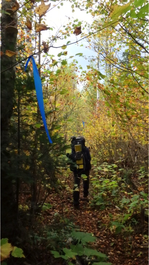
The trail was planned and built in the early 1970s by the Minnesota Rovers Outing Club, the first long-distance, wilderness backpacking and hiking trail in Minnesota planned and constructed by volunteers. The BRT folks are a doggedly energetic bunch clearing brush and downed trees twice each year and marking the way in more dense sections with bright blue plastic ties.
They also maintain a superb website with updates on trail work. Do take seriously the damage done by blowdowns and believe them when they say a campsite is closed.
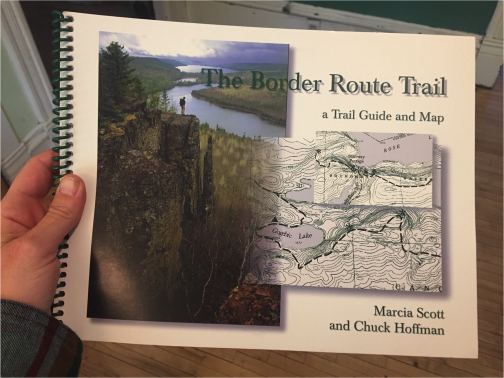
Pro tip 2: Buy the BRT map book and check the website for updates.
Before setting out, we camped in the Grand Marais campground right on Lake Superior. We started on the more wild east side and walked west towards the resorts with a waiting burger and brew egging us on.
It was a dreary morning when we started out. Several people in soggy rain parkas were going our way and we felt a twinge of disappointed having to share our little adventure. As it turned out, they were all headed to the overlook less than a mile from the lot, which – with its stunning view of the Pigeon and Stump Rivers – made a finer starting point for the SHT than a wide space in the dirt road. They were the last people we saw for days.
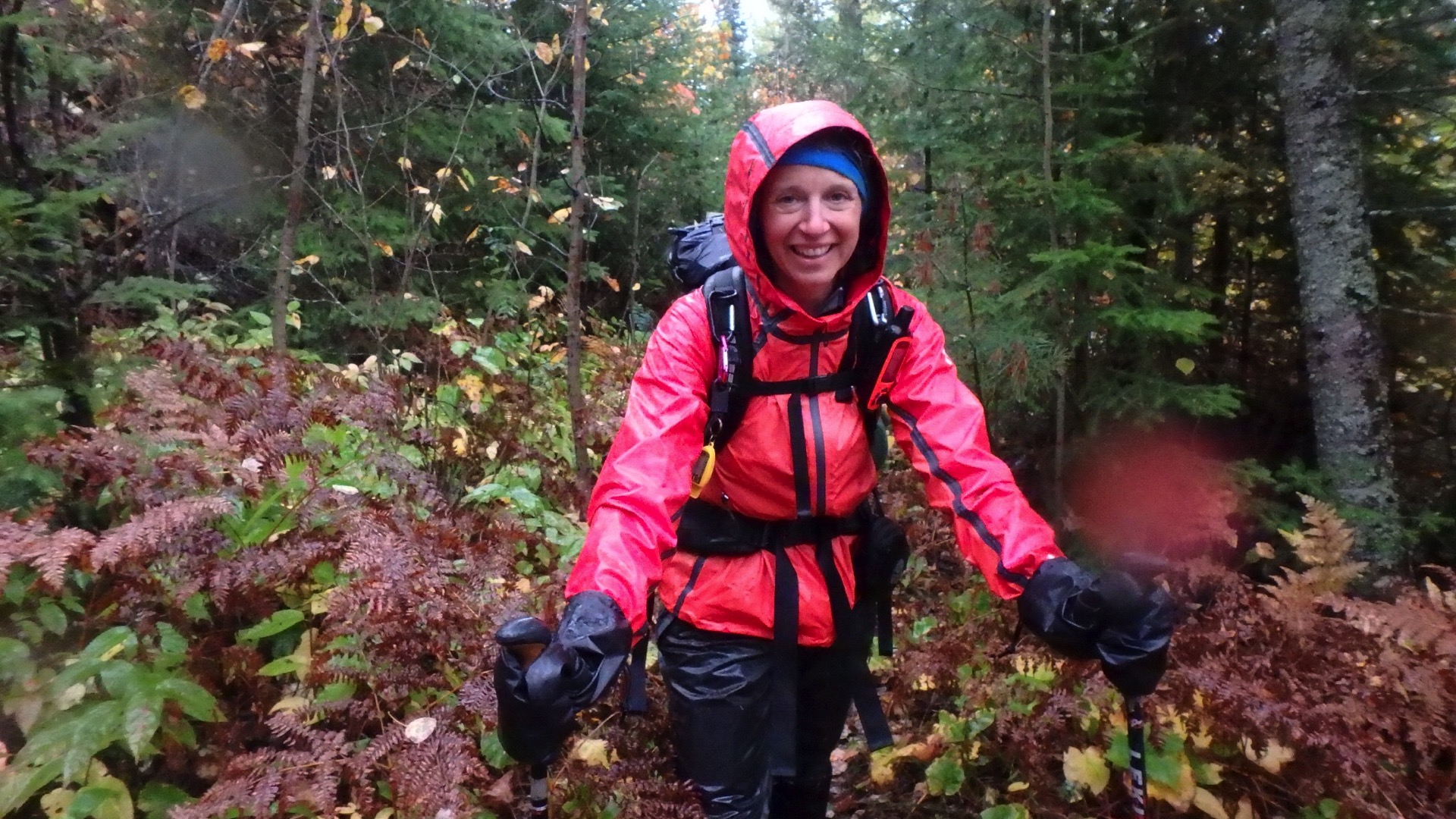
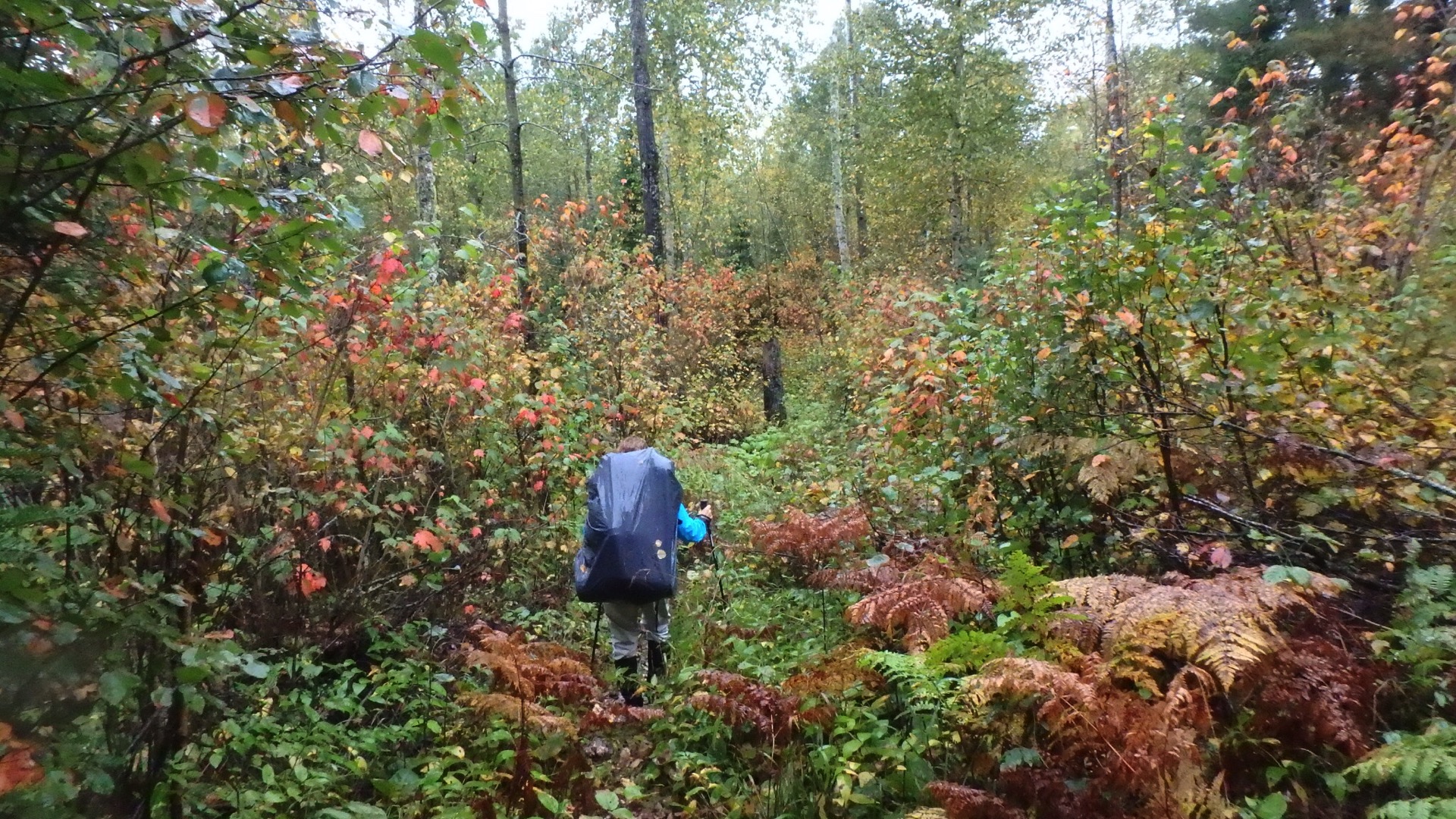
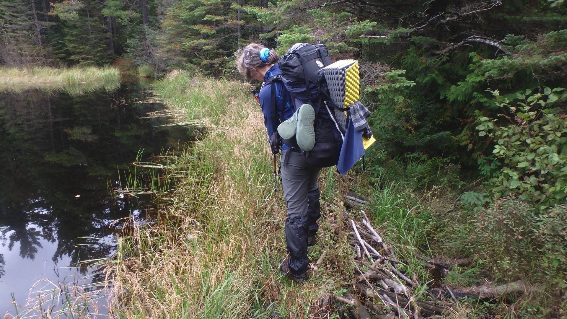
After a few photos, we waded into the deep tunnel of damp foliage of the BRT: steep climbs, wet rock-strewn trails and an endless succession of fallen logs.
Pro tip 3: Wear boots with good ankle support, gators to keep the mud off your pants (and out of the tent) and use trekking poles. You will thank me later.
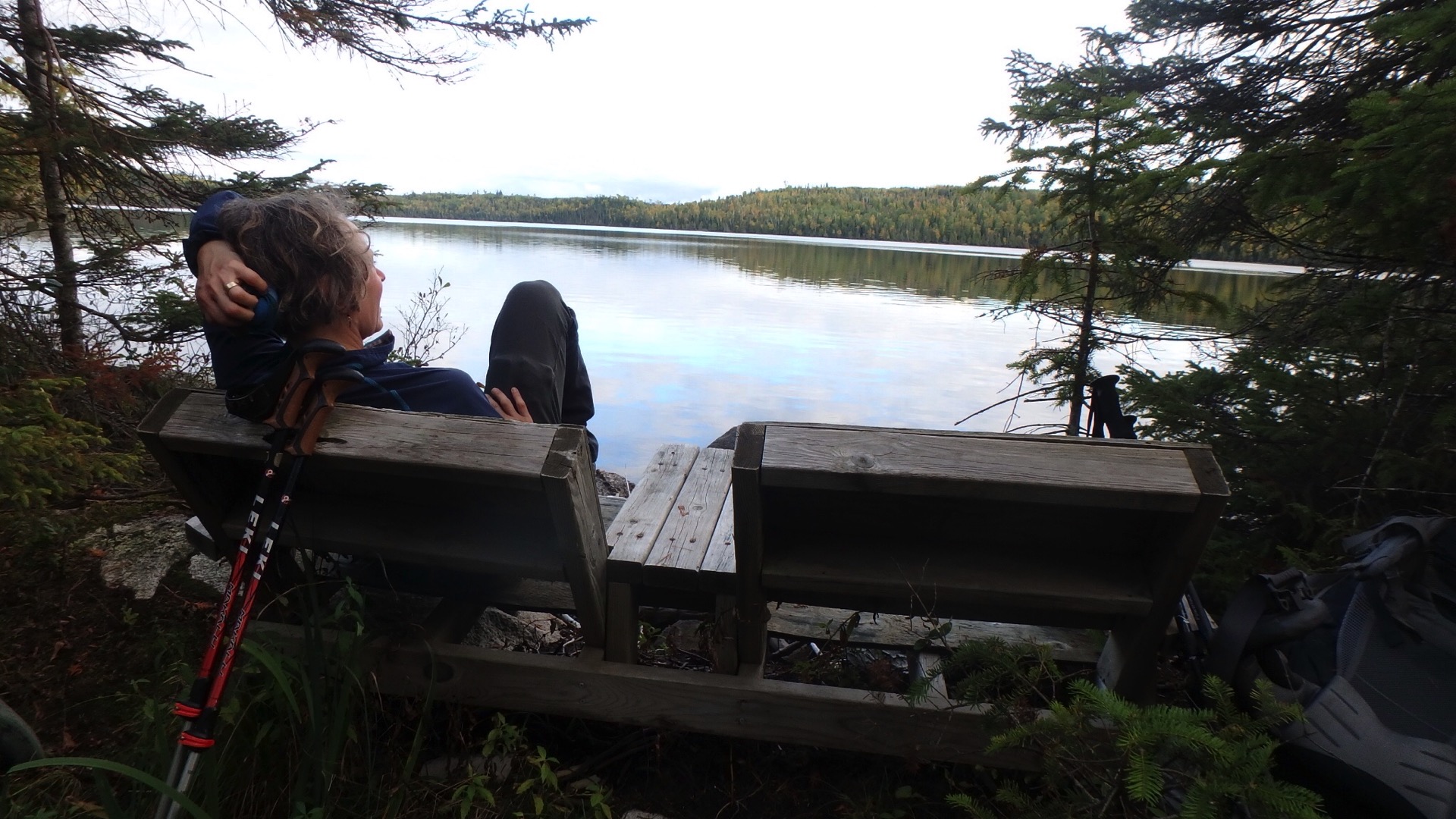
We stopped at the one random picnic table on the trail for lunch next to a leaning and rickety bridges. The air was pristine, the place beautiful and – when we took a breather from our non-stop gabbing – the silence swallowed us whole.
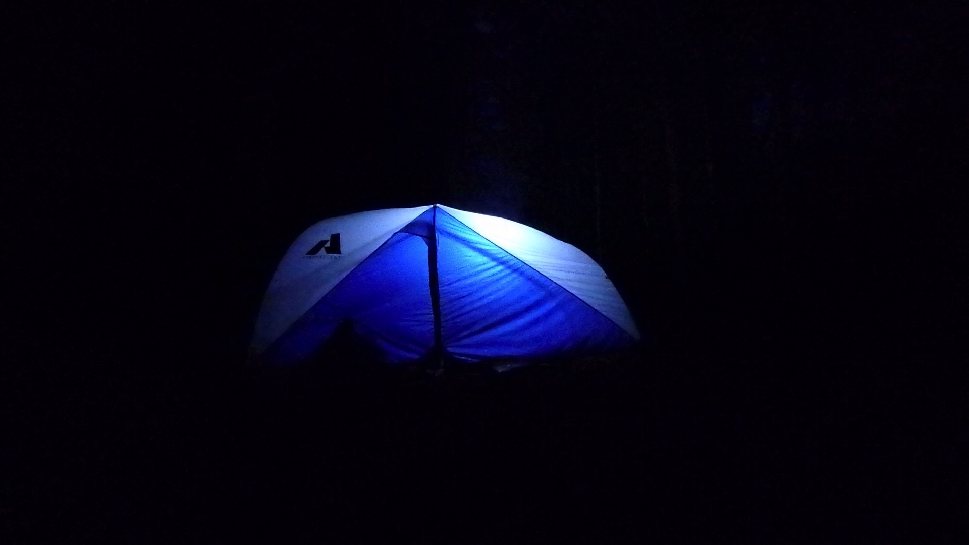
The official campsites are quite decent and some even have vault toilets. Our first night we pitched at a “potential” campsite, a bit sketchy with room for a single tent right along rapids on the Pigeon River.
Pro tip 4: There is no decent stealth camping on the BRT. It’s too steep and rocky, and for us, too wet and far from a water source. Plan accordingly!
The next day, it rained.
All day.
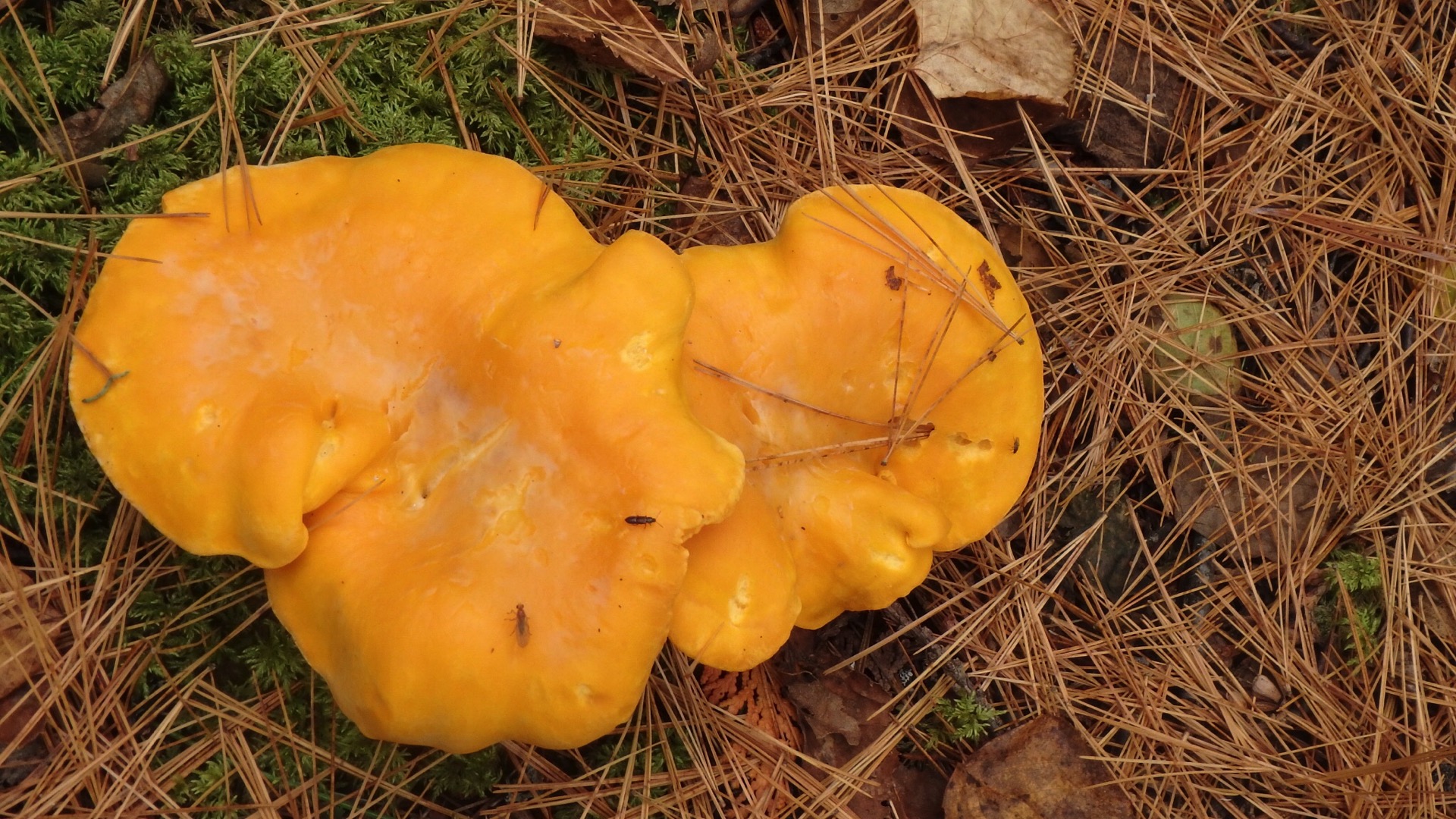
It rained until nightfall when the clouds opened for a sliver of moon. But we had good gear and enjoyed the many overlooks from high cliffs looking into Canada. Fungus was among-us, with myriad bright mushrooms in all shapes and sizes. The trail has a kind of fascination in far views after arduous climbs juxtaposed with tiny, intimate communions with forest life at your feet. Feet that got soaked through in spite of gore tex and never managing to dry.
The trail is exhausting and for many hours, we both longed for just “100 feet of joy” finally finding some along sections of pine forest, needles soaking up our footfall.
After a big day, we set up camp on the Pine Lake portage just as the trail entered the Boundary Waters. We celebrated our continued buoyant spirits in spite of foul weather by sharing all of the whiskey.
Pro tip 5: Bring more whiskey.
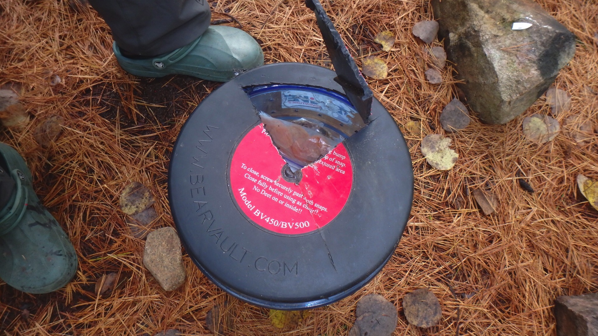
The next morning, I awoke early and went to the lake to pump water and make breakfast for my sleeping companion. The only problem was, I could not seem to open our bear canister. Somehow, perhaps a bit careless the night before, I overtightened the seal and it jammed.
Once HikerB got up I had banged, thrown, gouged, dropped it in the lake and screamed at the canister to no avail. A problem-solver and finding even both of us trying to pry it open a bust, HikerB set to work jamming tent stakes in to jimmy the top off, though the threads are too wide and it would not budge. The last resort was to use our one swiss army knife and cut directly into the lid.
Which quickly snapped every blade…
except one.
The smallest blade that never gets used she tapped into the lid with a rock and slowly, patiently cut a whole wide enough to retrieve our food. Heaving a sigh of relief and gobbling up our breakfast we packed up and shouldered onward, not stopping to consider how we’d manage to keep the food from hungry creatures.
Pro tip 6: Don’t over-tighten the bear box, and if you think you might, bring a better multi-tool and a rope.
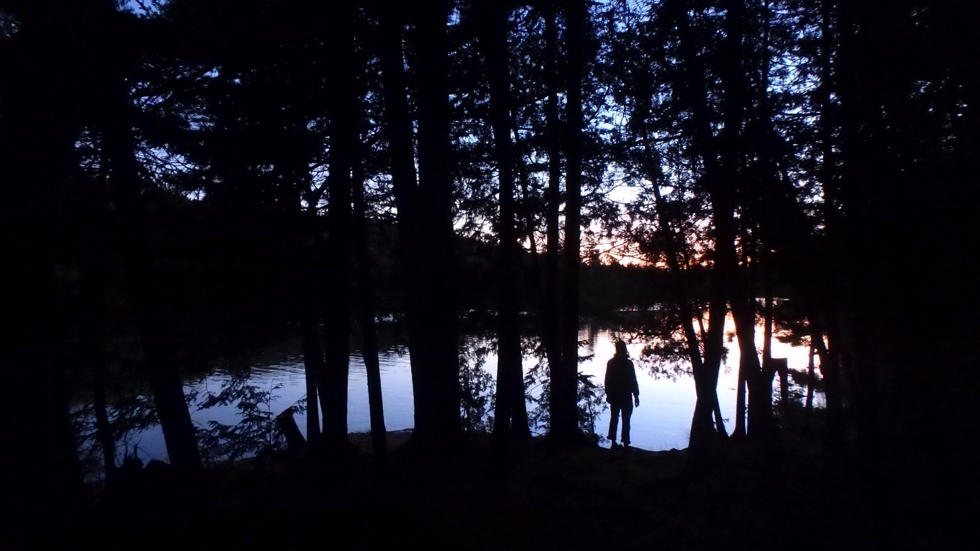
So here we were, the shredded bear box in my pack, the day half gone, and feeling a bit shaken up. At least the weather was better. We passed Gogebic Lake, a beautiful possible site and pushed on to Clearwater Lake and a deserved reward. The site sits on a shelf with 180-degree view for both sunrise and sunset. We strung a line in the wind, made a tiny fire, cooked up a nutritious dinner and watched the stars twinkle in a clear sky.
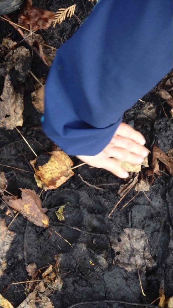
It was hard to leave such a lovely spot, but Rose Lake and the biggest cliffs yet were ahead. Bushwhacking up and down, we came upon numerous tracks along the muddy trail – moose, bear, wolf – and began to find our pace. When we got to Rose Lake, it took us by surprise how fast we moved, but the stretch was completely flat and we strode confidently toward the first site which was inhabited by a chatty canoeist. A bear stole all his food, leaving him just the Brussels sprouts.
Wise bear.
It was too early in the day to stop and site 2 on Rose felt cramped, so we climbed the enormous cliff to some of the finest scenery in Minnesota. Massive whimsically shaped cliffs tower over an inland chain-of-lake highway used for centuries by Native Americans and voyageurs. We met four guys on the rocks curious and friendly, who cheerfully handed us updates on the trail ahead. Having lost time with the bear box debacle, we ignored the updates and pushed ahead setting our sites on camping at Partridge Lake.
Pro tip 7: Don’t assume anything.
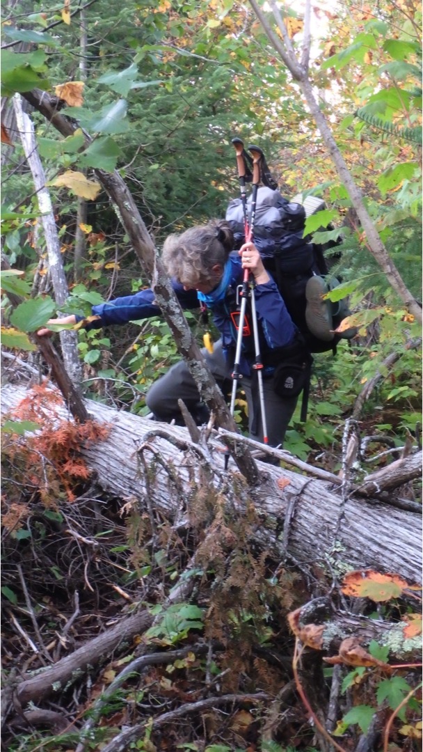
There was no warning as we took the spur down to the lake. We were tired and ready to set up, so we walked down a path that became more and more obscured. The brush was thick and fallen trees blocked our way, but we pressed on.
Soon we were stopped in our tracks by a twelve foot high root ball of a fallen giant. It was here that I thought to glance at the updates the lovely fellas at Rose Lake handed me and I discovered why the trail was so hard to navigate. The campsite was open, but only if you were approaching from the water. We needed to turnj and hike back out. But when we did, hike the path we had been on only moments ago, was obliterated. This was the stuff of nightmares.
My compass helped us find the direction and we recognized one tree we climbed over, and that set us back on our way. But we only had an hour of daylight left and a long way to go to the next official campsite. We moved fast, up and up over slick rock and brushy trails. One more overlook put us face to face with storm bearing down so we abandoned high ground for South Lake, far below us.
Evidence of the blowdown was everywhere and our spirits sunk surmising a repeat of an impassable trail. Until we heard a dog bark. Someone’s here! And that meant we could get there too. The campsite was a lumpy war zone barely large enough for one tent let alone two. But our companions were simply lovely, their dogs’ kisses brightening our spirits.
Pro tip 8: After a long hard day, make bouillon right away. It’s easy, warm, filling and salty.
We set up the tent, filled one of our water proof bags with all the food and hung it gently with my ultralight clothes line. There were bear tracks everywhere, but somehow, they ignored us.
The next day we bounded up the hill, proud to push through what the BRT Association calls “spasmodic thimbleberry bushes” heaving and quaking in our path. At the fork, all smiles and eager, we took a wrong turn, heading east by mistake to what turned out to be the other site on Partridge. I am here to advise that it’s a terrific little site, even if we hiked out of our way and wasted time for that tip.
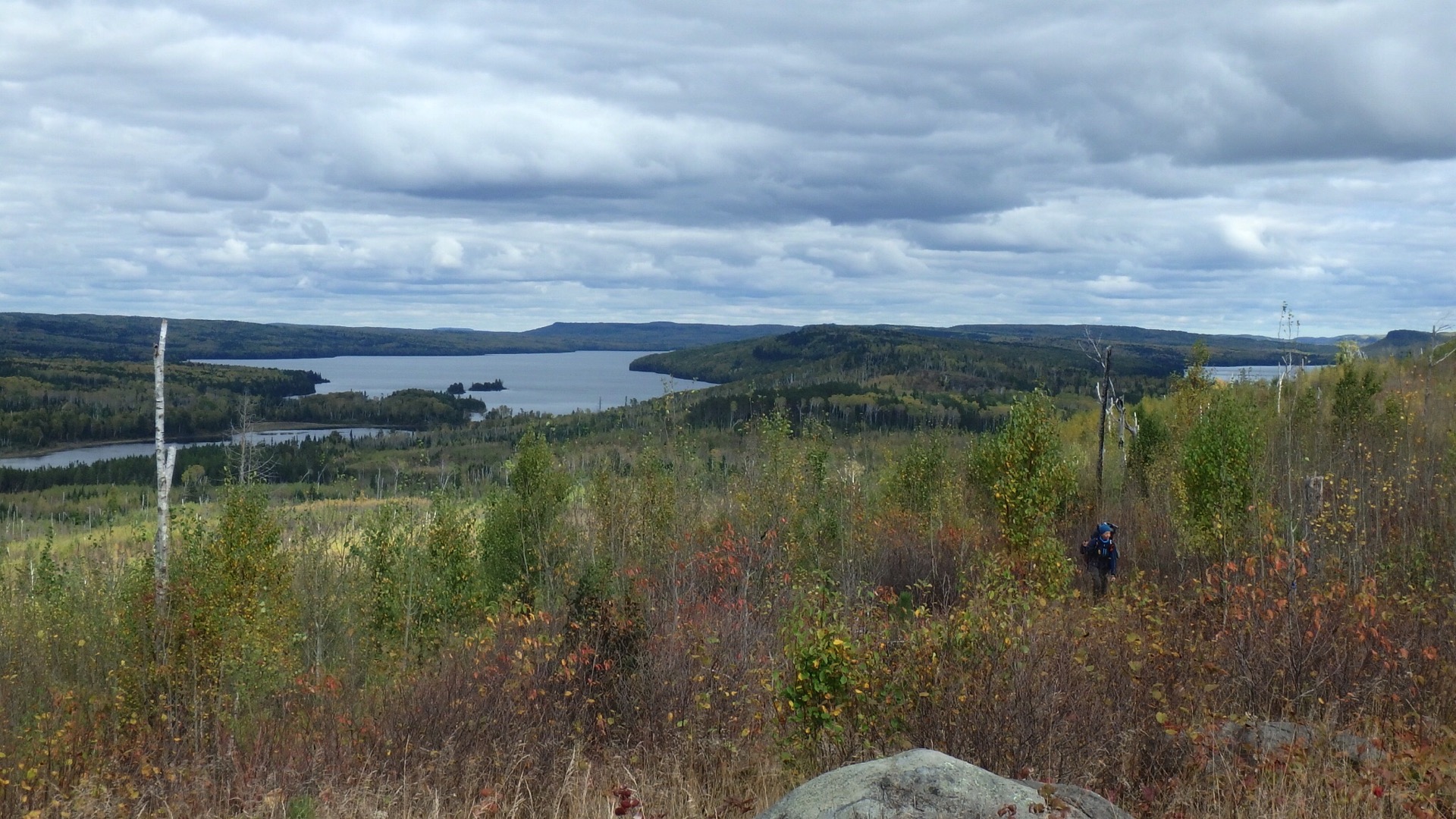
Our spirits lifted as we came into a wholly new environment. In 2007, the Ham Lake fire destroyed 75,000 acres of forest extending all the way to the BRT. These wide-open vistas of ghostly white and scorched trunks standing sentinel over bright reds and yellows in the recovering cliffside put us into a dreamy mood. Camping here was possible, but we were far from water. Later, as we approached Bridal Veil Falls, we searched for a “potential” site, but found nothing.
Our thought was that the many views ahead over the Gunflint would surely have a small pad for our tent, so we pushed further.
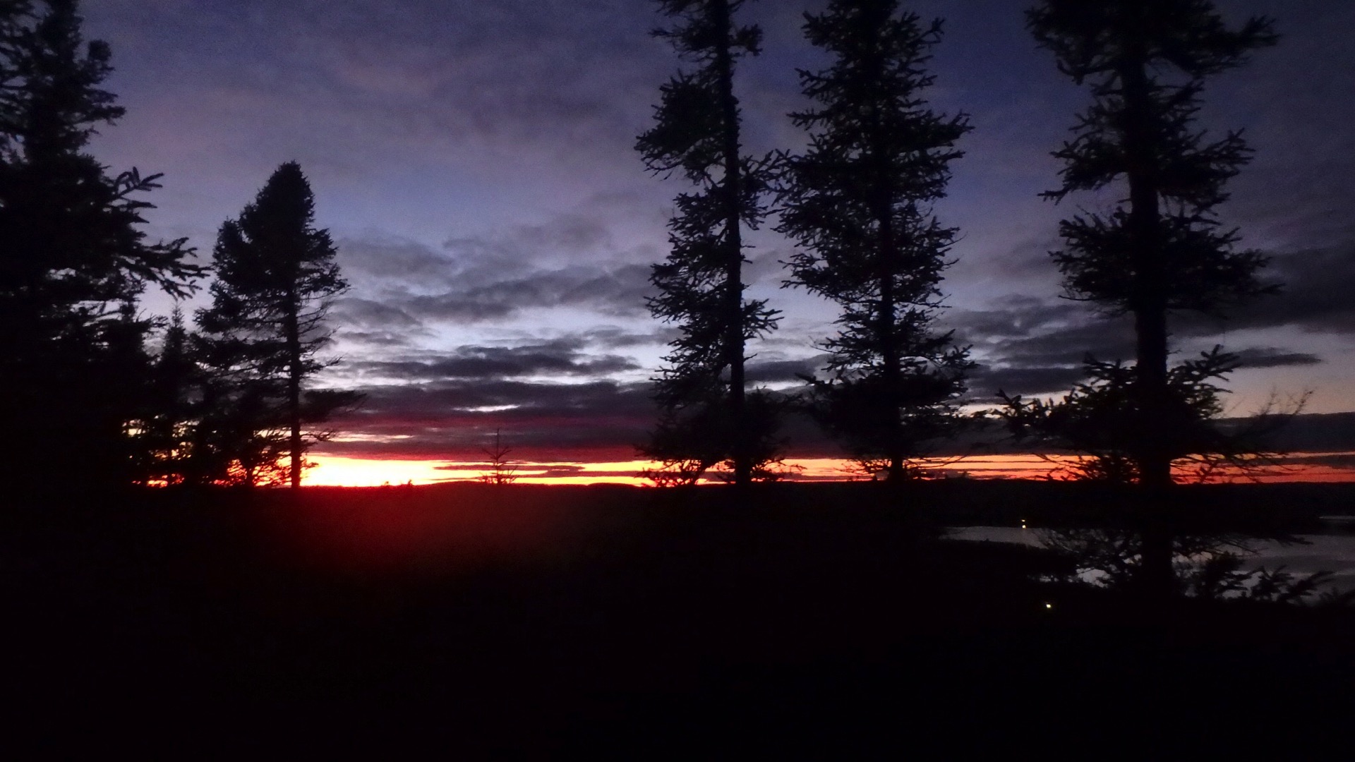
As we came closer to the resorts, the signage was heavier. On Loon Lake, a trail angel left a dual Adirondack chair, great for photos, but not much else. We climbed some more, up and up above the lake, though most of the views were obscured here and far too small to camp. They also faced north, and as the sunset took on the deep purplish-pink vividness known in this part of the north country, we moved faster a faster to catch a last look.
It was pitch dark when we descended to the other side of Loon Lake and our last night.
We awoke to a perfect breakfast spot on a rocky bench, a little sad to be leaving. After so many long days, this day would prove short and on wide – and obvious – ski trails. From the cliffs we heard gunfire and pulled out anything orange and began making a lot more noise. The sun came out in full as did the people making a short day hike to magnetic rock, where we held the compass and watched it twirl.
Pro top 10: If hiking during hunting season, wear orange
The last bit we walked with our new friends who applauded our accomplishment in the parking lot, HikerB’s battered Toyota awaiting our return.
With a few detours, we figured we walked about 70 miles in total. Not the longest thru-hike, but never-the-less, one with problems to solve, less than perfect weather and a some mistakes to learn from. We have heard comments that we look a bit like sisters, or at least cousins. We do share toothy grins and wild, curly hair that got even wilder in the constant humidy as well as optimistic and adventurous spirits. We made a good team and I hope later this season, we’ll keep walking from Magnetic Rock to Snowbank Lake. The Kekekabic Trail, like the SHT and BRT, is another section of the North Country Trail. Stay tuned!
And why, you might ask, did we name our hike no-boundaries waters and trail of secrets? Let’s just say there was a lot of girl talk and to paraphrase an old saying, what’s shared on the BRT, stays on the BRT!
- Where: The Border Route Trail, Northern Minnesota
- When to go: Early spring or late summer to avoid bugs
- Gear tips:
Bear canister
rain gear/gators
curly girls, bring hair bands to harness the wildness
good boots
walking sticks
orange hat
multi tool/rope
stove – no fires allowed outside fire rings in wilderness
compass
pump/iodine/dromedary – sometimes far from water source
dry bags and extra ziplocs - More general tips at my ten essentials blog
- You will need a BWACW wilderness permit

7 Responses