
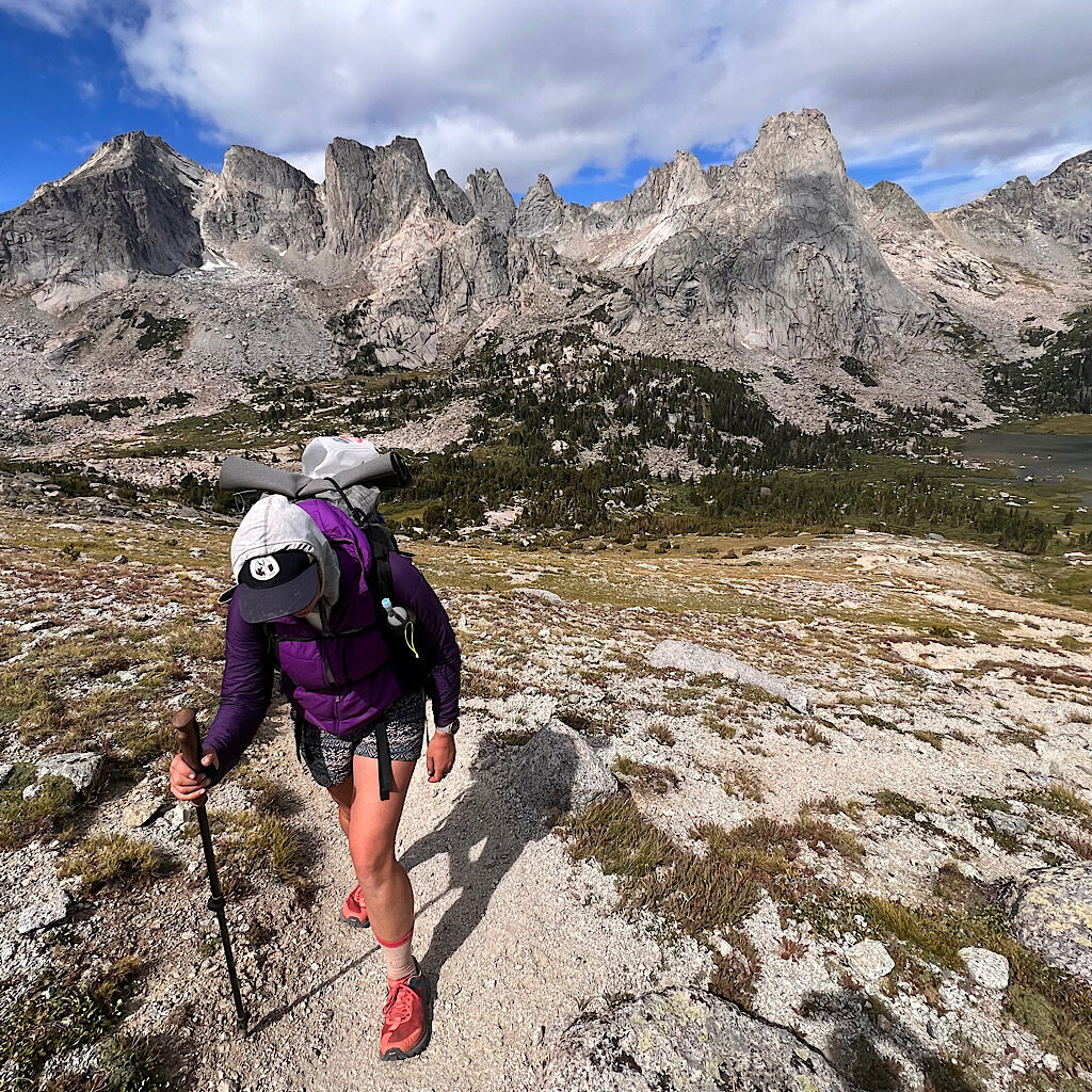
The day opens with a bright pink sky. Oh no, rain coming? So far just windy and gray. The towers still in place and impressive as ever. As we ascend it becomes obvious we may the perfect choice to camp at the view. It’s beautiful, but wild and barren. Trees give way to rock and tussock, the trail thankfully still well worn.
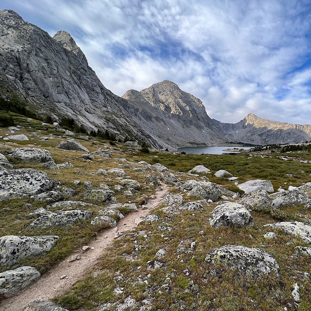
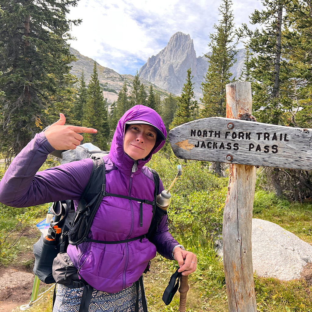
We pass Billy and Barren Lake and curl around the towers in stair steps of hanging valleys towards the final lake, Texas under its eponymous pass. Camping here is possible, but it is rocky and cold with views mostly to the wall that must be climbed.
We’re pros now and when one asks if anyone wants to stop for a rest, we shake our heads and plunge ahead. Steep? Yep. Slippery? Sure. Difficult? Nah, there’s a trail!
At the top, a sign flat on the ground and seemingly crushed by years of harsh winters, informs us we’ve entered the Shoshone National Forest. Over that rise and down a ramp opens up a view to one of the most sensational sites in the world.
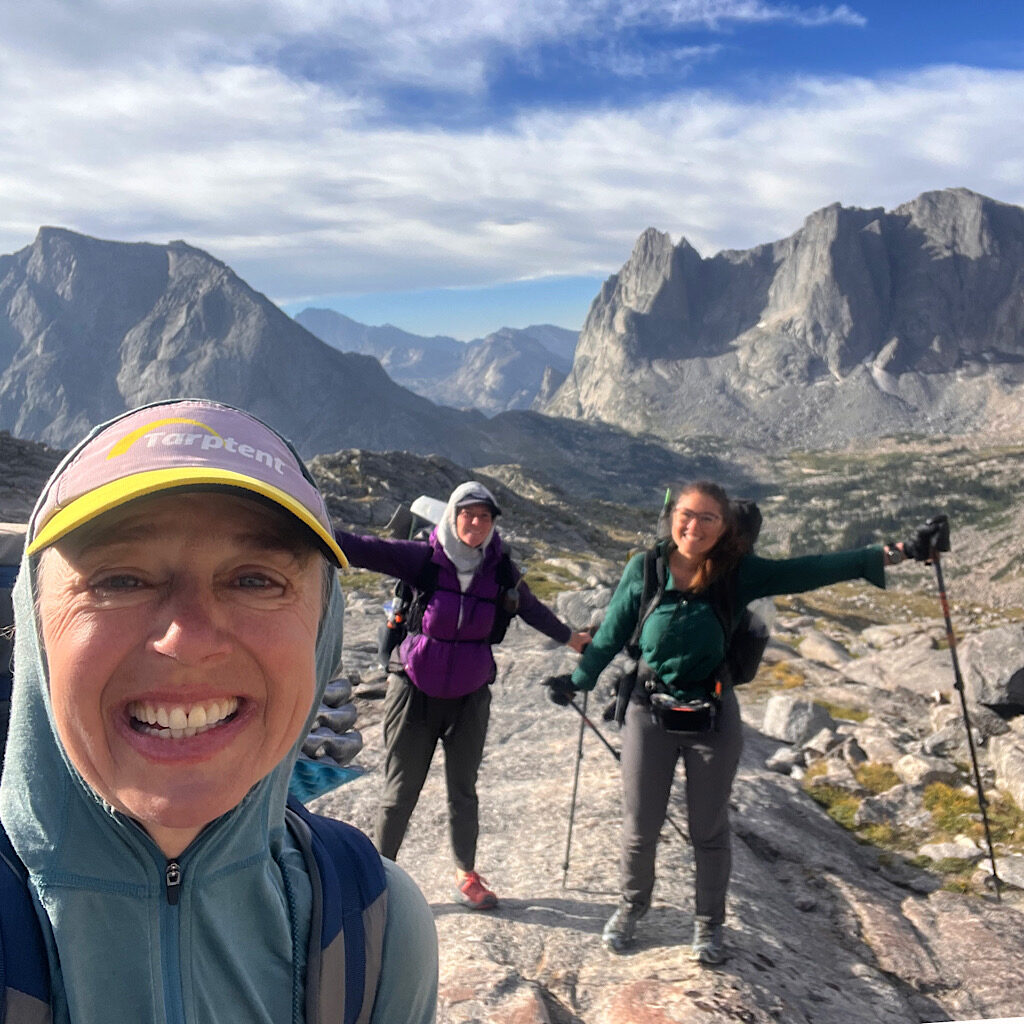
The Cirque is a semi-circle of fifteen, 12,000 foot granite crags, the most spectacular, the jutting Pingora looking smooth and solid from our vantage, though considered one of the best climbing walls in the world.
We clown around on the massive slab ramps, taking pictures and stopping to admire this unreal setting. Again, our choices are rewarded as the sun shines directly on the mountains and we spy climbers already scaling the biggest.
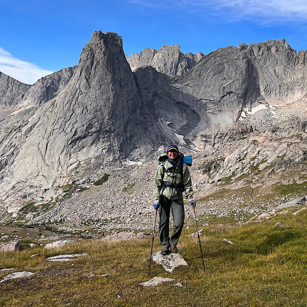
On the descent, we meet a lone hiker from Israel who takes my photo. It’s surprisingly devoid of many people even though the trail is rutted. Most consider the arduous Jackass Pass, which we see far across the valley, enough and skip this high altitude view.
Down and down we go, watching Pingora appear to grow. Superlatives fall flat when describing this place – glorious, grand, awe-inspiring, spectacular, magnificent – and there’s all the time in the world.
It’s steep on eroding trail to Lonesome Lake where we find sitting spots for a snack and check on the climbers. Nearby, campers seem to be calling to them or commenting. Still, the place feels surprisingly empty.
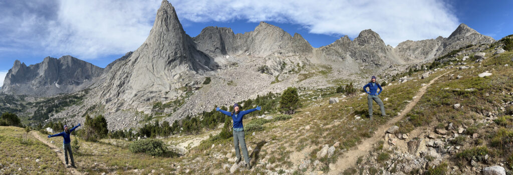
We round the lake then climb steeply up Jackass Pass. The views back reveal individual peaks at new angles – Lizard’s and Wolf’s Heads, Shark’s Nose, and Warbonnet.
Our last pass complete, I adopt a nonchalant attitude figuring it’s all downhill from here.
Never assume.
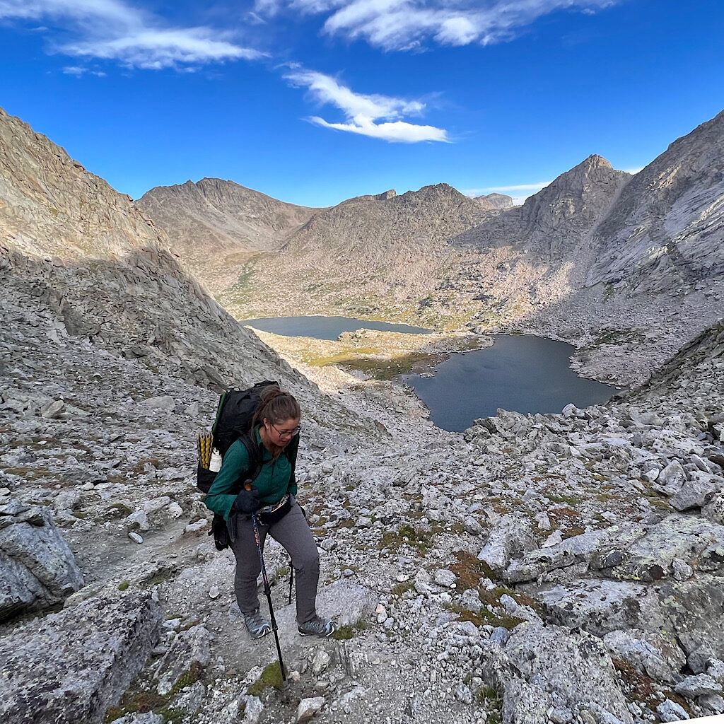
The trail is steep into a bowl where yet another magnificent tower looms, Warrior Peak. I snap pictures of its magnificence happily marching along until I see ole Warrior is shedding its bulk right across the trail.
At first, I follow a cairned trail straight up believing it will take me over the worst of the talus, but the girls yell back to follow cairns which guide me past yet one more pile of rock. I misjudge and go low requiring a few moves to shimmy back to a more doable route.
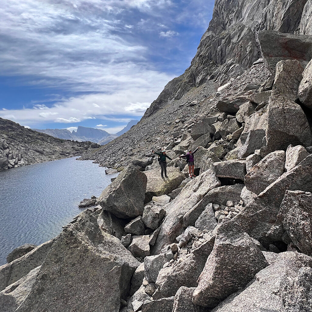
Maybe that’s the last for this trip. And it is so, except around another lake, it’s all up and down on rocky ramps. A bit more work requiring a change in attitude that this is not simply an easy downhill.
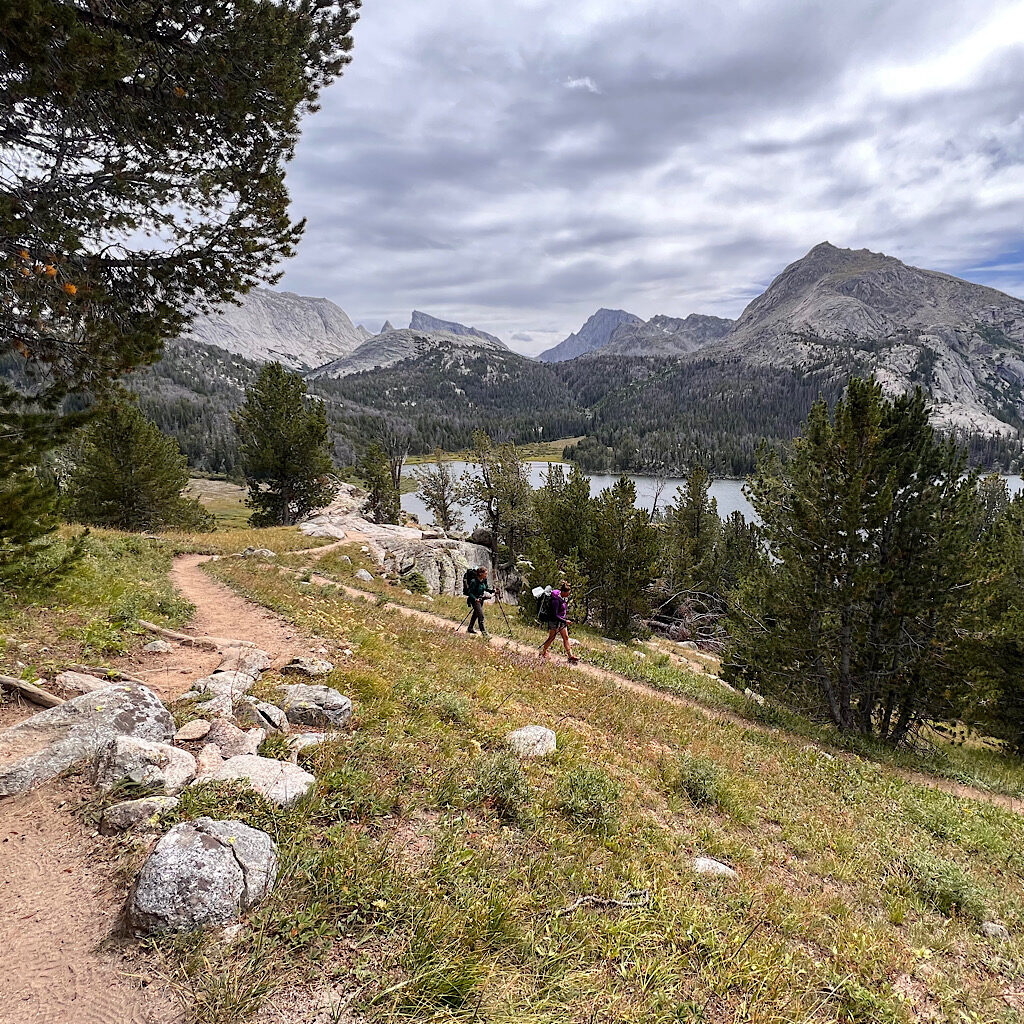
But how lovely it all is as the humongous, seemingly impossible peaks recede and give way to a final lake and a long walk through deep woods following a crashing stream.
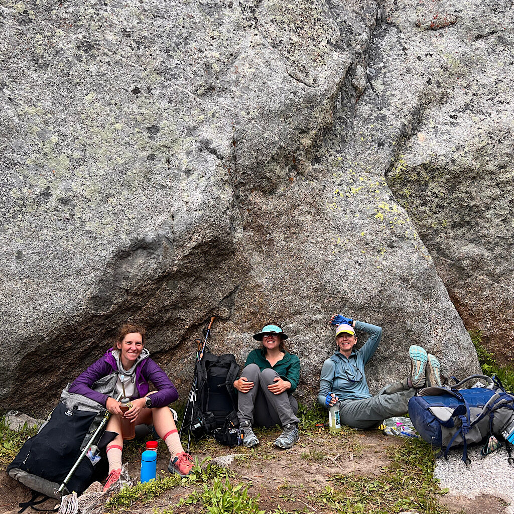
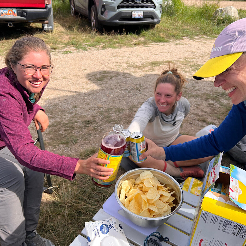
We share one last rock couch, a last fill up on water from the giant jug and scrounge for the last of our snacks before marching out to a very full parking lot and waiting partners. Richard even brings chips and beer and we clink cans (with Kelly’s kombucha) to a route well walked.
Parting words? The Dixon Route for the Wind River Range thru-hike is a stupendous walk with plenty of challenge, variation, and thrills. We easily found good camping although some rocky areas would be less ideal without a bivy. In fact, a tent is not really necessary when a tarp will do.
Kelly suggested our start date of August 22 which turned out to be ideal for warm days and few bugs. I suggested seven days, but it could be walked in six even at our pace although I found a week just right. At the very least, pack traction for the shoes to avoid a slip and take all the time you need on talus. This might be hardest for thru-hikers wanting to ’crush miles’ but why would anyone rush through this wondrous country?
It’s possible to get off trail and resupply in Pinedale, but it’s best to stay on trail in my opinion. The couple we met on Knapsack Col was carrying ten days food, so a longer trip is possible, just heavier.
We all walked well in trail runners wearing long pants and layers including rain gear. Temperatures never dropped below freezing. We used Alan Dixon’s maps as well Backcountry Banter’s on the Gaia app and had no trouble finding our way.
I believe an experienced and fit hiker can accomplish the high route though best to walk with friends and carry a gps with SOS capability due to the high risk of injury.
All this bring said, my favorite part of all was how a route changes the way I hike. Every muscle is used for such a wide set of needs – talus, snow, scree fields, tussocky meadows, bogs – and I never slipped into the mind numbing quest for miles. In fact so much of the route felt like I was playing at a jungle gym and trying to solve problems. I was happiest when letting myself simply be in the problem at hand and figure it out piece by piece.
And what a bliss that is!

4 Responses
Like usual, loved it! CONGRATULATIONS what a wonderful trip. Thanks for sharing especially all the details at the end of your post….maybe I’ll find someone willing to try it and give it a shot myself.
Waiting patiently for you next adventure 🙂
thank you!! such a new thing for me and really glad I had this awesome team.
Wow! I am so glad you survived without injury. I have hiked talus slopes but not to this extent and I know how hard they are. You truly live step to step. But I agree the Wind Rivers are so beautiful. What a great team you made! As usual your photos are breathtaking. This trip was quite an accomplishment even if shorter than your through hikes!
What a fabulous, smart, bad ass, lovely little team too. We had hard walking plus some weather and just kept on. I am so lucky!