Sometimes, you just need to take advantage of a situation.
It was a significant drive from Saint Paul up to Lake Superior and the soulful Porcupine Mountains, where I’d set aside several days to walk a loop as fall was just beginning its audacious celebration of death. A place I’d always hoped to visit – and take my kayak – is only three hours drive from the State Park.
Three hours in the opposite direction from home!
Still, I asked several paddling friends if they might want to meet me there on a whim and with fingers tightly crossed we’d have no wind and few waves.
No one could go.
So, I stuffed the idea in the back of head and gave it little thought as I immersed myself in the emerging colors, the luminous light, and the intimate sounds of the Porkies. But, as has happened so often when I’m out in the field, on the next-to-last day I ran into another backpacker I’d met on day one. We took photos, shared stories and then she mentioned that she had worked at Pictured Rocks and I was not to miss it – especially the sunset cruise and Chapel Falls loop.
After checking in at home and with my clients, I was cleared to tack on a few more days to see this astonishing natural wonder, and walk a few more steps of the North Country Trail.
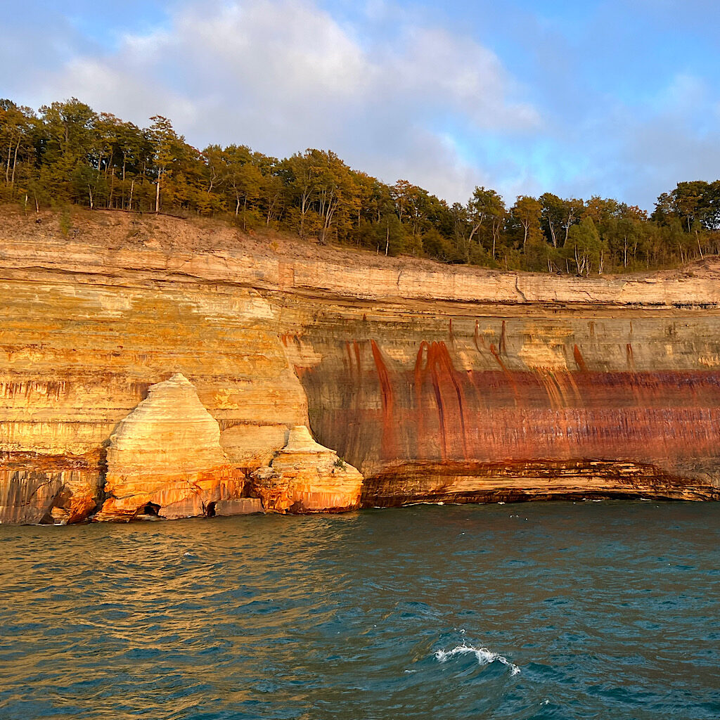
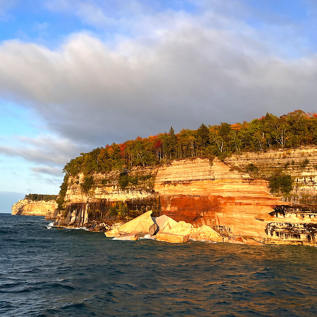
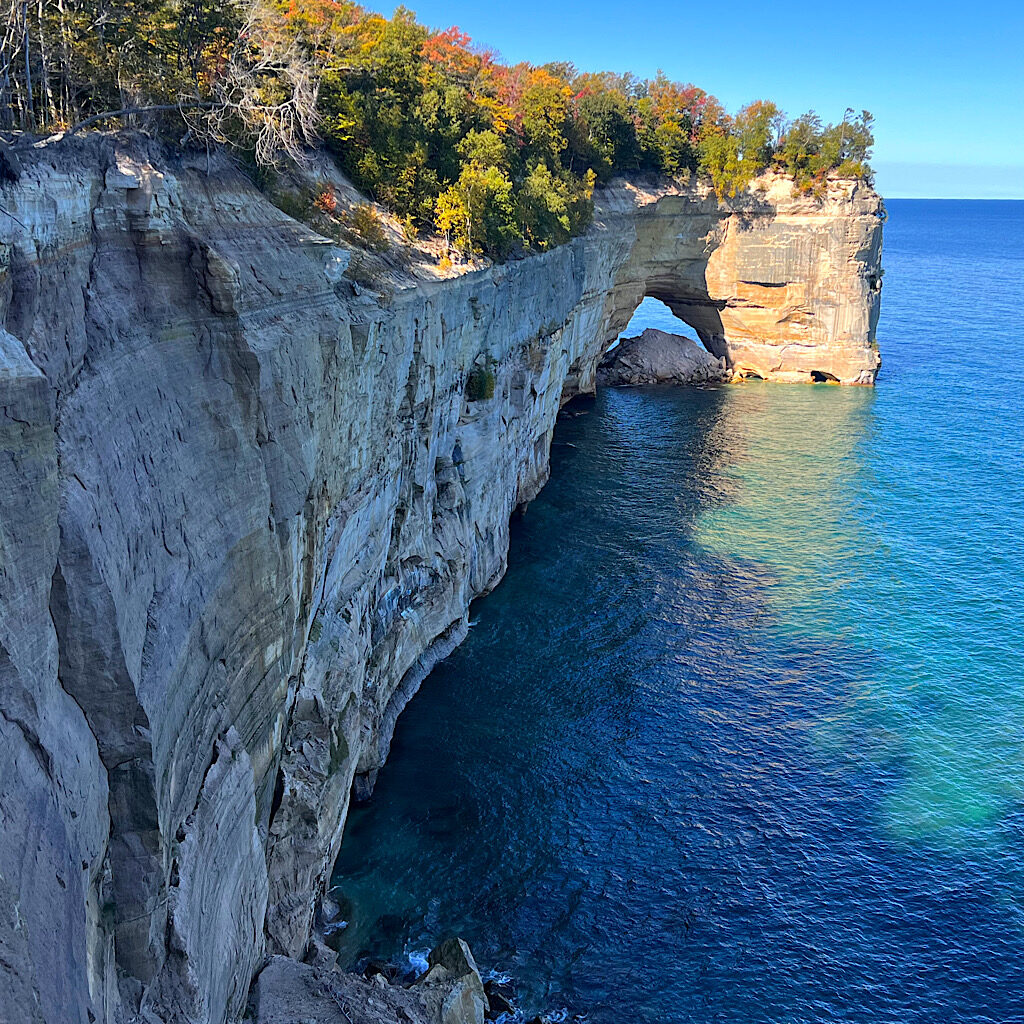
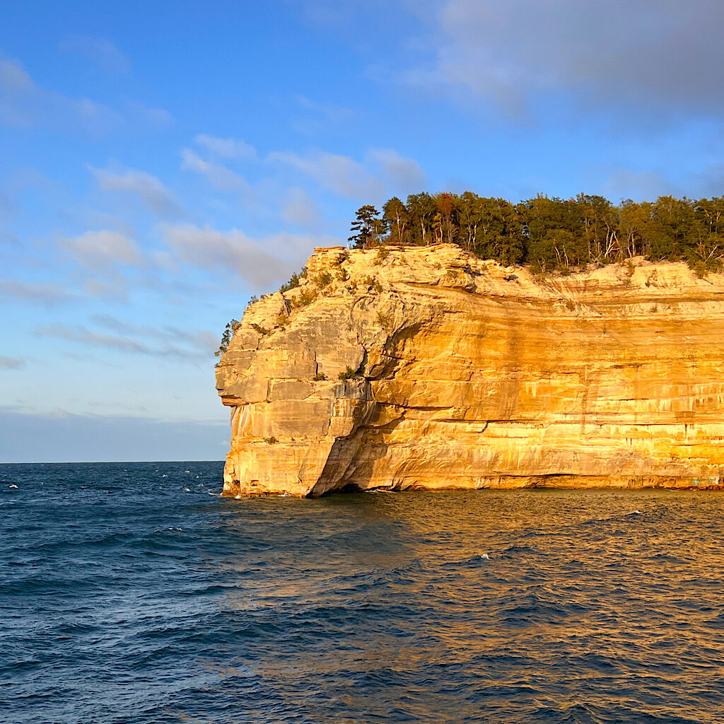
Michigan’s Pictured Rocks National Lakeshore hugs the northern coast of Lake Superior at its widest point. It’s named such because of dramatic 200-foot sandstone cliffs that are dramatically colored as if a painter spilled her pots down the side. The four pigments are from minerals leeching out of the rock – red iron, white limonite, blue copper and black manganese.
In addition to the cliffs, there are magnificent formations looming above remarkably clear water, in shapes that have acquired apt names like Miner’s Castle, Chapel Rock and Indian Head (Gitchee Gumee Manitou by the original people’s meaning “Great Spirit of the Big Water).
While it was a bummer to be without kayak – or any of my paddling gear – hiking above the cliffs offers striking vistas as well. In fact, 42 miles of the North Country Trail follows the length of the park with several developed (but primitive) backcountry sites.
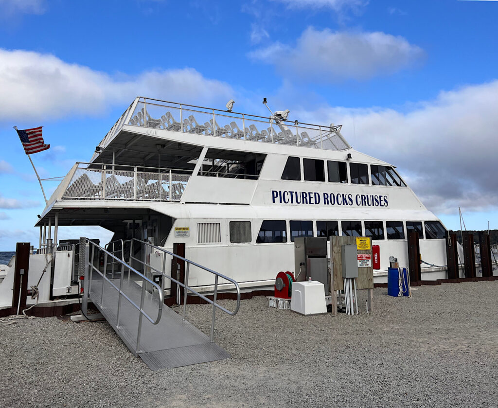
I bolted to Munising, nabbing one of the last seats on the day’s final launch of Pictured Rocks Cruises. Funny how even when the weather turned blustery and cold with 5-7 foot waves, no one backed out. It helped that someone passed around Dramamine in line
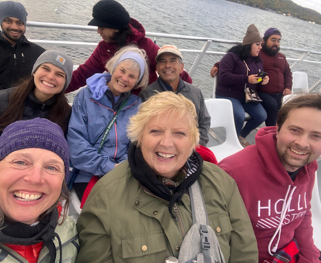
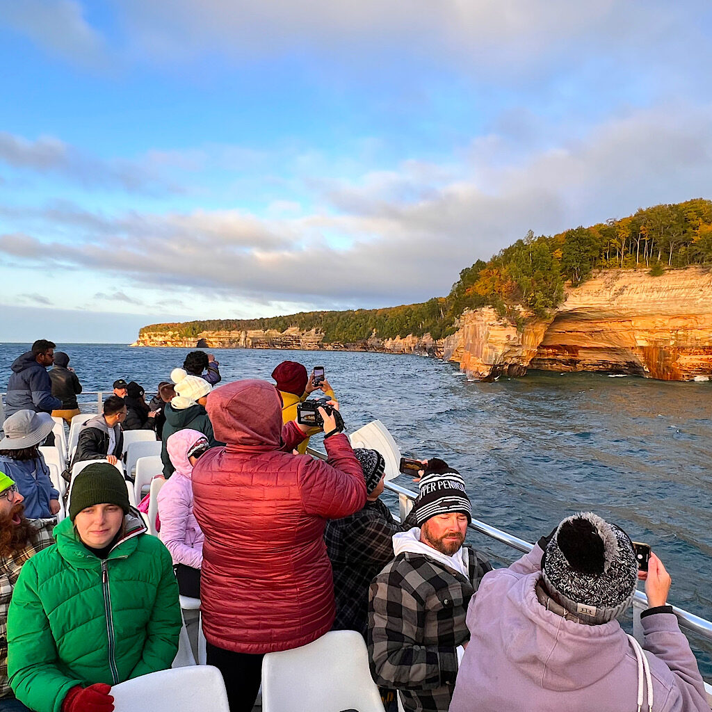
Due to the waves, our trip was shortened, but thrilling. We all bonded in line then on the boat, “oohing and ahhing” at the spectacular scenery as the boat bounced and shook. I was terrified my phone would bounce right into the lake and held tightly to take photos, walking up and down the third deck even when warned to stay seated.
That night, I found a stellar little site right on the lake at Bay Furnace near Christmas, Michigan. Northern Lights were predicted, but I slept through it all – if it actually happened.
I had my eye on the brilliance promised the next day – a magical combo of crystal clear skies and fall leaves. Ernest Hemingway is long associated with Key West and yet he spent vacations in the UP (Upper Peninsula, Michigan) He said, “The best sky was in Italy or Spain and in Northern Michigan in the fall.” Ain’t that the truth.
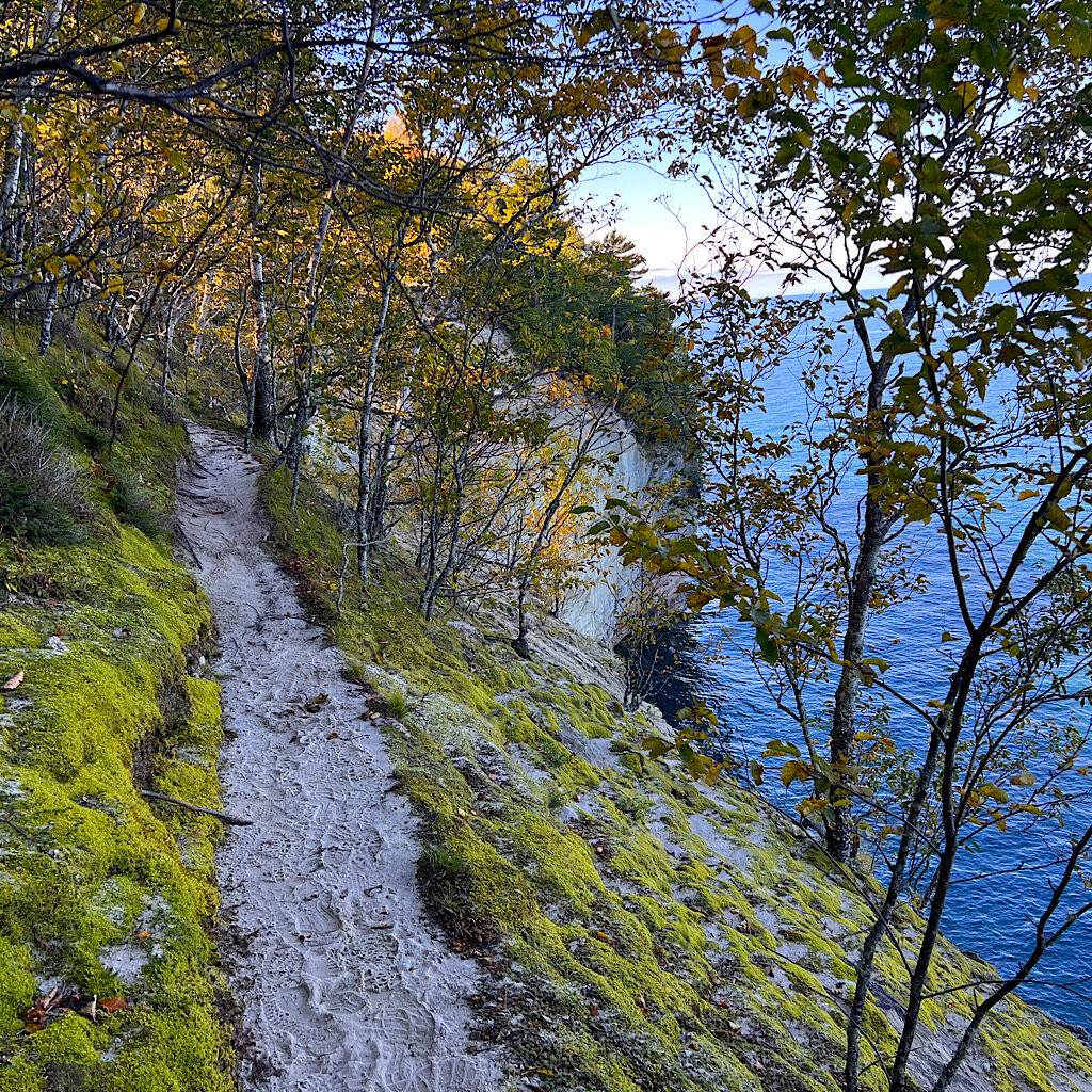
My sky was cerulean and vied for attention with the equally dazzling water, more a a light azure in many shades, like an interior decorator’s paint-chips. It’s five miles from the county road on bumpy and rutted dirt to the trailhead. I chose to walk counter-clockwise and take in Chapel Falls first.
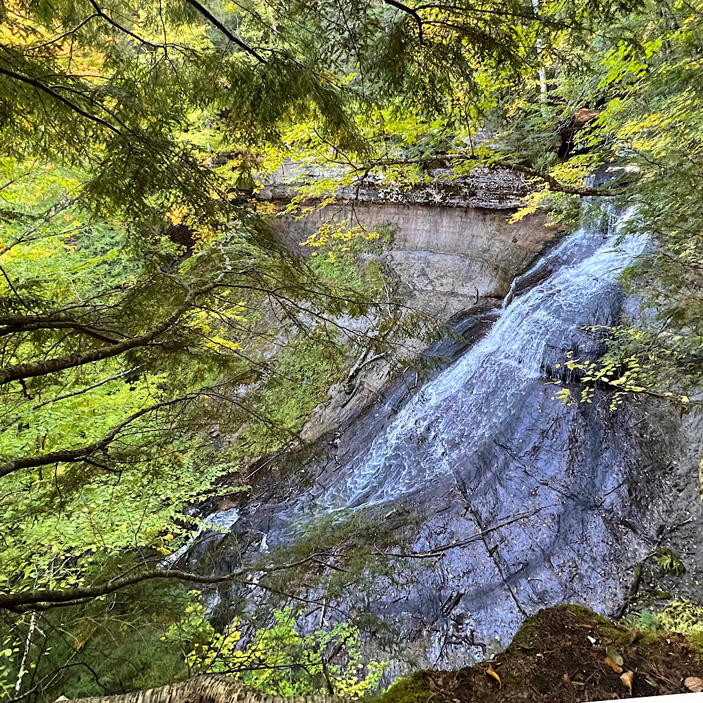
Chapel Falls is one of hundreds of falls in the “UP” (Upper Peninsula) of Michigan. Framed by hemlock and maple, fuzzy semi-circles cling to the exposed cliff as the water makes an 80-foot journey. I view it from all sides before I continue through the forest to the lake.
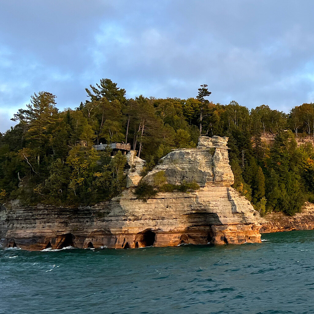
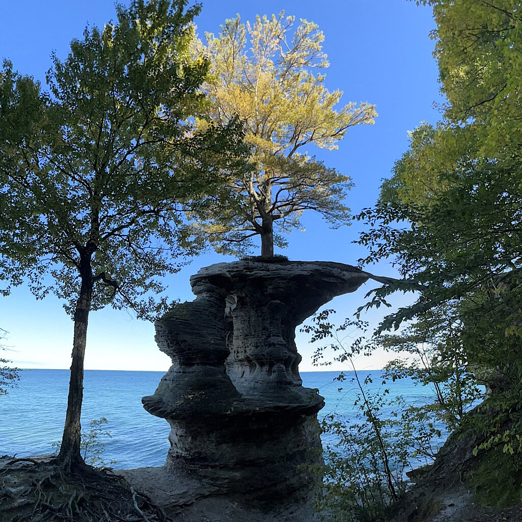
Here, I meet Chapel Rock, a remnant of Cambrian-age sandstone carved and eroded, leaving its lone white pine stranded except for one thick root reaching to the cliff behind it. I take a photo in the chilly shade and talk to the other hiker, a Japanese man teaching at a school in Southern Michigan.
At this point in my hike, I was starting to talk to myself and mull over my life, but Daiske crashed in and changed the tenor of the walk. “Let’s walk together!” he suggests and I say ok with laugh, as my day becomes a shared one, where silliness and playfulness infuse the walk.
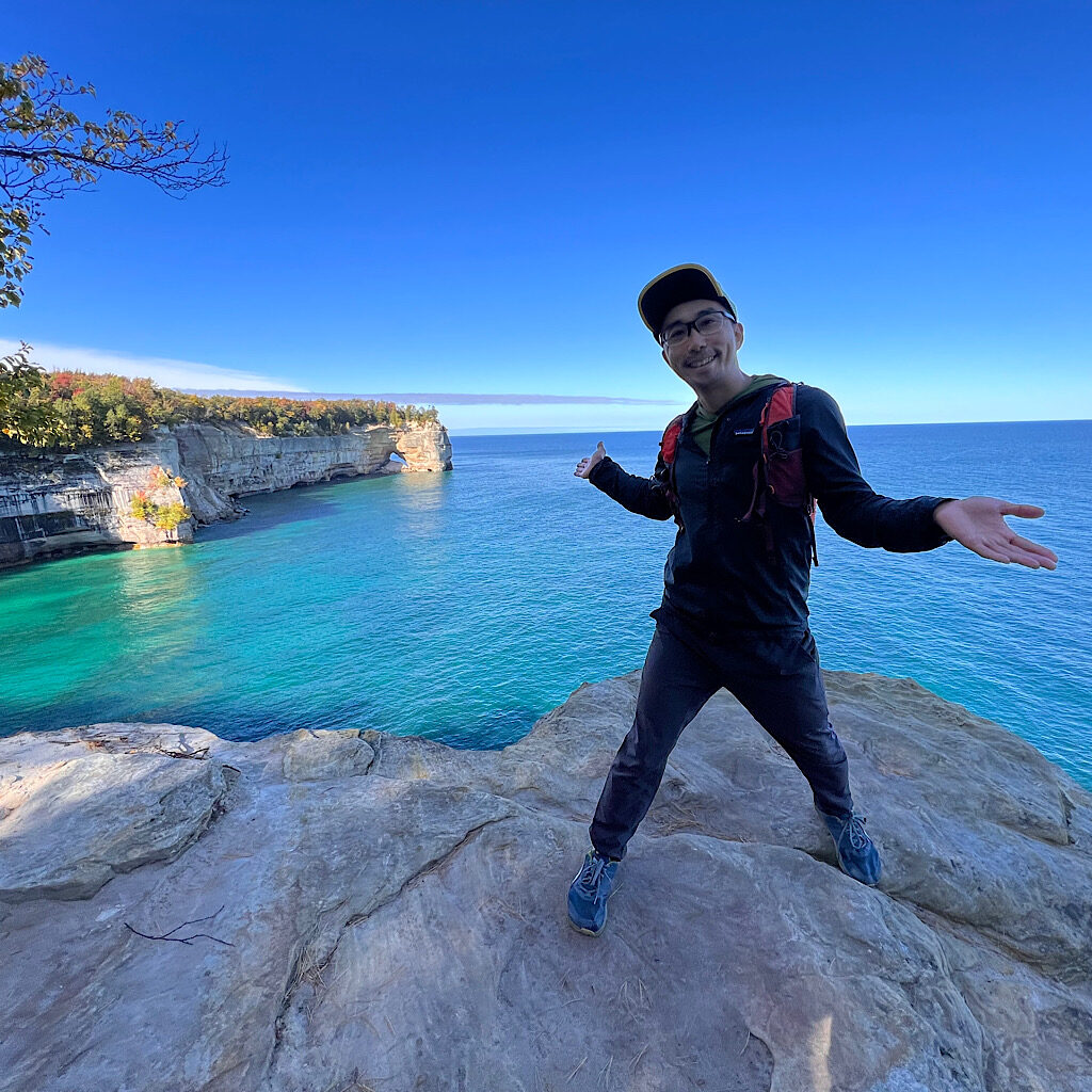
It’s a very easy 10 miles, down to sandy Chapel Beach, skipping stones begging to be skipped and a sandy ledge calling to my Frankenstein post-holing. At Indian Head, we wonder at the views and snap photos of each other, stopping for a snack on an impossible precipice.
Daiske’s English, of course, if superb while I can only sputter out Kon’nichiwa to the amusement of passersby and a very formal Arigarogozaimashita when my picture is taken. Daiske will have none of this, chattering away in Japanese and hoping I pick up a few words, like my favorite, Sugoi – amaaaaazing!
As we walk in an out of yellowing Aspen, Daiske takes out his phone to write down the slang I use over and over. He tells me that his Judo pals in Southern Michigan say things like, “I gotta split,” or “I’m outta here!” when saying goodbye. I suggest using a phrase from the surfer community of yore, “Let’s blow this popsicle stand!” I’d love to be a fly on the wall when that comes out of his mouth!
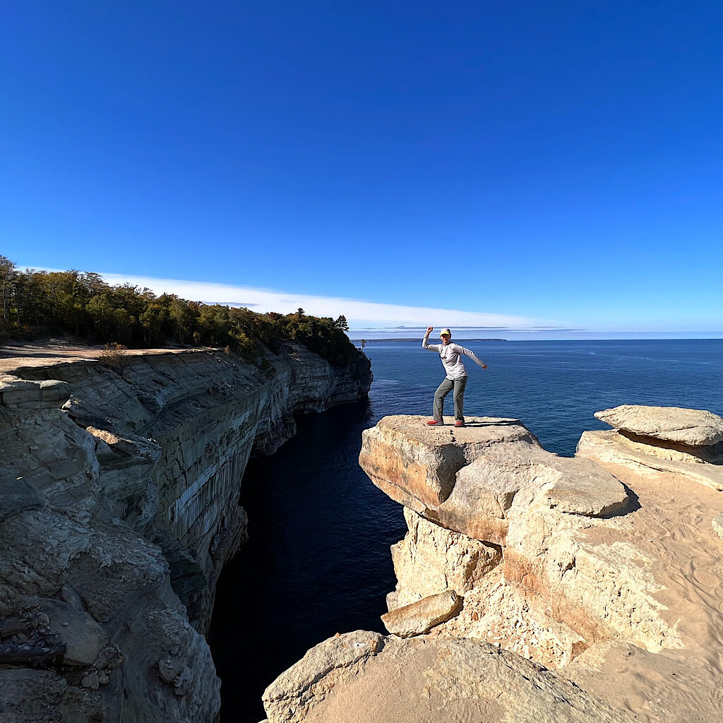
A tour boat slowly follows the shoreline below us. It might have been a better day to see the cliffs from the water, but I loved last night’s bumpy ride in orange light. Kayakers skim by as do sailboats. One takes our picture as we climb steeply down to Lover’s Leap, warned not to leap as the water is only about six-feet deep.
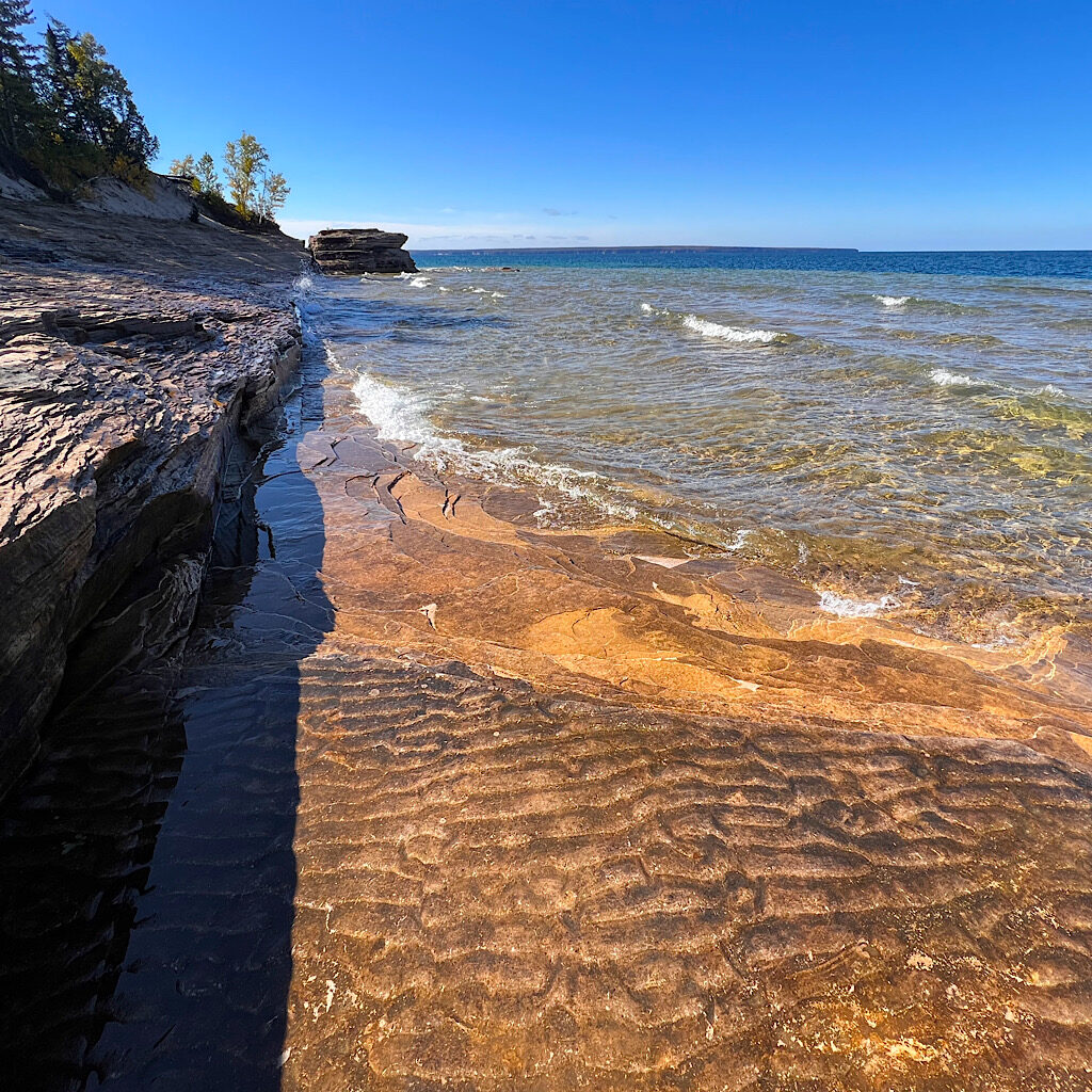
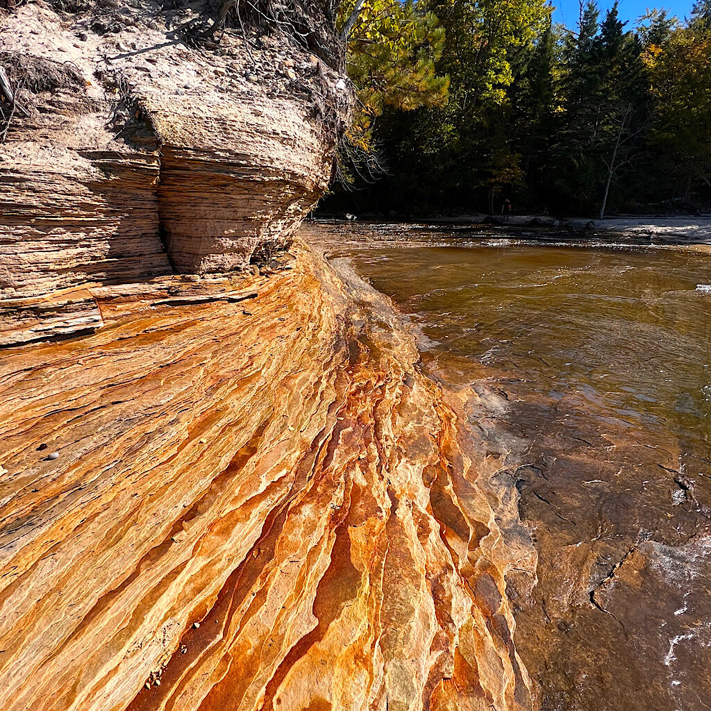
Soon, we meet Mosquito Beach, where Sandstone erodes into flaky pancakes, crispy under our feet. A shelf underwater reveals ridges as if still in motion but now solid, formed by waves of another eon. People from a nearby campsite build tall, triangular cairns from flat rocks, dwindling in size from large to teeny.
We walk in the water to meet the trail out and say goodbye to this magical shoreline. The forest walk takes us past a few more falls, not as impressive, but rushing and musical. The forest itself begins to glow in the late afternoon light as if the air has also changed colors for the season.
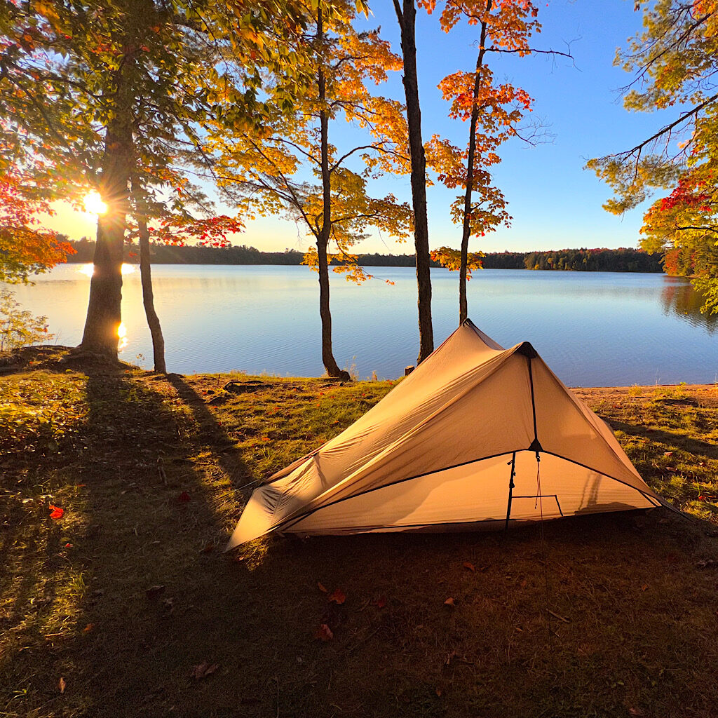
I drive Daisuke back to his car, five miles out, then five miles back in on another rutted road. It seems he had a different hiking plan, but was having so much fun, he stuck with mine. I have a huge meal at the Bear Trap Inn, sampling local brew and yet, again, sharing my experience by inviting a couple to sit at my table. We all do “mystery shots” before I drive south and grab a campsite in the National Forest on Colwell Lake.
Only one other camper hunkers in the woods next to his fire and I turn in as the last of the light glows on the alicoop.