
Exhausted and dirty with swollen legs, blistered lips and starved for anything besides bars and jerky, Katlyn and I stop at the hippest laundromat just off Pinedale, Wyoming’s main drag. Here, we put every bit of gear through the hottest available cycle while stuffed moose, elk and pronghorn loom above.
After finishing the Wind River High Route, we needed to help Katlyn retrieve her car. But this required a long bumpy exit from the Big Sandy Trailhead, an hour along the very range we just crossed and another tedious rock-filled back road to our start a week ago at Green River Lakes.
Richard was happy to help out, but that required staying close since the ”Green Emerald” (her Chevy convertible) was only moving in second gear. It was a late night, flashers-running trip but finally, while the clothes were spinning, we learn all that was needed was for lines to be drained. That’s when Katlyn suggested we drive to Colorado’s Rocky Mountain National Park and give another high route a try.
Andrew Skurka is a legend in backpacking circles. A National Geographic Explorer of the Year, he took what was more of an idea for an 80-mile line following the highest bits of the Divide in Colorado’s Front Range, and hammered it into a traversable reality featuring extensive off-trail travel and substantial vertical gain and loss, just like we did in the Winds.
Katlyn and I feel fit and experienced, if tired, after our most recent high route and find we both have the time. Besides, Colorado is (kind of) on the way home, so it’s only natural to head right back out on another high route.
Details, details: The Pfiffner passes through Rocky Mountain National Park, Indian Peaks and James Peak Wilderness, requiring permits to camp. A phone call inquiry got me to Trevor who both discouraged a ’last minute’ plan while also vague on closures.
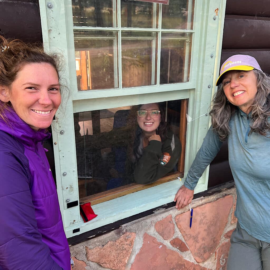
We manage to nab the only remaininv tent site at gorgeous Moraine Park Campground in Estes Park, waking before sunrise to be first in line at the permit office. The afternoon before, we met Katlyn atop Berthoud Pass to arrange a car drop at our exit, but her car barely ground up the switchbacks and needed a tow.
No way our hike was getting stopped by a ‘minor inconvenience’ like lack of transportation. Still, we’re unsure how permitting would transpire. It must be Trevor’s day off and we’re greeted by friendly, helpful – and most important – knowledgable Sarah, who informs us much of the northern part of the park is closed to cross country travel due to fire damage.
Still, she picks an entry point through Wild Basin on the eastern side of the divide, and, in spite of the fact it’s Labor Day weekend and nearly sold out, locates a couple of sites we’ll use as we climb over a magnificent pass to join the ‘Primary Pfiffner Route.’
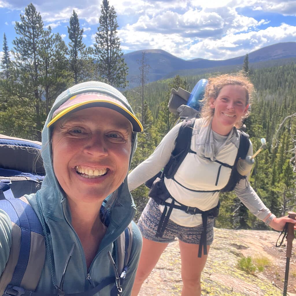
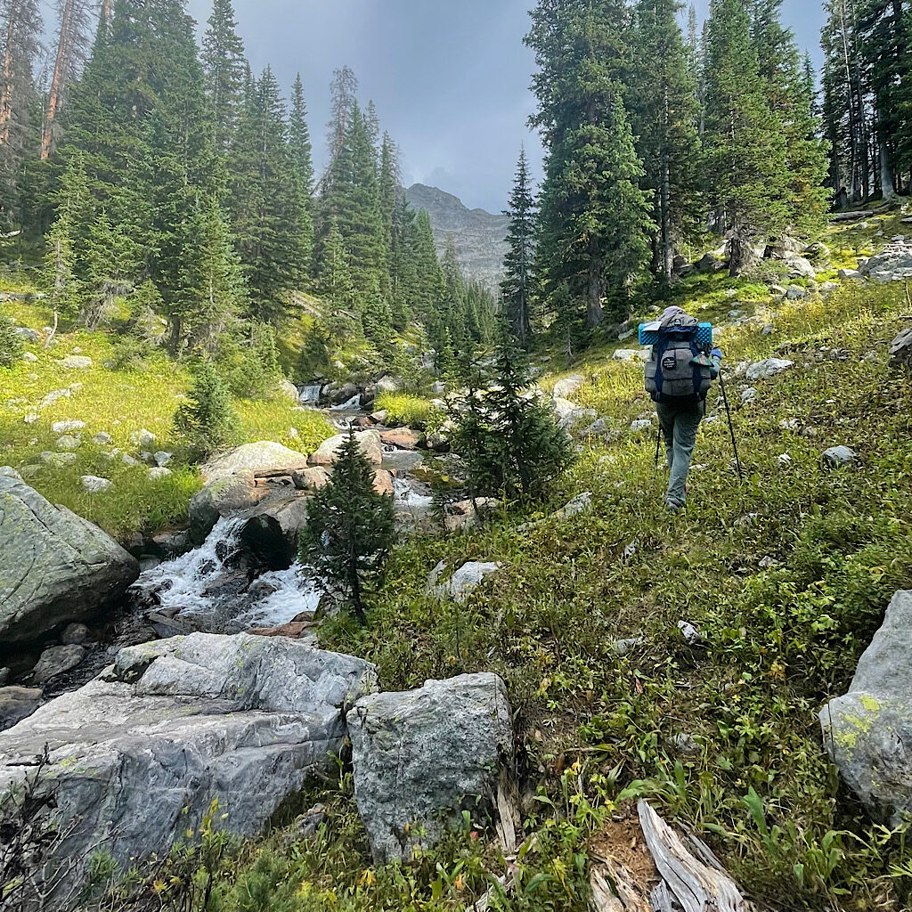
I hug Richard goodbye after a big breakfast and a nosy ranger asking if we’d camped in the lot overnight – sheesh, they must get a lot of rule breakers – then head back up fully loaded on easy trail, slowly climbing into the bowl that begins the meat of our second adventure.
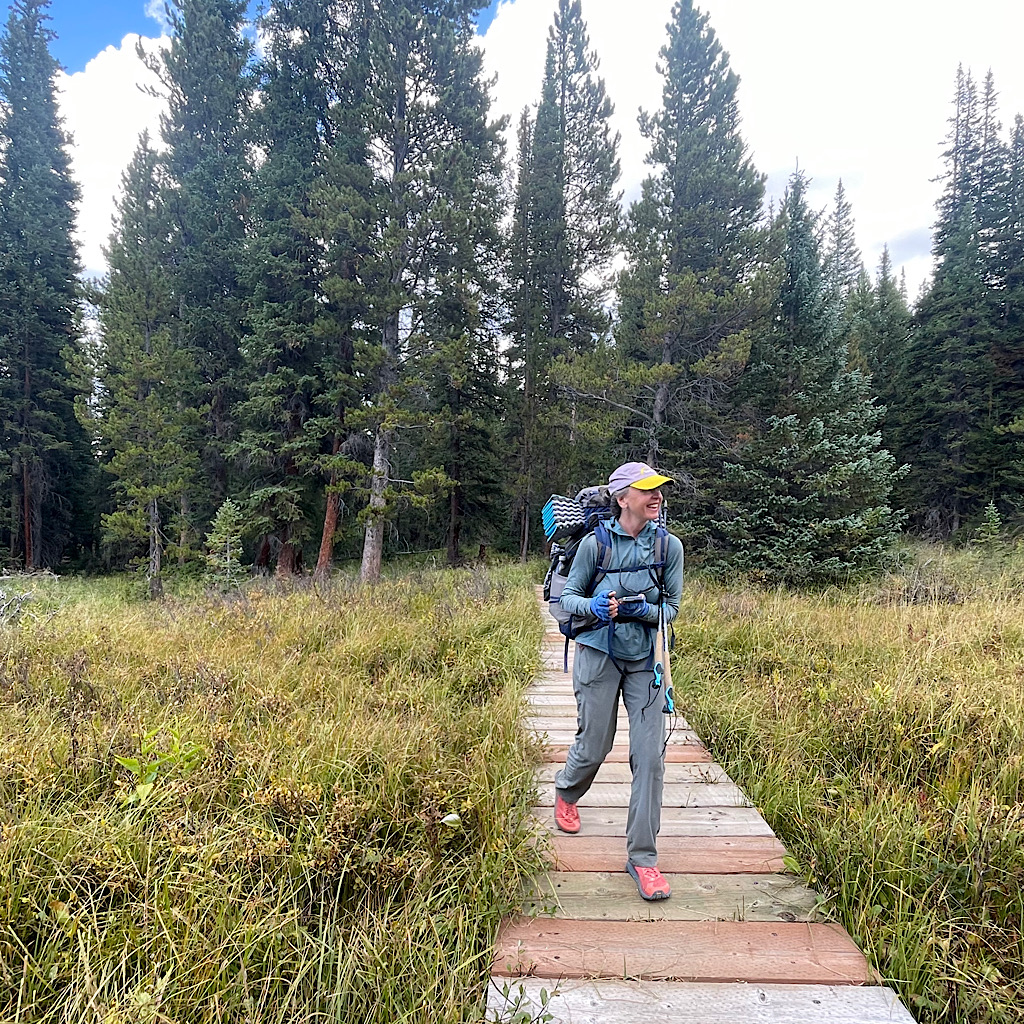
Trails like this through pine forest along a stream of gentle falls and building views are filled with hikers, many camping yet even more day hiking. An older woman led by a you a REI guide asks if we have maps. This combination of crowds and more new hikers on trail during covid has contributed to an increase in bear visitations. When ’rewarded’ with food, they’ve increasingly come to associate backpackers with easy meals.
So, a hard-sided bear resistant container is required for overnight travel in Rocky Mountain National Park. Katlyn carries her food inside her pack and straps a nearly empty container on top to use at night. We’re also required to follow Leave No Trace principles, and Sarah slips us a couple a Wag Bag portable toilets.
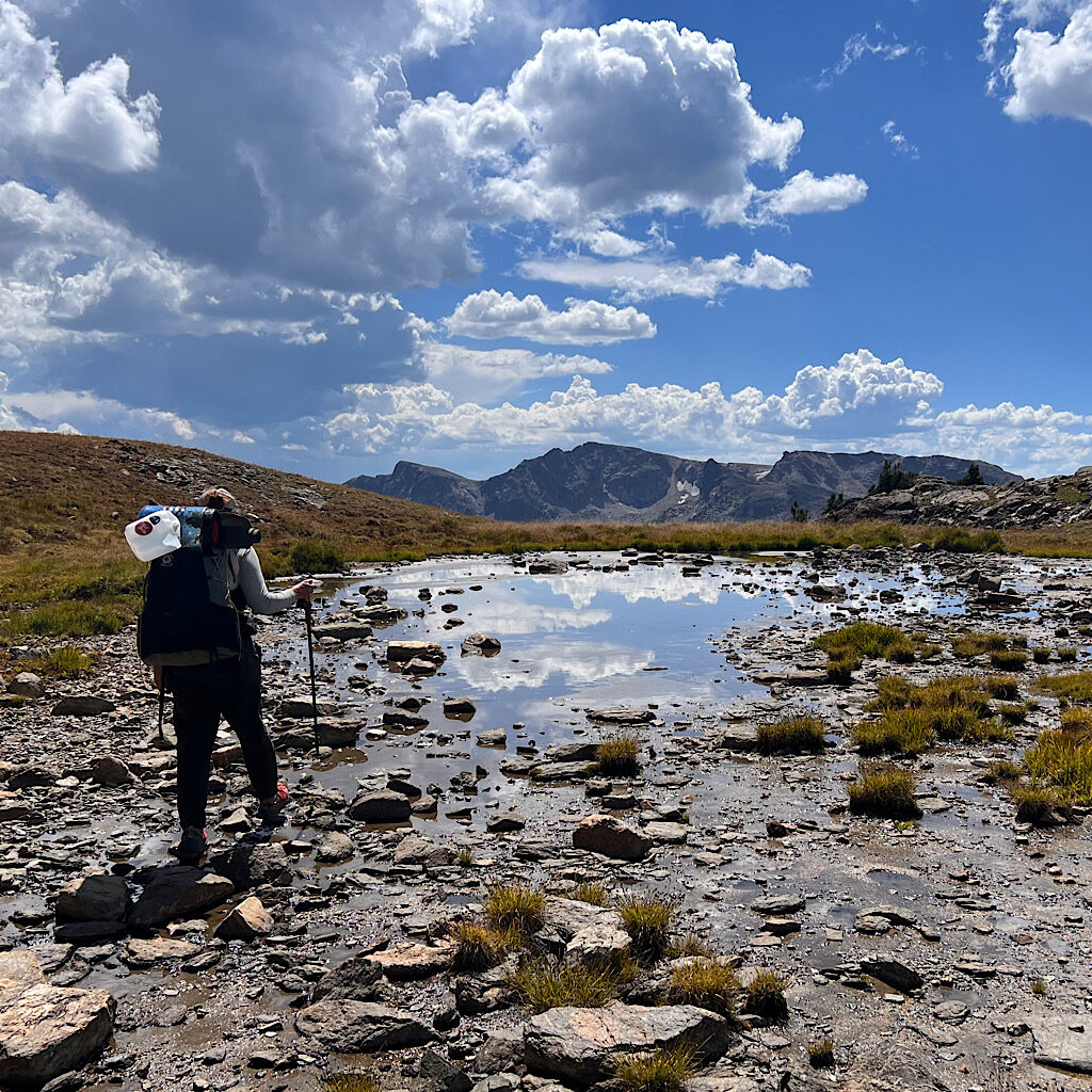
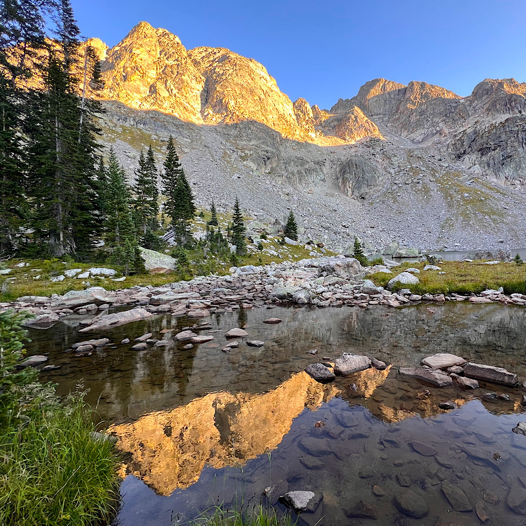
We’re in camp around 10,700 feet early, flat and tucked in the woods. Woodpeckers, noisy Clarks Nutcrackers and friendly Red Breasted Nuthatches fill the air. The lake is close and we start lunch just as a storm builds and thunder booms in the aptly named Thunder Lake. I head back and sleep away the afternoon, waking only for an eerie orange glow as the sun sets before getting the best sleep of the trip.
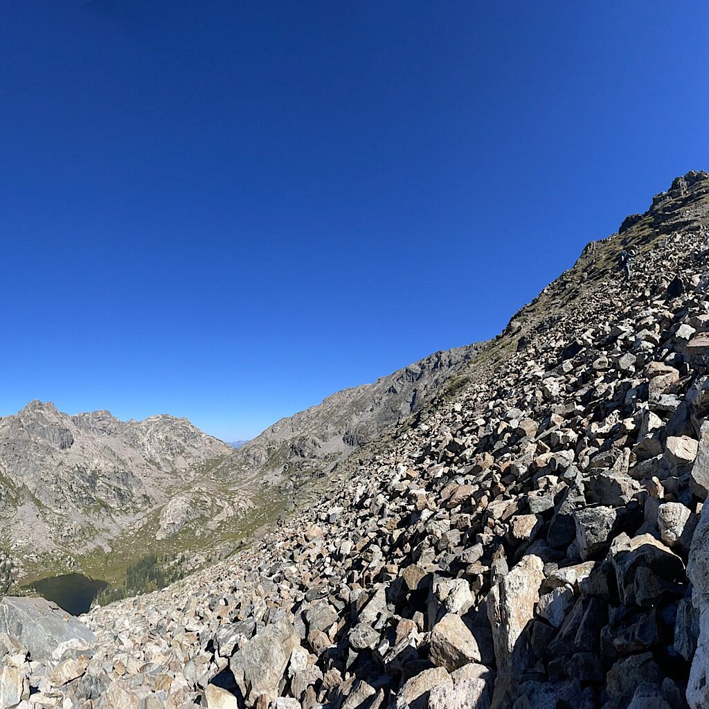
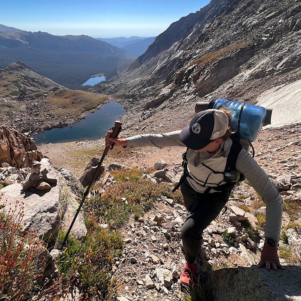
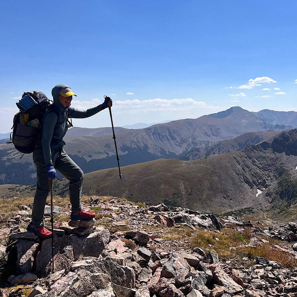
Boulder Grand Pass rises like an impermeable rock face above the talus bowl of Lake-of-Many-Winds, 12,000 feet high under lapis skies. A well-used trail rises through heart leaf arnica and hot pink mountain paintbrush, only one bit of rock climb to advance as water rushes down and crickets hop out of our way.
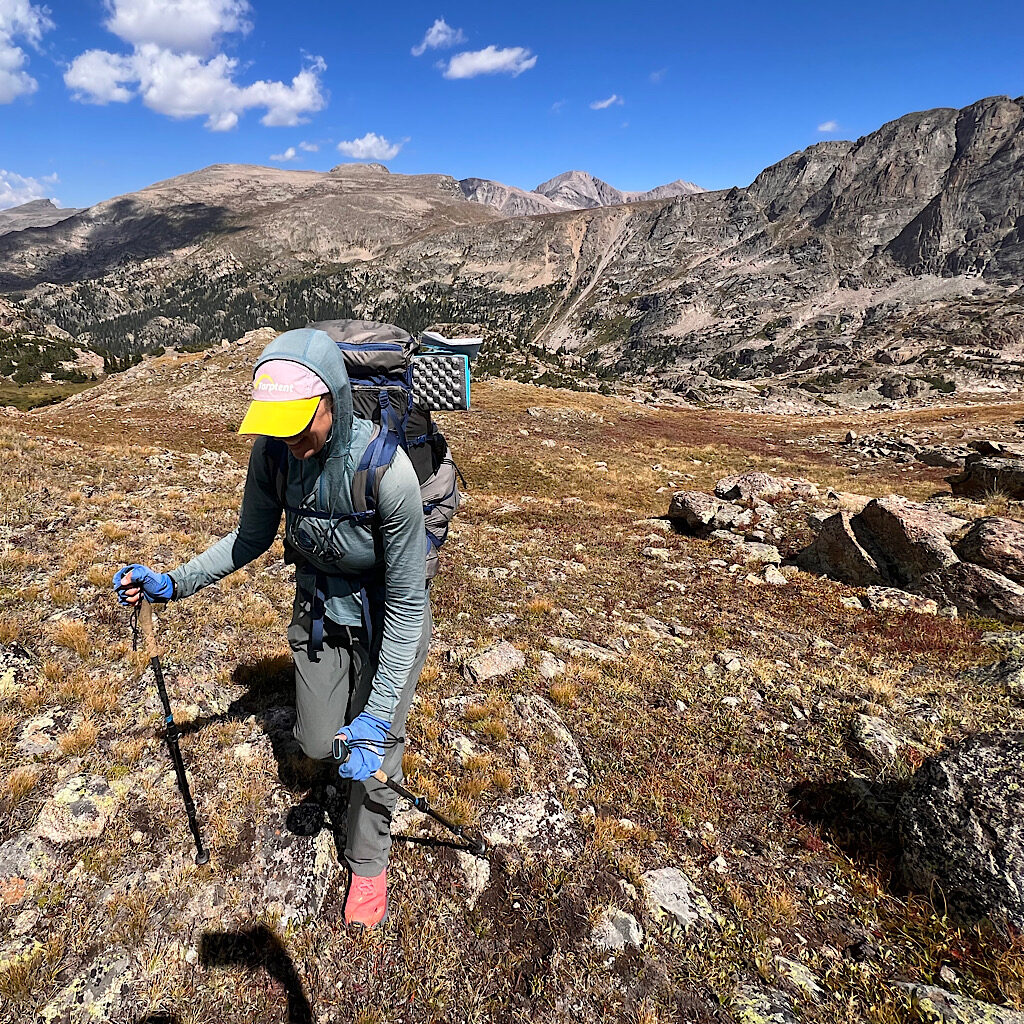
I lead strong on inclines, glad I have something to contribute as my legs wobble on talus. We’re used to it now, seeing a flat expanse with no trace of a trail and simply getting ourselves on it. I see a cairn at the top of a chute, one filled with slippery and dusty glacial til, stones rolling down as I step up.
There has to be a better way! But this mess appears the most used and in a little way, I come to solid rock acting as more of a handrail than a route. My trekking poles are shoved from side to side as I reach and pull or press down to push myself higher.
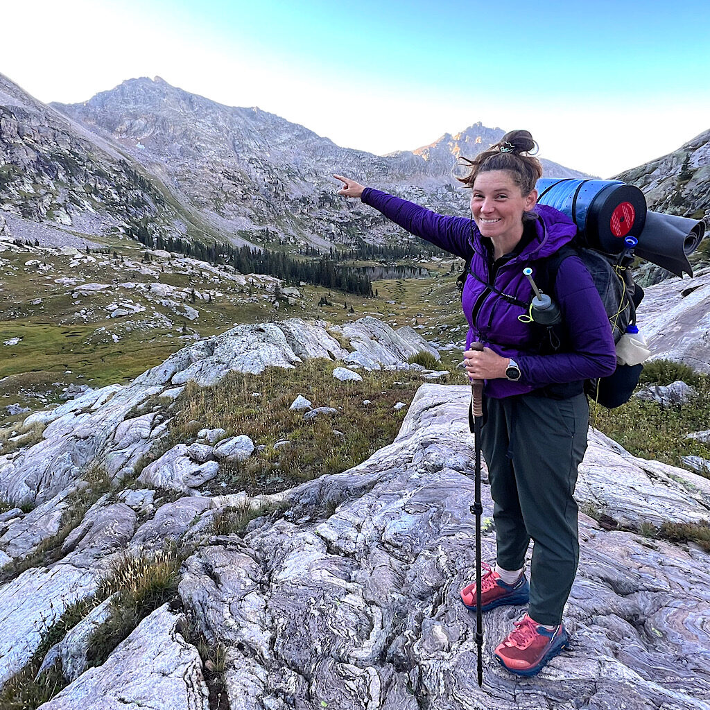
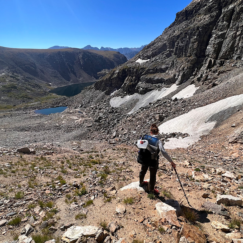
Truth be told, it’s not hard or technical, just exhausting – and dirty. My freshly laundered clothes stink now. But it’s a half hour of exertion and we’re up and out on a leaning football field of tundra and rocky ramps as if oozing out of the ground. Behind us is the keyhole hook of Longs Peak, the park’s largest fourteener. Ahead, a necklace of lapis lakes tucked into pointy pines.
The most direct route is straight down to the trees, then a sharp left up towards a final lake and another pass. But we have a better idea.
Perhaps we can sidle this deep valley and follow the U around, skipping what will inevitably be a blowdown nightmare through an uncharted forest. But exactly where is there cliff band to follow and cliff edge to avoid?
Mountains rise above us, most notably The Cleaver, reminding me mountains can care less what we choose to do out here, just two tiny specks in a vast wilderness. We choose a route carefully, thrashing through willow and ensuring any move won’t leave us stranded.
I am slightly behind Katlyn, following a small shelf of grass when suddenly I hear a bang.
The bear canister on her pack somehow wiggled out of its tether and flies down the cliff. We reach out our hands as if to command a stop, mouths open with not a word coming out. It slides, bounces, bangs and somersaults before coming to rest in a small pile of talus.
Getting down requires some scrambling, me mostly on from a sitting position But we kept our eyes on that box – an expensive and necessary piece of gear, storing a stove, a jar of peanut butter and gas. Oh, no! What exactly happens with that kind of impact, anyway?
Katlyn is worried. What if the canister blows up? She hides behind a rock touching it with her trekking pole. I keep my distance and suggest she put on her sun glasses.
Nothing blows up when she removes the lid, but the peanut butter jar ejected its sticky contents on everything a a bear-proof canister has instantly become a bear-attractant.
All we can do now is focus on sidling forward out of this cliffy-ness and towards Fifth Lake. Something strange happens in that moment. It’s as if the bear canister led us through its wild trajectory, right to s path. It’s not a proper hiking path, but one beaten down by elk hooves, avoiding fallen trees, staying on an even line and leading right over avalanche paths towards a pristine lake and shaded lunch spot.
Isolation Peak Pass is next, beautiful and almost cliche as Moomaw Glacier clings to the side of the peak and it’s more heavy breathing up steep meadow and into a hanging glacier before another rise past East Inlet and up the precipitous col.
The passes are straightforward and easy going even hovering around 12,000 feet. Perhaps we’re lulled into thinking it will be all easy going ahead. I should point out that route finding and cross country traversing are slow and tiring. You can’t simply zone out like on trail, even if the way is obvious. The ground is uneven and many micro-calculations are made along the way to avoid water, steep sections, rock or just tussock you’d prefer not to have to negotiate.
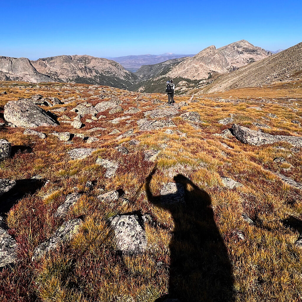
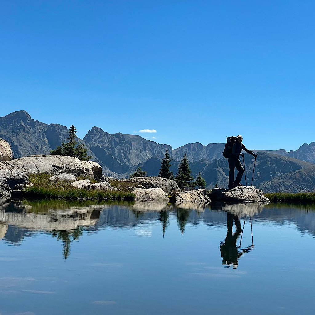
The reward is not seeing any trace of people so ferns and flowers remain intact, alpine tundra plants like mosses with tiny white flowers are abundant and deep purple mountain marsh gentian open up like champagne flutes in wind-waving bunches.
It’s a fairyland of tarns and mountains, the final push a gateway into a special place also beautifully named – Paradise Park Research Natural Area. There are dozens of these pieces of land set aside for scientific study, left alone to simply let nature do its thing. We’re welcome to explore, but not allowed to camp.
Clouds build fast as we pass tarns spilling down the hillside and rock seemingly growing out of tundra. It’s steep down on stair step tussock into the woods, spotted coral root and common fireweed brightening our descent.
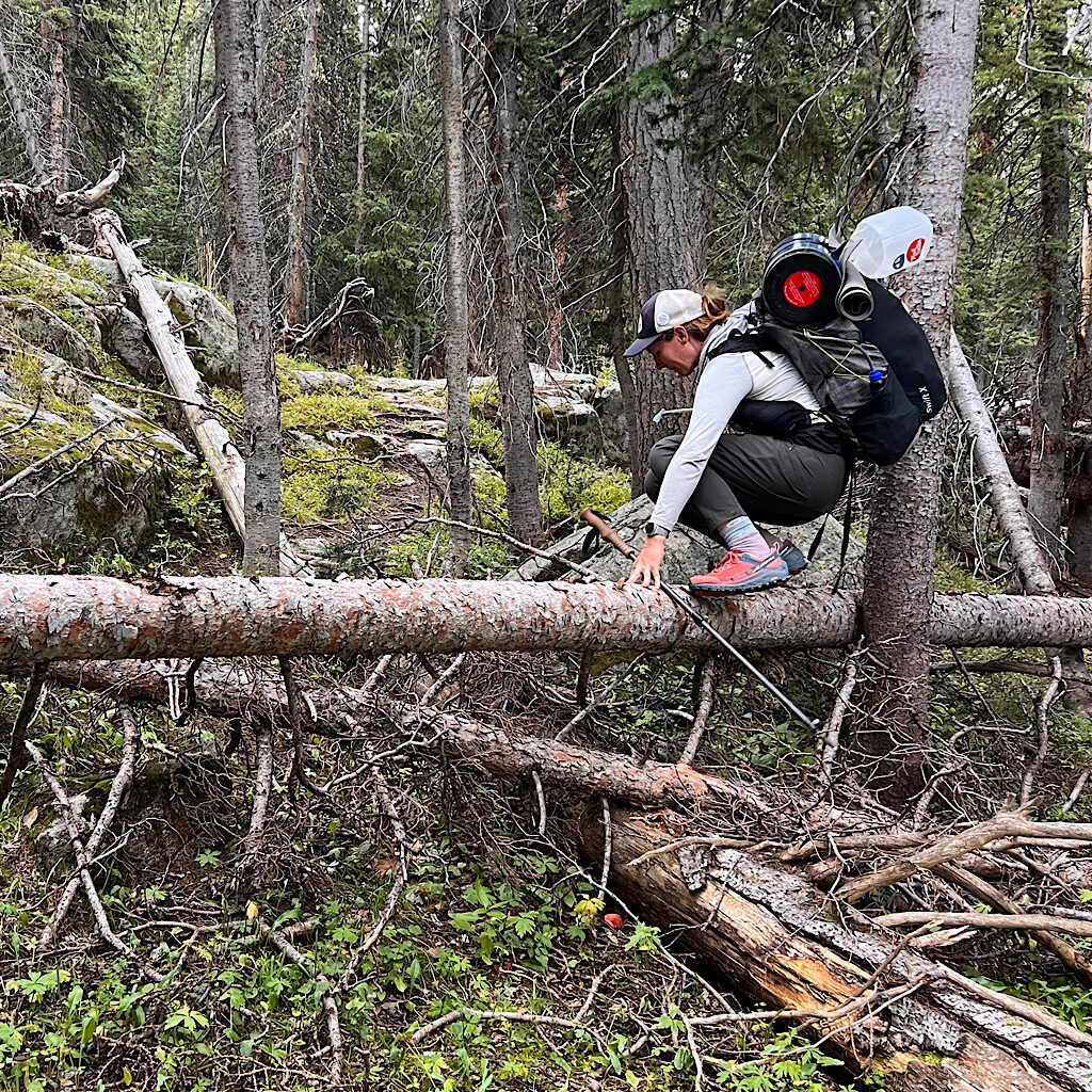
Thunder rumbles, long and ominous, turning the forest into a dark and mysterious place. There is no ’way’ through, just to reach a blond meadow that will lead to another pass. Paradise is very much in its natural state, one of blowdowns. It’s tedious in the gloom, but lucky for me, most are only one tree high and an easy stride over.
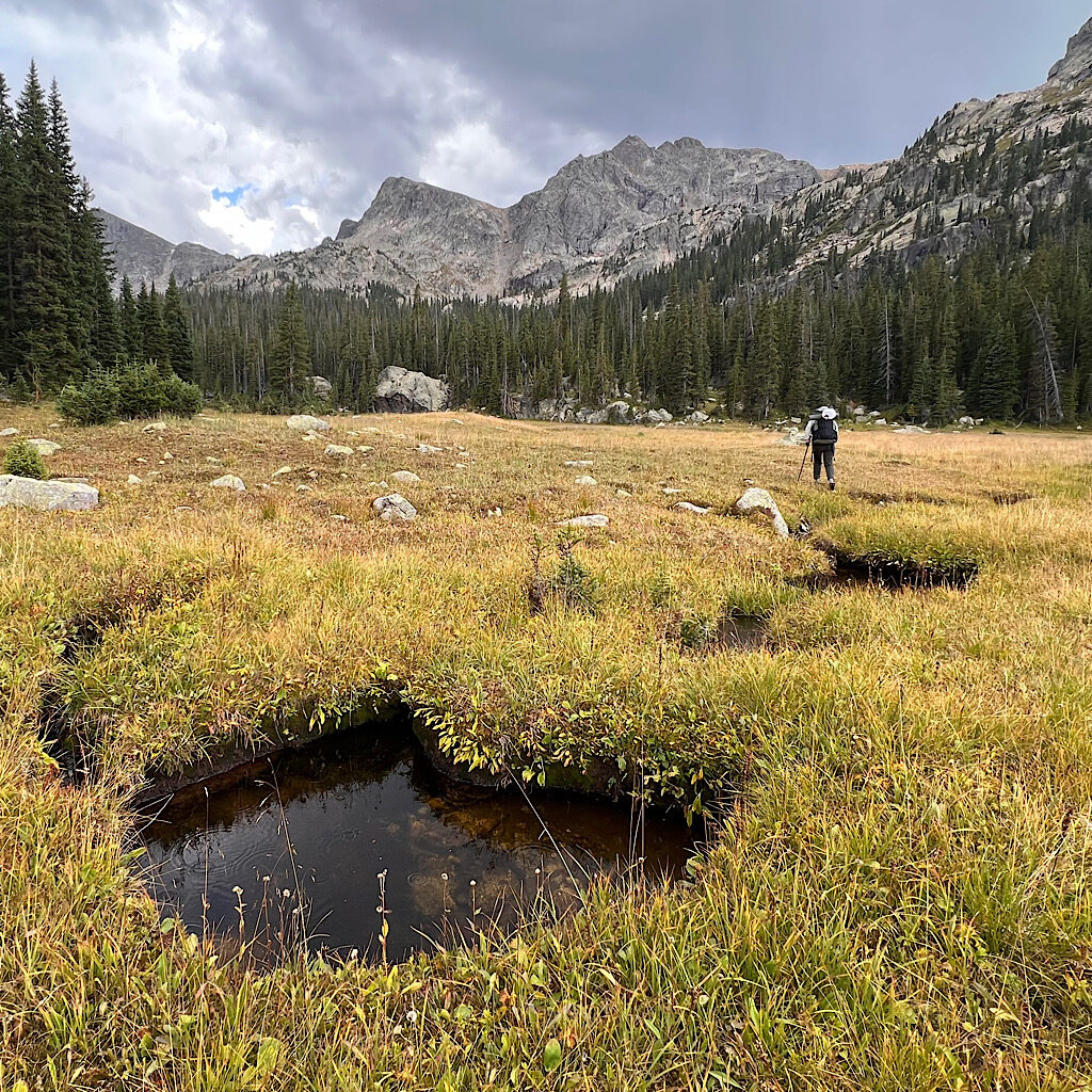
A few drops of rain splat on my arm, but not enough to take out rain gear as we leap over the last tree and join a meadow like a carpet rolled out to the mountain bowl. We still need to watch our footing over elk trails and deep streams hidden by grass, ones we shout out in warning as “meadow holes!”
Fir and rock fringe the meadow, a warmup act gor the smooth, steep slide of pass we’ll catch tomorrow. We cut off slightly up and over another stream flowing out of a no-name tarn. It’s a magnificent bowl carved beneath Watango and Hiamovi Mountains exfoliating truck-sized boulders into the still water.
Katlyn announces when we leave the research area and arrive at a thin strip of national park. There are no ’durable surfaces’ here for camping and we set on soft grass, lovely as a bed, but destined to leave our tents a dewy mess by morning.
Still, it’s glorious in our bowl, water gurgling nearby and the light turning the crags a deep shade of gold high above. I lay down to eat, tired and happy, while Katlyn carefully cleans peanut butter off the bear can.
As expected, we’re soaked in the morning. Sleeping bags now have a protective fabric, so a damp bag does not mean I’m damp, only that we’ll need to find a sunny spot to dry things as the day progresses.
I’m awaked by cracking branches and peer out on a mighty elk running in to check us out. He bounces as he moves, elegant and athletic. We pack wet and begin sidling towards the pass.
It’s grassy steps, mostly, and easy to avoid rocks, then straight up to the pass. The lake sits below, deep and dark then disappears behind rock. Paradise Creek snakes through the meadow. We’re tired, but it’s again like climbing a ladder.
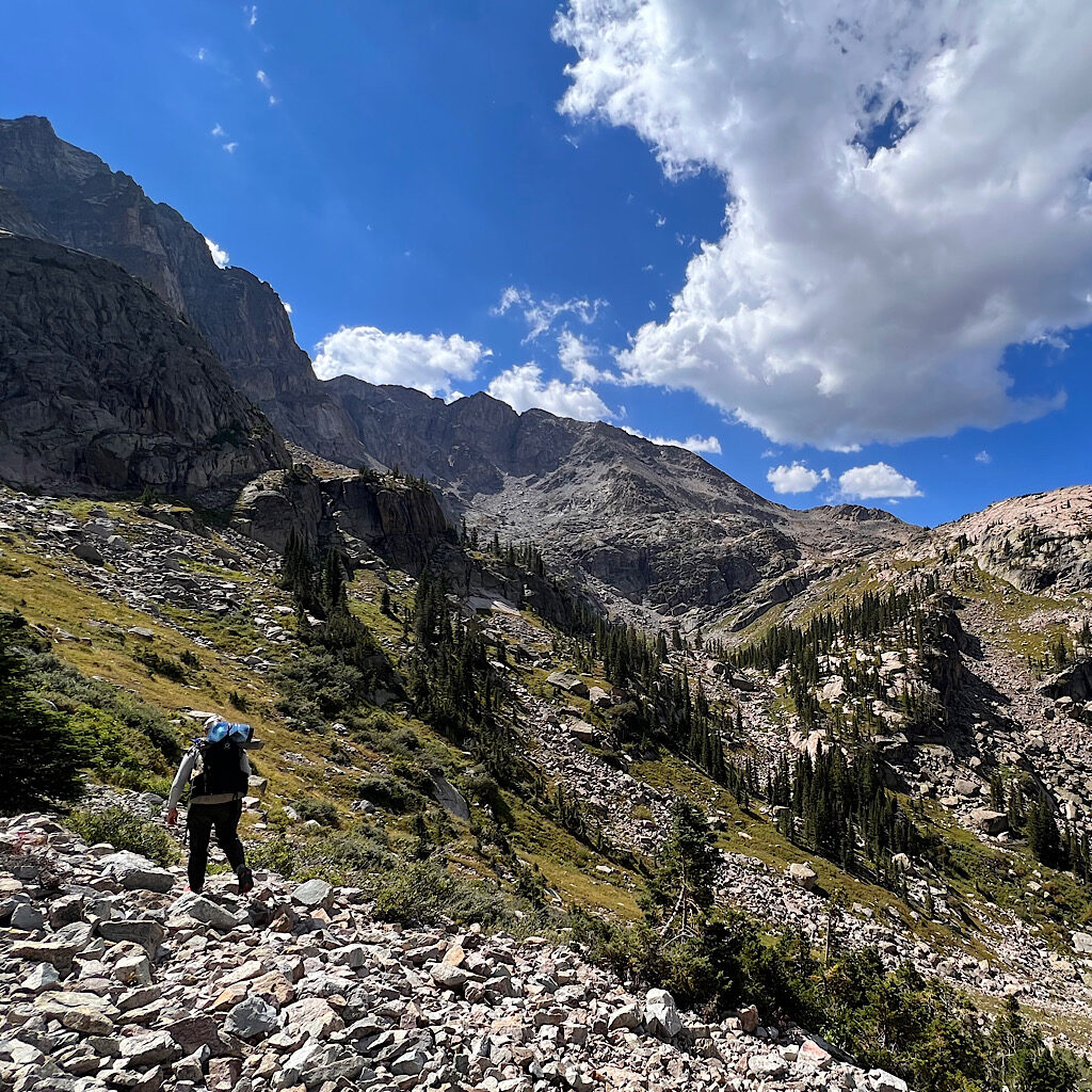
The top leads into Hell Canyon, an easy descent of rocky ramps like tongues down into willow-enveloped wetlands. And what is that ahead? A kind of roller coaster of talus spitting straight down into a slide of green. Steep, straight down, relentless.
Skurka jubilantly points out that Cooper Peak Pass is 1,100 feet over a 1/4 vertical mile, ending with a bolded exclamation point. How can someone be this excited about a long, hard, straight-up, non-stop, calf-burning pass?!
Truth is, I don’t know most of this at the time as we send ourselves through lush tundra, still filled with flowers. We hear voices wondering if yet again, a coupla of ‘splainers are on the way.
But no! It’s four women heading up the pass and asking for beta on the blowdowns. This canyon is accessible by easy trail and many hikers use it for a loop. But when we point to Cooper Pass that we’ll be on in a moment, they freak.
That cannot be climbed!
Then one remembers seeing a man come down it with goats. Well, ok, then. If it can be descended with a herd, we’ve got this!
Admittedly, we’ve got an optical illusion on our hands. It appears a 90-degree angle, but there’s some slope, some tufts of grass to grip onto. But what about the talus above? Well, that’s way down the line.
We wish the quartet good luck and again sidle the cliff to get into position. Small drops, meadow holes and lumpy tussock slow us down. Below, a dog barks. It’s still shady where we walk, but sun covers a flat spot by the lake where campers dry their tents – a task we’ll catch up on later.
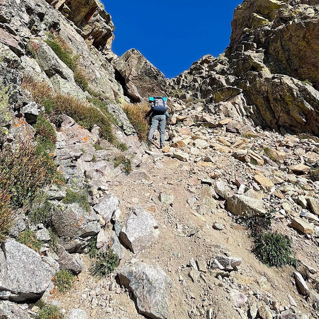
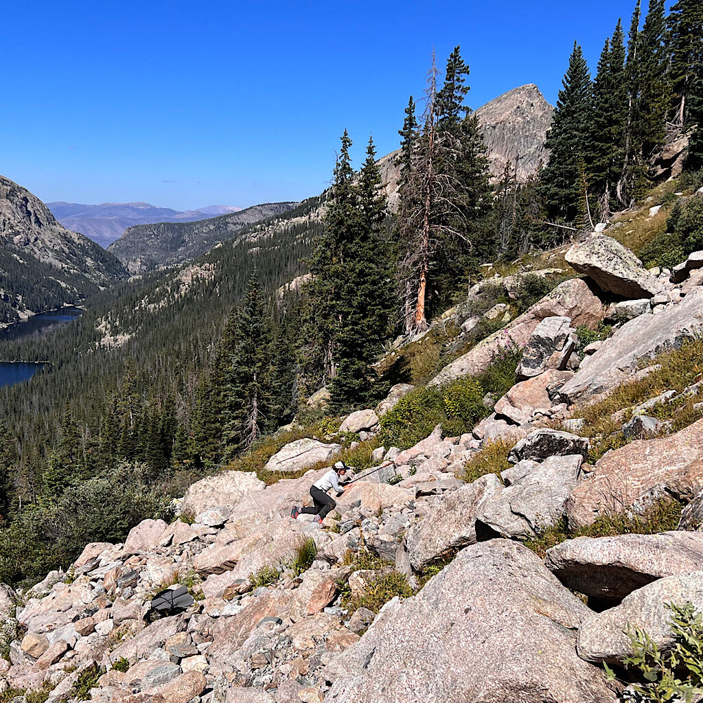
As we reach the band of vomited tussock, an avalanche path we have to climb, we hear cheering. For us? You bet, and we’re going to play this up. The grass makes thin shelves to hang onto, but there’s no stopping here. My legs are on fire and the land is disintegrating under my feet.
Katlyn finds a line to the right which looks steeper to me, while mine finds the rocky stream and holds for a few dozen feet before fading into disintegrating scree. “Move right!” Katlyn offers, but it requires superhuman strength to power past.
I’m on all fours not so much because my pack pulls me backwards and the height is dizzying, but I spend less time placing all my weight on individual bits of earth.
About 700 feet above the lake, I no longer hear the cheers and shimmy up to a boulder which appears solid. I need a break and can hardly believe how far I’ve come. Katlyn catches me breathing heavy and wild eyed by the scale of our ascent.
And that’s only halfway through.
Katlyn points out Cooper Peak Pass, an avalanche slide of never ending climbing.
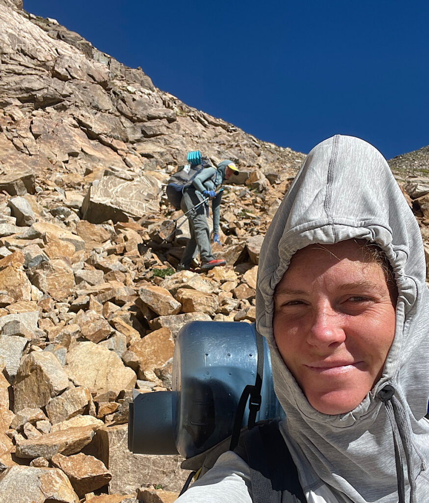
These high route projects have brought out a new appreciation for talus, especially on slopes. Here, it’s steep up to the horizon where the sun begins to peak out, glaringly blinding. It’s mostly solid but hard to keep lifting my body up and on and the pass feels just there.
But like a dream, I move in slow mo and cannot believe this height. I only look back to check that Katlyn’s progressing but fear snapping a picture and my phone popping out of my hands to the bottom for a rerun of this climb. I admit little technique is involved besides brute force and determination. Still it’s a haul and feels like rock climbing.
When we finally pop over, it’s into a talus-filled bowl, one lone lake below, cold and remote. It’s not quite the drop, but dizzyingly steep and hard to grab hold. To get purchase I sit and reach for anything solid. How do runners throw their bodies down these ball bearings?
I have to admit this is dreadful and I’m completely out of water.
A more stable line of cliff appears and I stabilize using my hands as the slope eases and we reach the first lake. Below is another with an island, a partial rock bridge jutting out as if ruins of a castle. We navigate still more talus which leads to cliffs. Worn out, we decide to simply downclimb and splash through the water.
My knees hurt, my thighs, my feet. I’m dead tired pulling into a grassy stretch surrounded by krumholz. The sun is hot and the sliver of shade is delicious. The sky and lake both are deep blue, a gentle breeze cools my wet feet and I crash.
Have I ever been this tired? I wonder, not wanting to move. Talus gives way to ramps, drops, gullies and another magic lake seemingly floating above distant mountains. A chipmunk zooms up a vertical face like an Alex Honnold of the animal kingdom and we watch, transfixed. Gourd Lake glistens, pristine in this high valley.
It’s hard to go when we meet trail, gently switchbacking 1,000 feet to Buchanan Creek, peaks disappearing as we drop. It’s less than a mile to Thunderbolt Creek, fish darting from our shadow as the water winds through a side valley of meadow leading towards a steep pass below tall spires.
Exhausted now, we set camp and turn in hoping to be refreshed by morning. But it’s not meant to be. Too much work, too far, too hard, all of it takes the will and strength from us and Katlyn makes the call to save the final passes for another time.
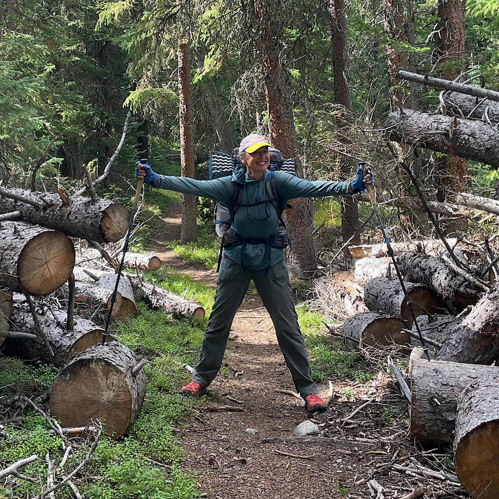
Superb trail maintenance is a must after a catastrophic windstorm.
I dream of inviting old boyfriends to a dance, the kind I like the best where everyone just grooves as a group and I feel ok saying goodbye until next season, grooving to the beat I’ve been given today.
We still have miles and miles to walk on the Continental Divide Trail, up and over Mount Adams (with minimal views) past Junco Trailhead where a volunteer remarks on the growing size of backpacks over the years, through a burn area and finally to a tiny camp spot next to a babbling brook where the sunset turns surrounding peaks a deep mauve.
We talk all day, on and on about our lives, hikes we’ve done, people we know and hope to keep our pace and maybe rejoin the Pfiffner. Snapping twigs wake us and we later spy the culprit – a lovely young moose with long, shapely legs and a soft, boxy snout.
She watches us climb through a spectacular blowdown which stretches for miles up a canyon and into the Devil’s Thumb. Without trail crews clearing a path, these pick-up-sticks of fully mature trees were surely impassable.
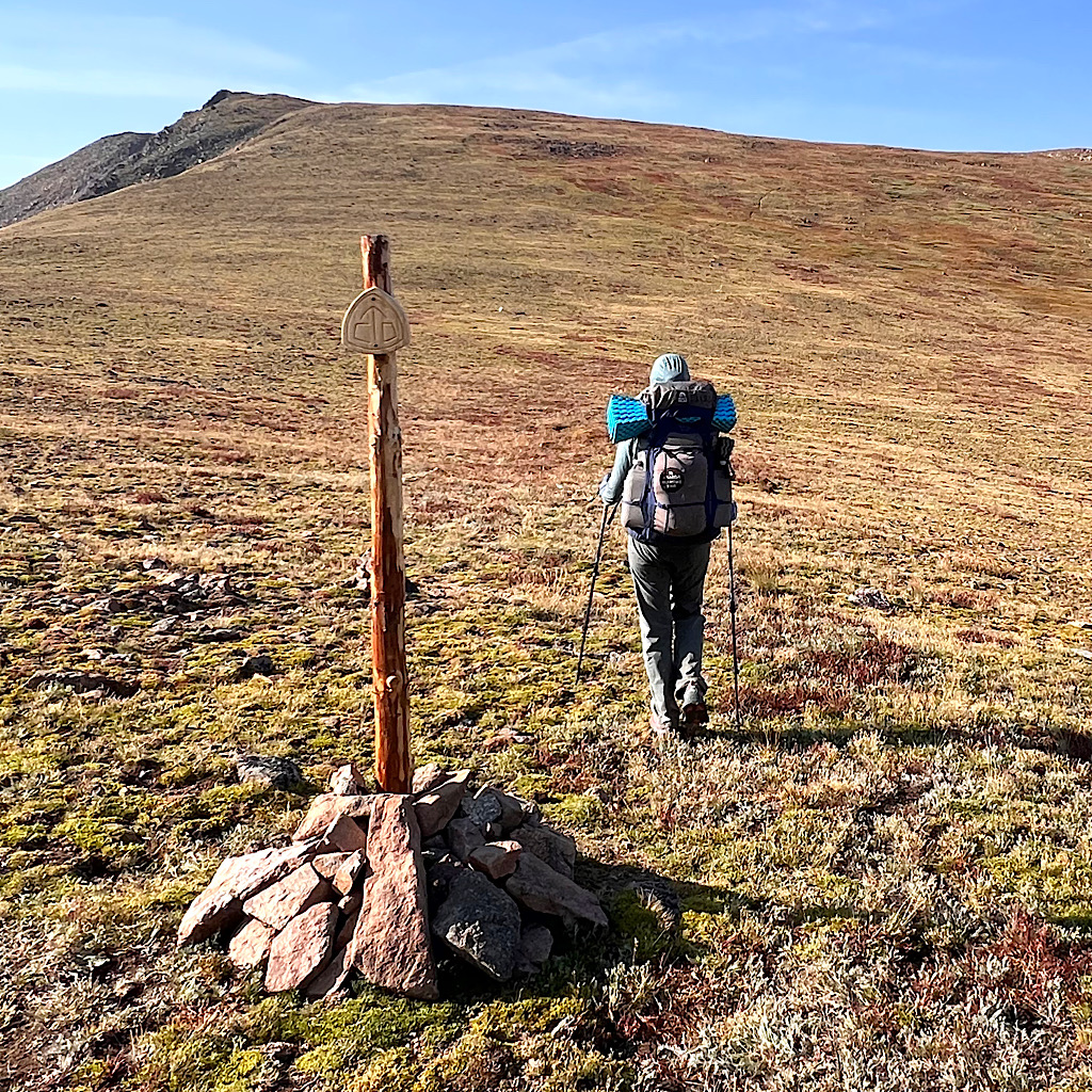
The trail climb higher and higher, a giant’s front lawn close to 12,000 feet rolling above ski hills and towns. Sadly, smoke from California wildfires settles in the valleys and obscures the view. It also begins to affect my breathing.
I make my best effort, cruising on brightly colored tundra with mountain lakes winking from below. I drink and eat, even scoring a beer from a friendly tourist at Rollins Pass, but my mind gets foggy and it’s clear I can’t keep going.
Trail magic appears in the form of a road nearby. We descend overland and meet a couple, Chuck and Karen, happy to get me down as quickly as possible on a dirt road filled with basketball-sized rocks.
They must have taken pity on my sorry state because they drive out of their way to deliver us over the pass to another town where my friend, also Karen, picks us up and gets us cleaned up, fed and watered.
It’s an odd and sudden way to end, but we both felt sick from the exertion and an overland high route is nowhere to make a mistake. Katlyn leaves by bus to retrieve her car after a good rest and I stay longer, talking and laughing with my friend a filling up on fur therapy from her dogs before I too need to head home.
The project is not finished and more is still to come, but we both agree more rest time might be in order for a trail of this magnitude. It’s harder in some ways from the Winds – messier with more altitude gain and loss. Plus Colorado is hotter with longer water carries and seemed to sap my strength faster.
I’ll return to finish but got now feel pride jumping right in on another high route, challenging my mind and spirit and savoring the emptiness and vastness in less explored reaches of the backcountry.
Until then, stay tuned!

6 Responses
Looks fantastic. I am just a little confused on on the path from Grand-Boulder Pass onto Paradise Park via Isolation Pass and the approximate route you took? I understand where the Grand-Boulder Pass is and what is needed, I just don’t really know the exact position of Isolation Pass to go into Paradise Park? I also do understand where to go into IPW as I have camped there a Stone Lake. Hope you can maybe clear it up… Thanks!
Thanks so much for your note, John! We used Andrew Skurka’s route of the Pfiffner and crossed Isolation Peak Pass from Fifth Lake after contouring from Grand Boulder Pass. The pass is really obvious from the lakes. It’s easy a long way down until you meet the forest with blowdowns to crawl over before reaching the meadow in Paradise Park. I don’t have a GPX track for our path rather the Skurka route but a huge portion in RMNP was closed when we were there because of fire. I hope that helps!
Thanks for this! I’m going to attempt in late August. Fingers crossed!!
fantastic! I hope this helps. it’s really cool but very hard. Let me know how it goes, alison
Whew!! I’m exhausted just reading this entry, but what spectacular country. Congrats on the beautiful back to back adventures and kudos to making smart decisions. Cheers to you intrepid scramblers!
thanks, Susie! It was “hard as” as they say in New Zealand, but a totally different mind-set on a route vs trail. More a puzzle! I loved it and will do more.