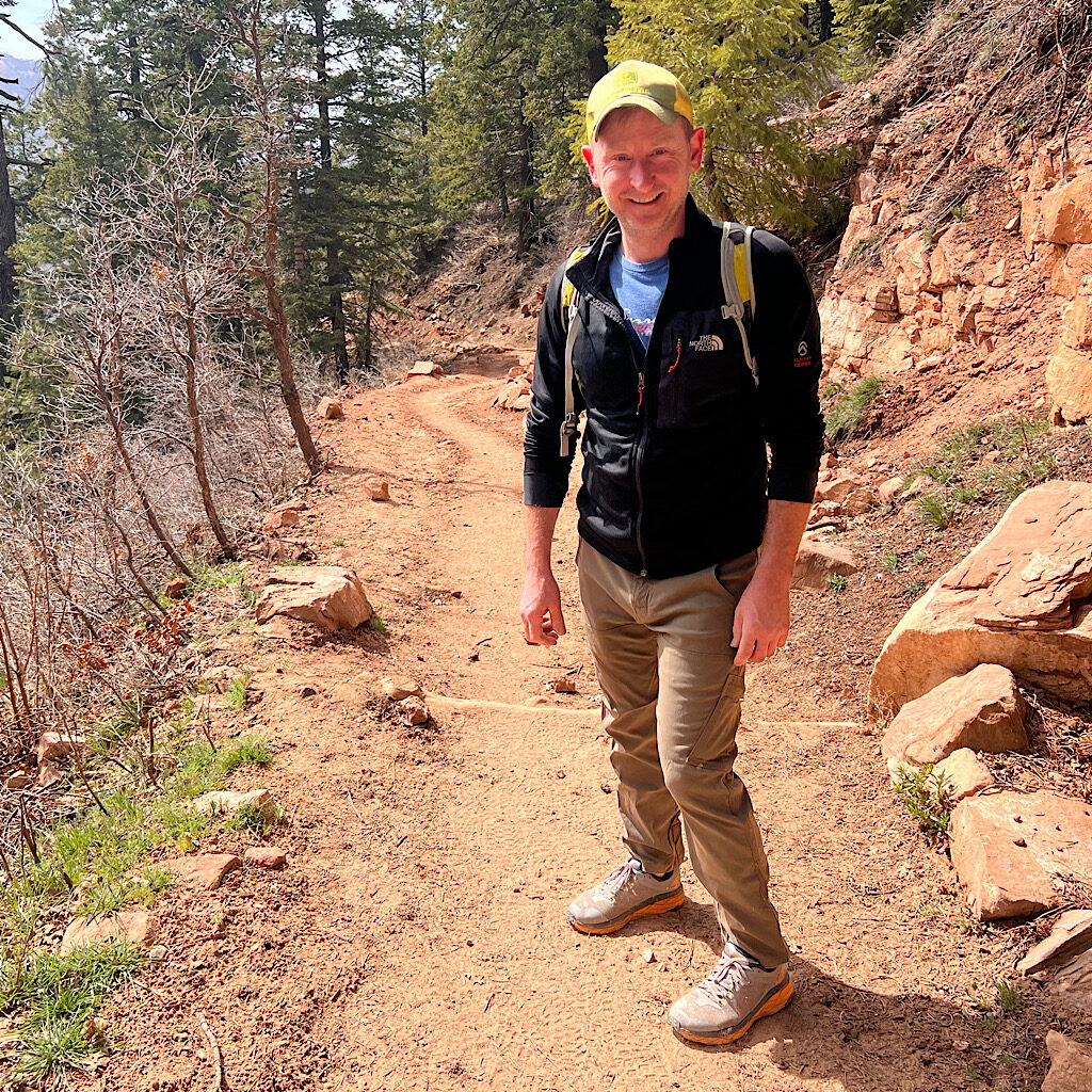
It’s the last night I’ll be hot in my tent. The wild wind finally settles and I barely lay the quilt over me. Our neighbors are up before dawn and their headlamps bleed into my tent. Hasn’t anyone heard of the red light as an alternative to the blinding setting?
I always take a headlamp and batteries, but never use it. My night vision is good enough for me to get myself to the fancy composting privy. As long as I’m up, I decide to get ready to head up and out. The direct sun did a number on me yesterday and I still have a mild headache. Perhaps it would be safest to get some miles behind me before the sun blasts into the canyon.
It’s uphill all day today except for a very few bits. 4,200 feet in seven miles. There’s only one water source on the way up at Manzanita, a kind of rest area with benches, another fancy two-story bathroom and running water. I’ll need to fill up and ration through the climb.
The plan is to get to the rim, then hike as far as possible on the Grand Canyon Highway – which is plowed but closed to the public – and try snd beat the cold front coming in. The reason for the road is the trail is still covered in snow drifts. It would be a wet and muddy affair to risk it, as well as slow.
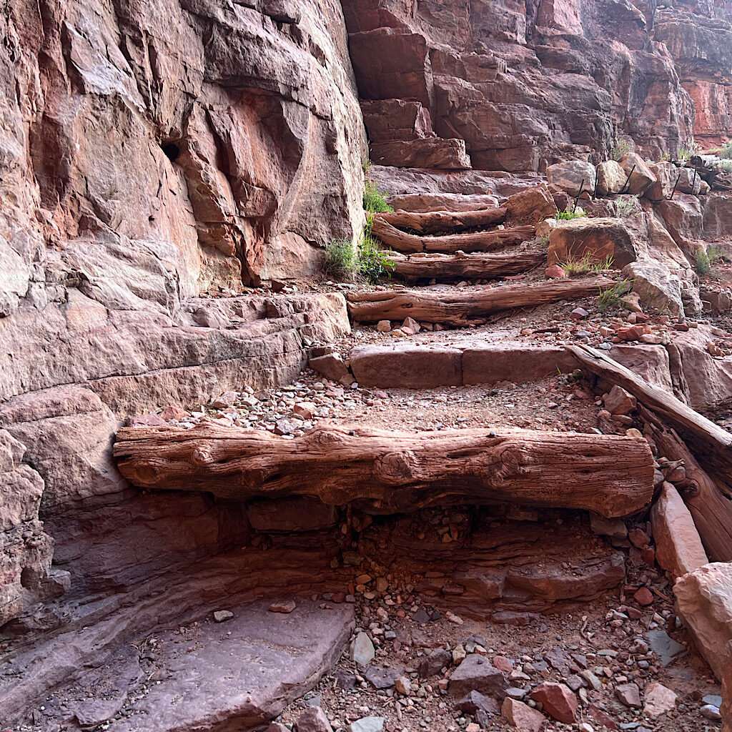
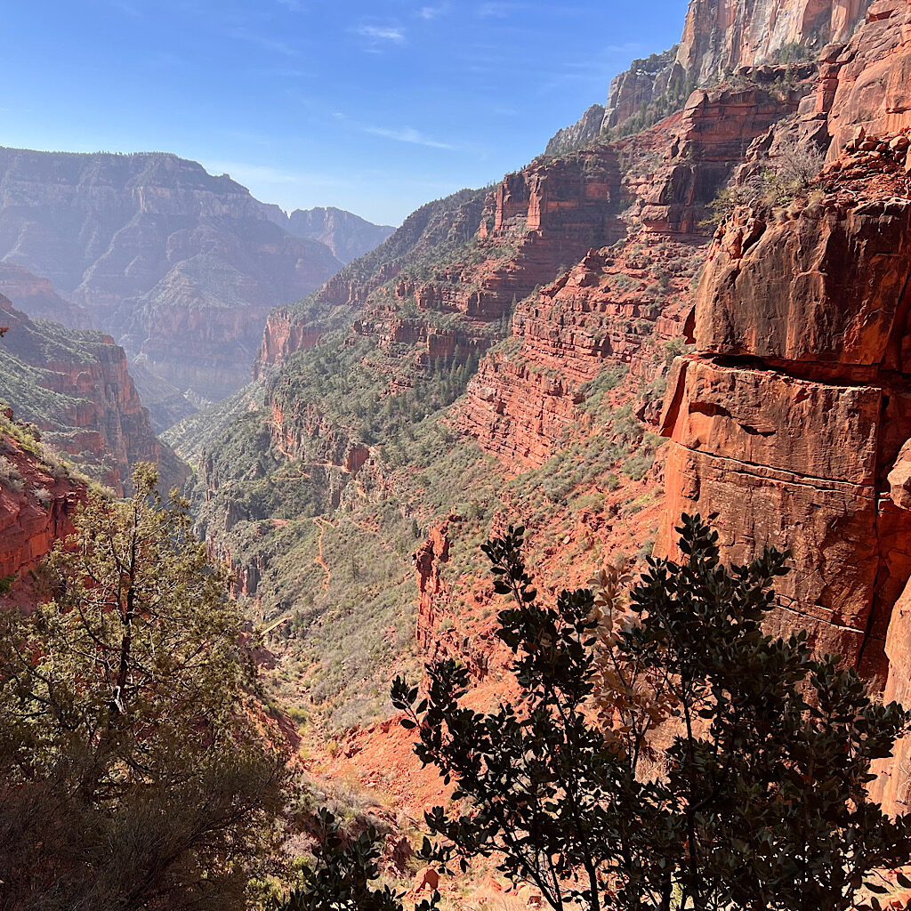
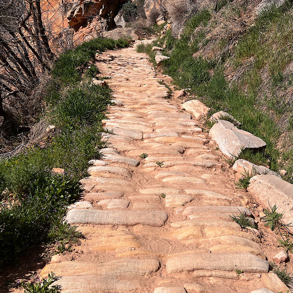
Right now, I pray for strength and endurance to get up these canyon walls. Truth is, the trail is spectacular. An engineering marvel, it’s set against the rock walls in such a way to look natural but has been blasted, seated and reinforced in place. Sure, it’s a work out to climb, but there’s nothing at all technical involved.
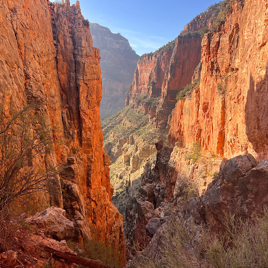
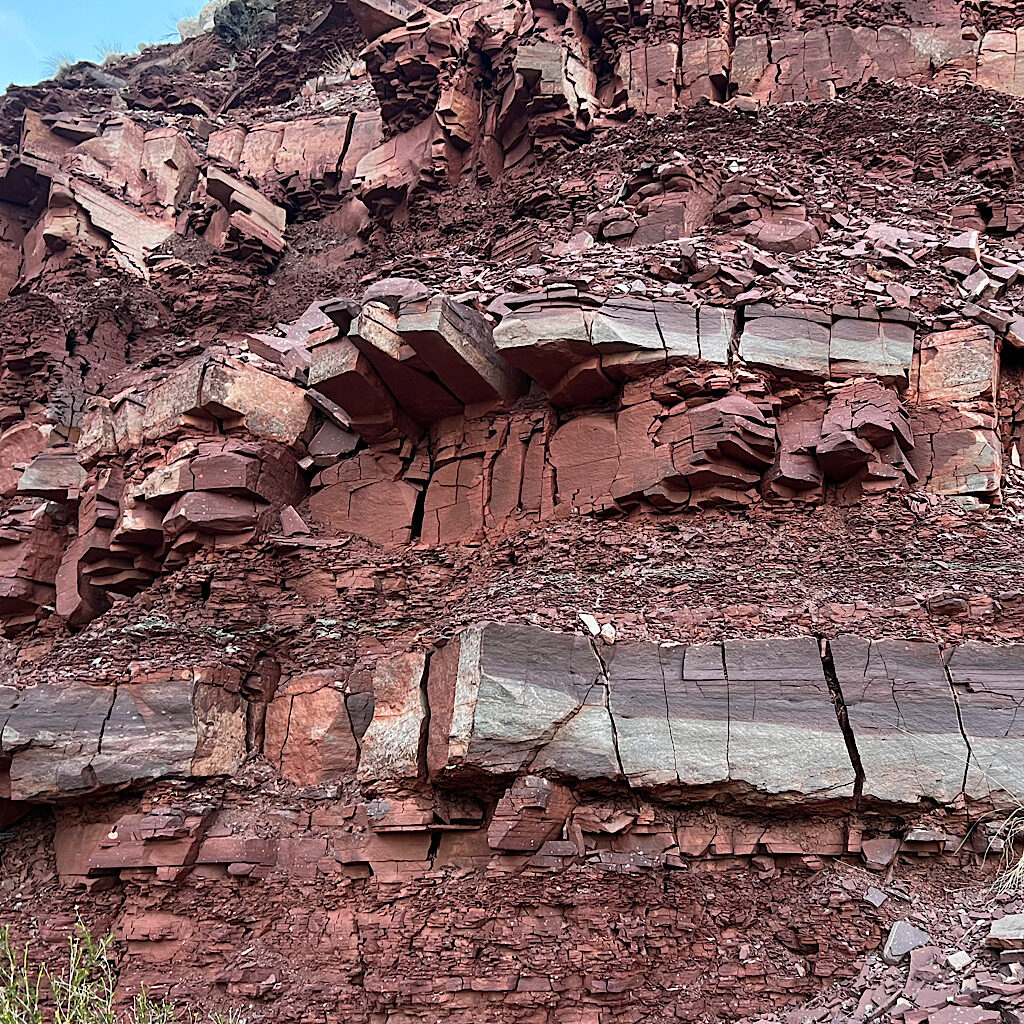
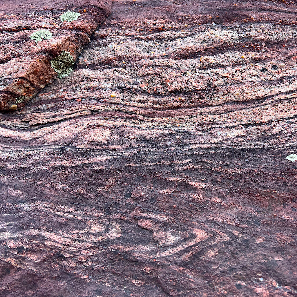
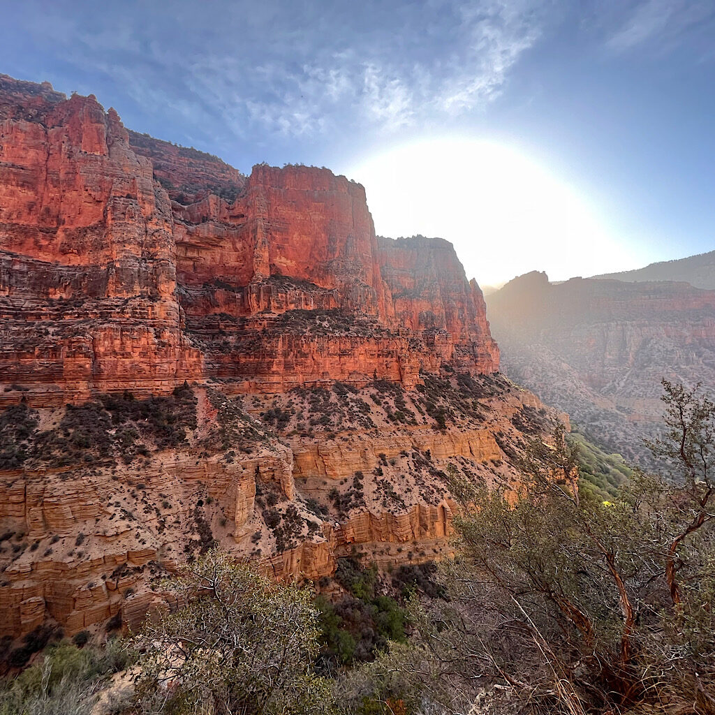
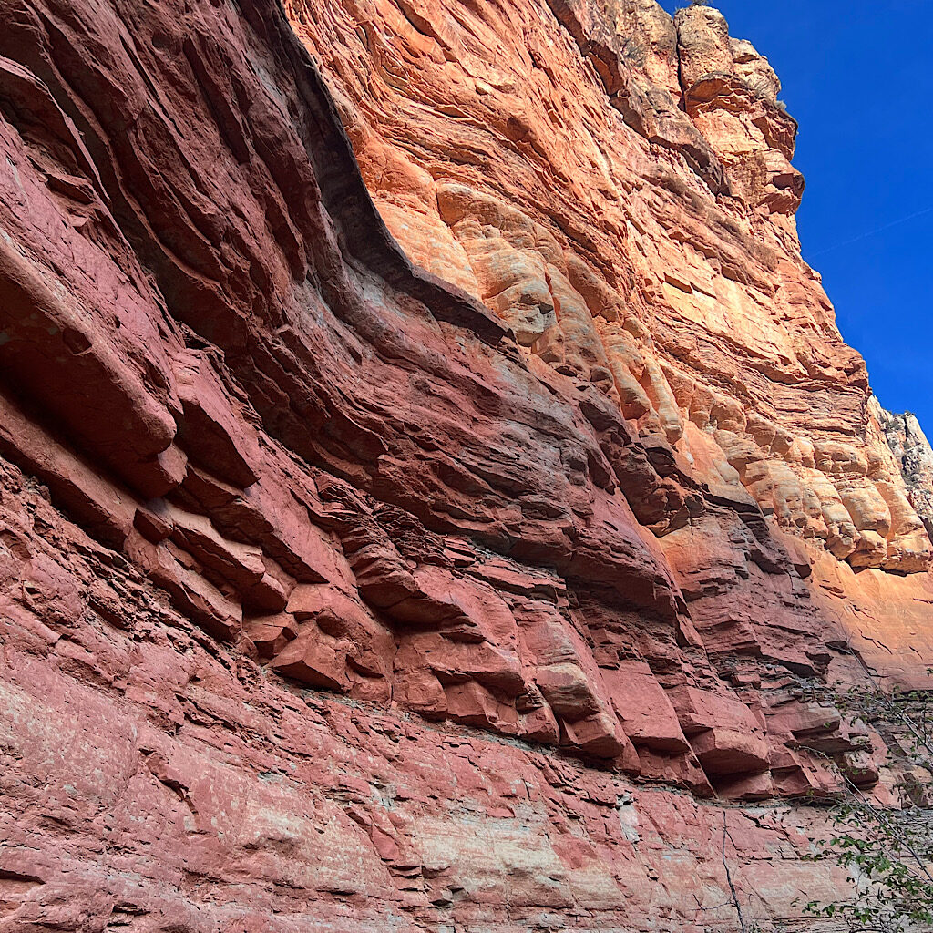
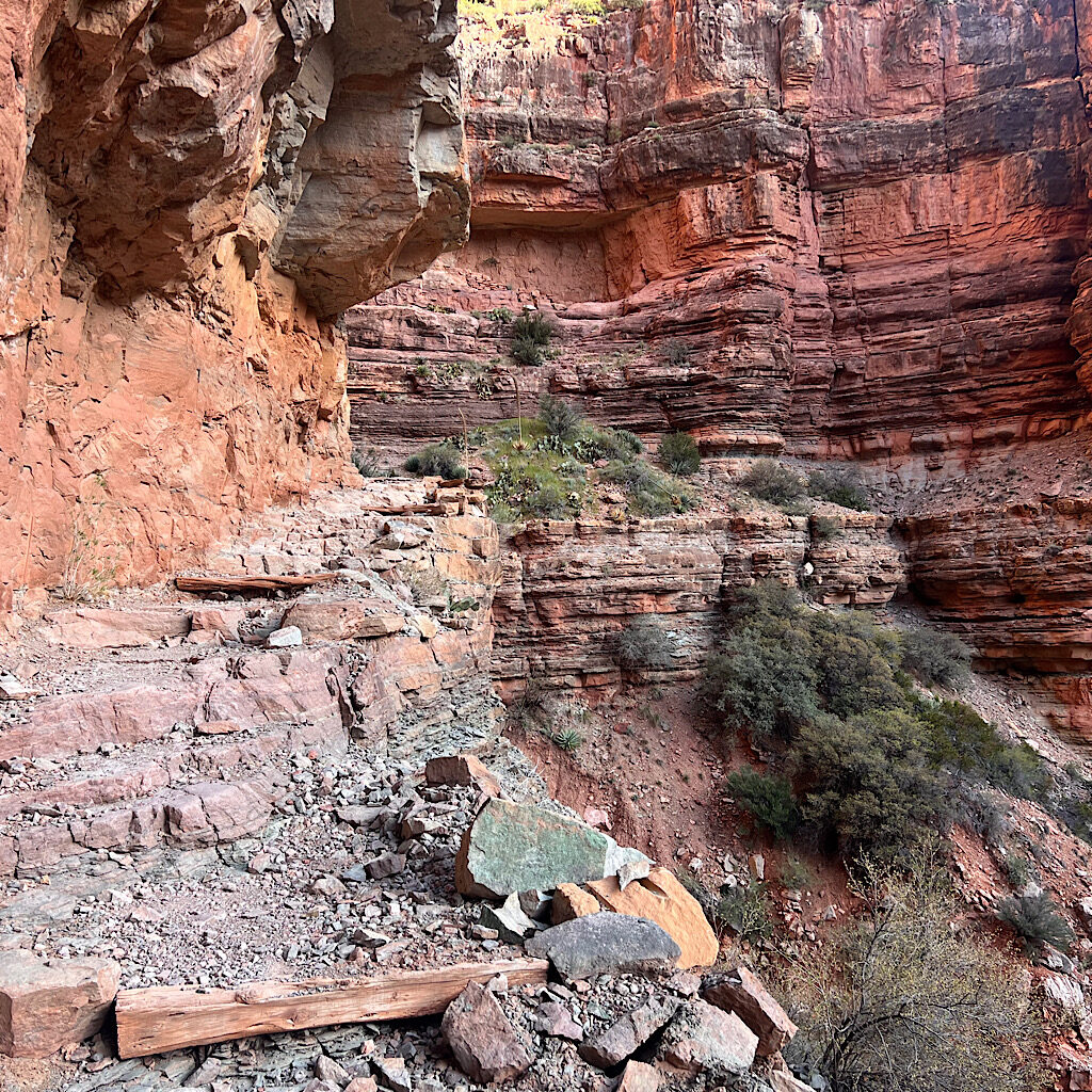
At first, it’s a gentle rise next to the roiling creek through high, red walls. The destructive forces that created this masterpiece are still at play in fallen rock and worn down edges I walk next to. The colors are brilliant and patterns fanciful.
I follow Bright Angel Creek through heaping mounds of rock slowly shredded apart by bushes snd trees. It’s light enough to see as the sun glows behind large ramparts. The trail is s gradual rise and I warm up to the challenge slowly.
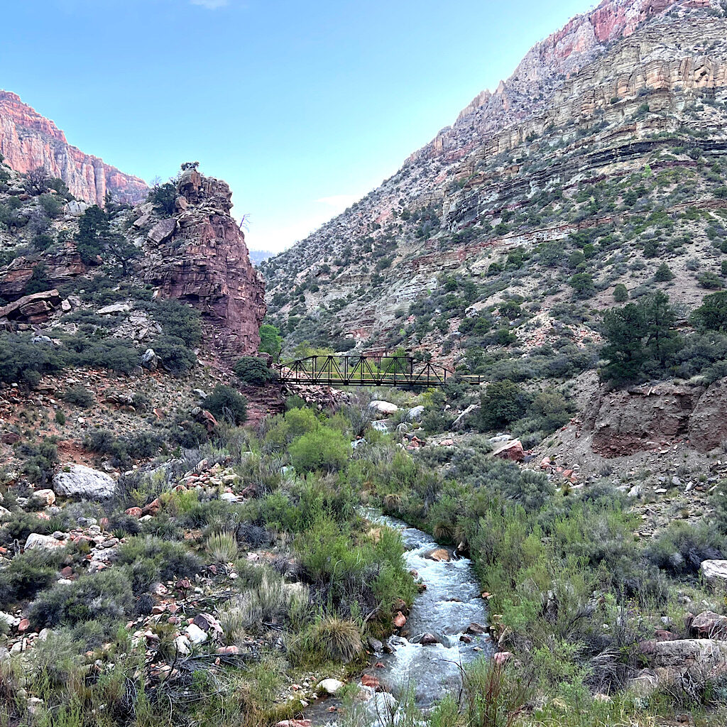
I quickly reach Manzanita with its beautifully built bridge taking me to a beautiful terrace of leafy trees and benches. I fill up a liter and gulp it down, then pack 2 1/2 to be safe. Sisu told me she likes to linger in the morning with coffee, but I walk so slowly, I’m surprised they haven’t caught up.
That means the canyon is all mine right now. No runners are clogging up the path today. It’s just me and the “fwee-fweeee” of a canyon wren.
The trail is steeper now, rising quickly in steep switchbacks above the pumphouse. This is one of the oddities of the canyon, how the zigzag of the trail seems to stack on top of itself as seen from above because the steepness is so dramatic.
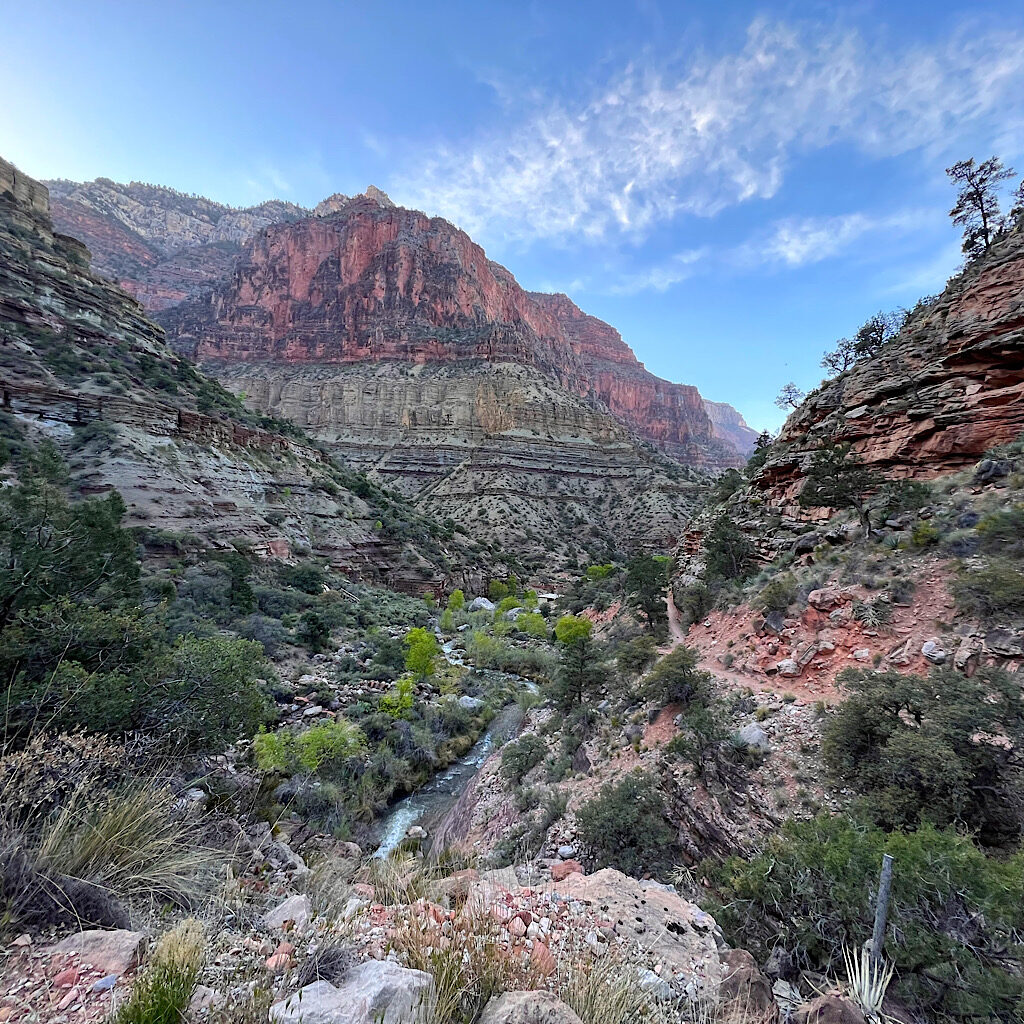
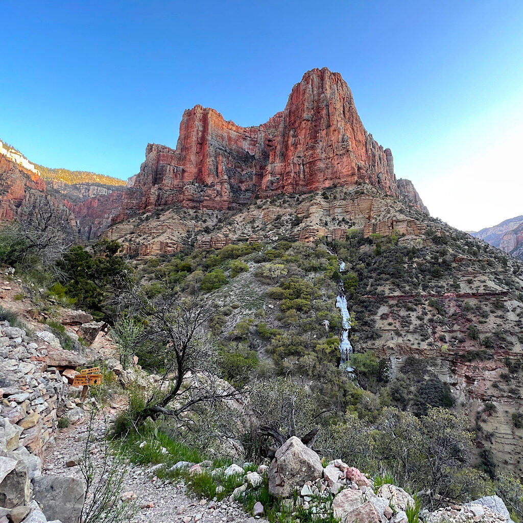
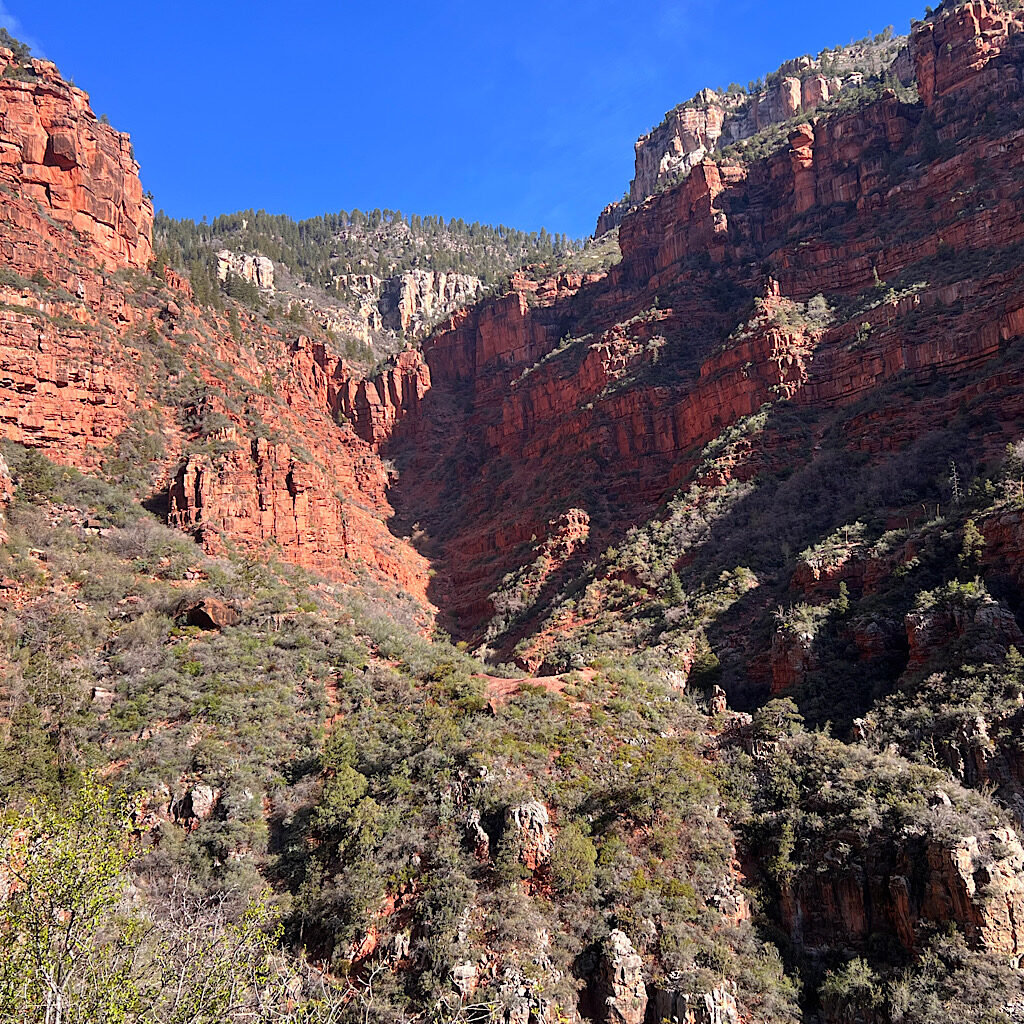
I move slowly, but steadily and find just the rhythm to fall in love with this magnificent tight canyon. I snap pictures, seeing all the way to the top when the trail turns to the left up a different canyon. Across from me is Roaring Springs, a cascade in full roar. I laugh when a trail spur points to it yet emphasizes there’s no water.
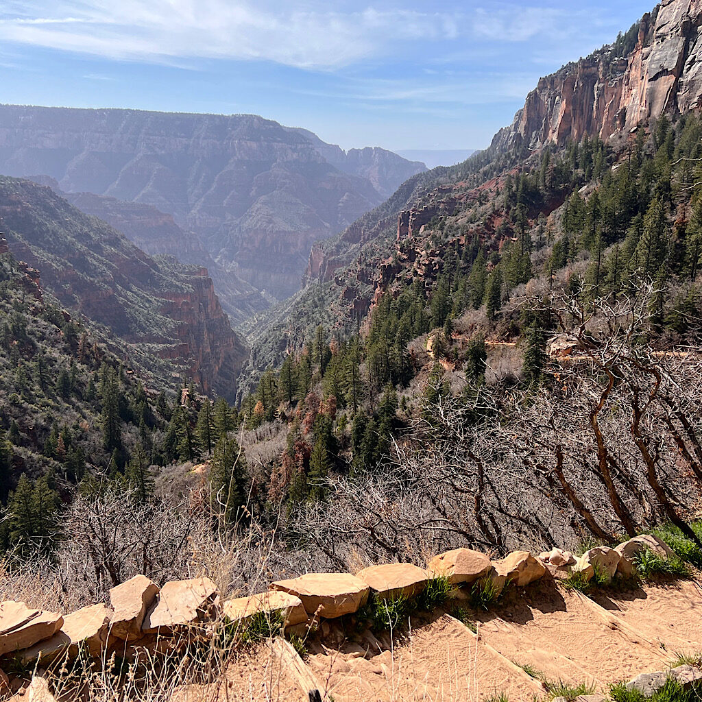
This will be the canyon that gets me to the rim. But how? I can only see s portion of trail in front of me. It follows the vertical rock wall, then seems to disappear. Sometimes it switches back, but other times, it’s hidden by the shape of the rock.
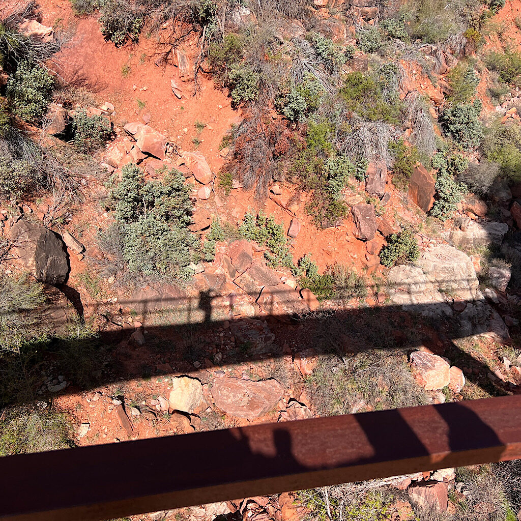
The trail is wide enough, but the edge is right there and a stumble could be catastrophic, the bottom hidden now in dark shadow. I’m very careful and hug the wall as it curves over me then around in a U-shape.
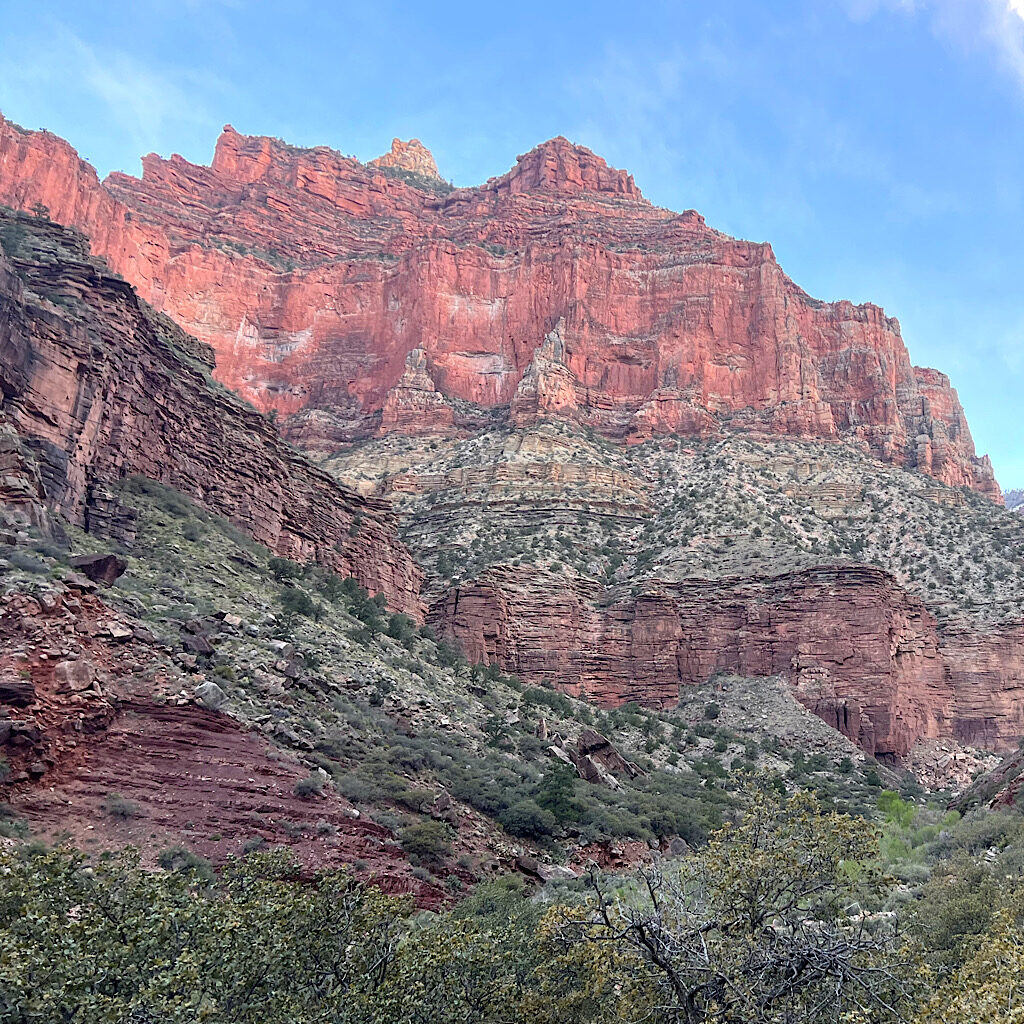
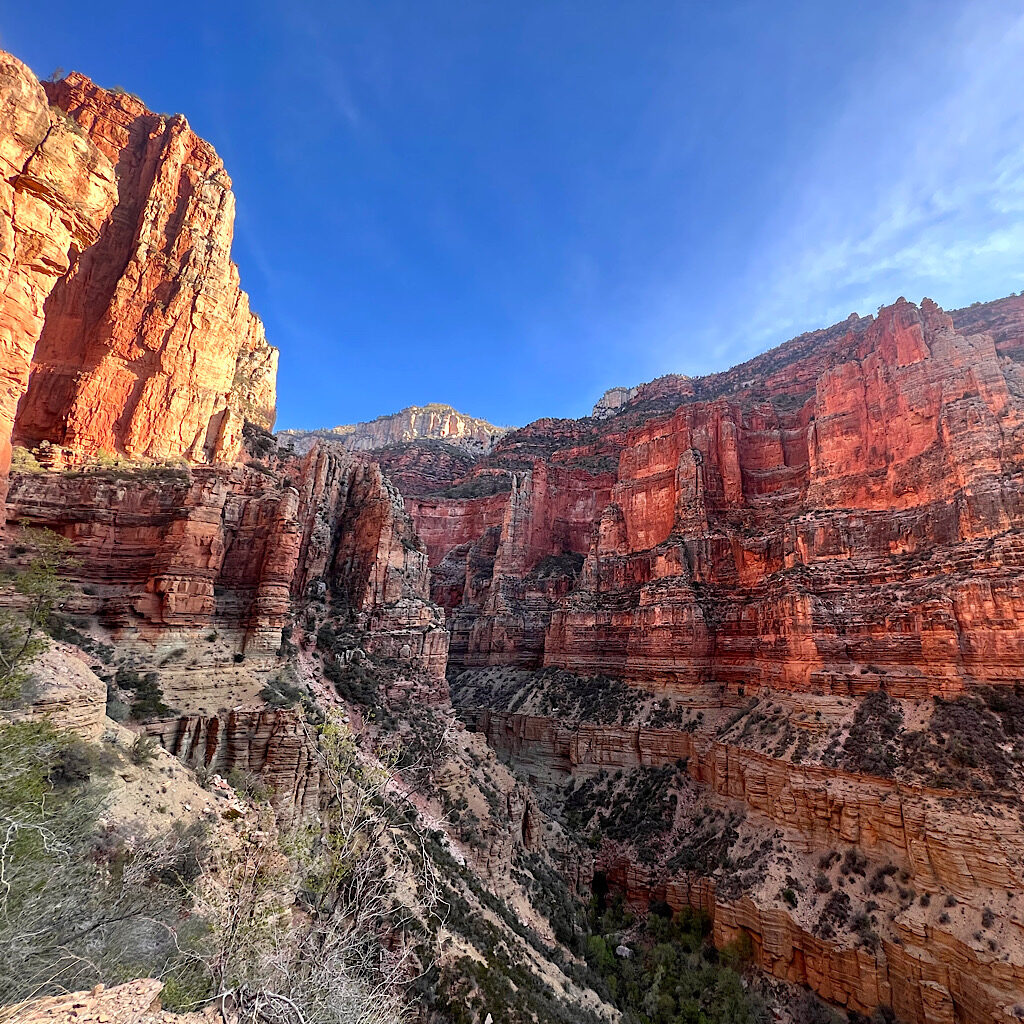
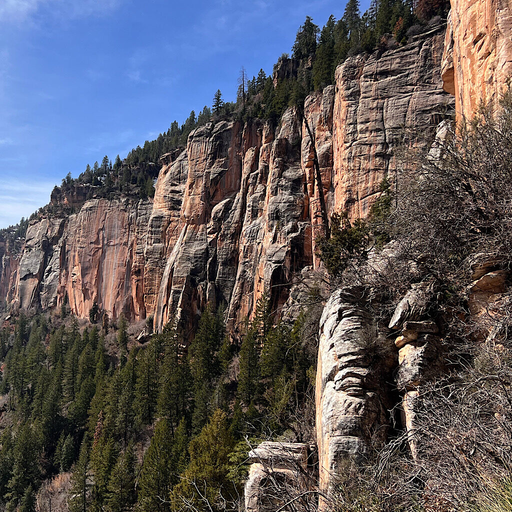
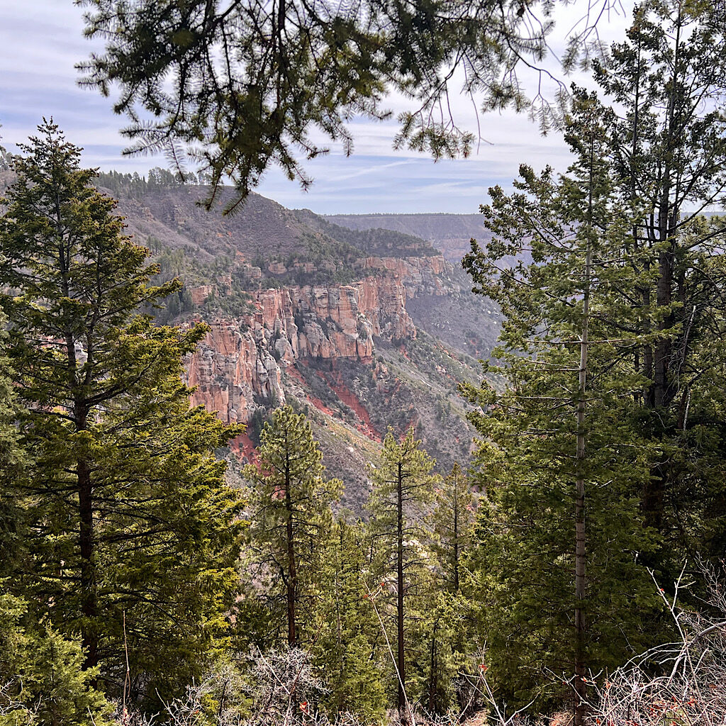
Logs create steps at one steep spot, that curves back on itself over a large promontory. I find a shady spot to drink a liter and eat a snack. As I’ve climbed higher into this colorful rock, I’ve seen the rim get ever so closer. It’s white rock atop red and appears absolutely vertical. In fact, most of the red rock ahead is adorned with towers and impenetrable buttresses.
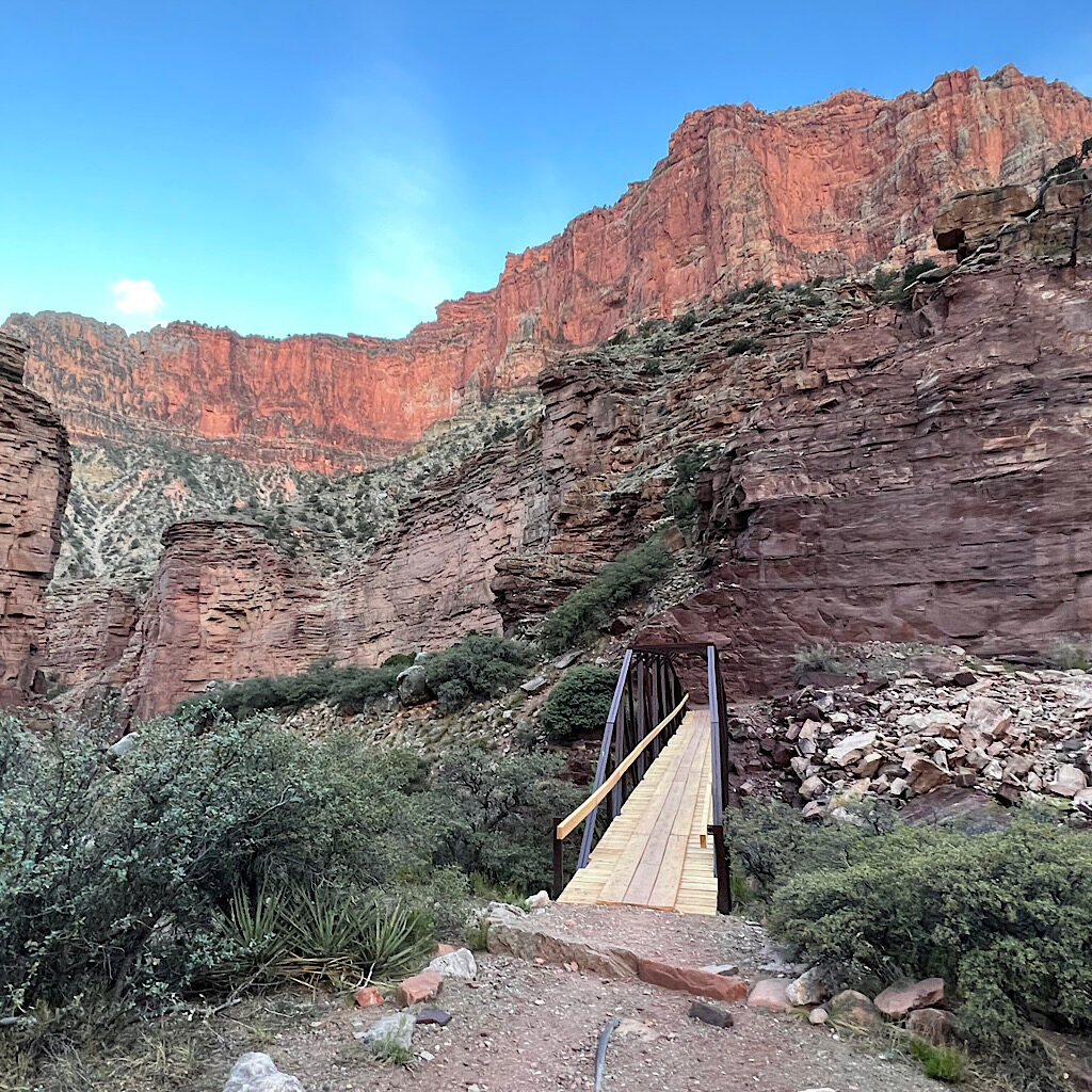
So far, I’ve mostly sidled the rock. Now it appears, the real climbing begins. But not before I descend steeply to a bridge across the canyon, taking me to the other, and better, side for the task at hand.
Now the real work begins with a series of steep zigzags bringing me closer to the wall that appeared unclimbable. The miracle of the engineering is the trail’s invisibility from below. As my path is revealed bit by bit, it creates a joyous tension that’s truly exhilarating. Each twist and turn is a surprise as I walk it, but also from the views revealed, sometimes of a 1,000 foot air space to the canyon floor.
Now, the joy is in the route revealed. How do we get past that giant rock? Why, a tunnel. the Supai Tunnel to be exact, another spiffy long-drop and water spigots that are off at the moment because of freezing temps.
I notice it is getting noticeably colder as I ascend. Patches of snow cling to the walls. I’ve finally met the white rock, but it’s not the very tip top. Above is dirt with massive pines. My ponderosa are back!
It’s still many zigzags to get closer to the trees. From above, the trail is visible. I come to the Coconino view and consider lunch here, but it’s cold so I settle for pictures and a last look. Volt and Sisu never catch up.
It’s sad pressing on, but bitter cold is coming and I need to get a move on. I wonder if I’ll remember these spectacular past two days, how hard it was, how elated I felt, the views and trail and friends, the sound of the rushing water and the drama of the brooding rock.
Just as I begin ascending, a man walks down. He looks too casual to be a runner. Jeff lives here, working for the National Park. He’s an EMT and wilderness ranger but mostly builds things. And now just taking a stroll.
I tell him about my plan to walk and avoid the cold and he assures me, there are other hikers walking the road, as well as park employees driving it.
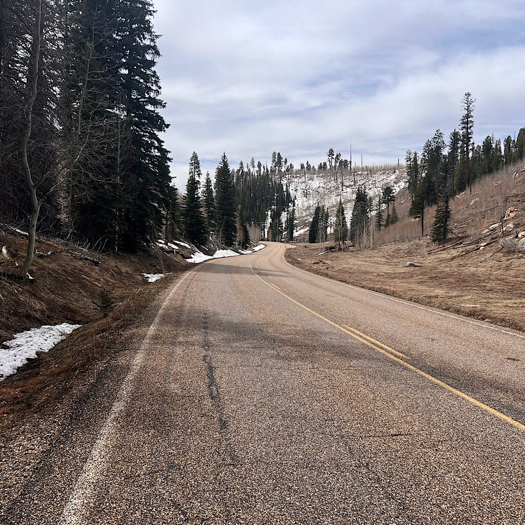
I head on and have lunch next to two large, black and hungry ravens. It’s cold and getting overcast, so I begin my journey. The ranger yesterday wasn’t totally wrong in that road walking is pretty unpleasant. It’s hard on the feet, but also the eyes. It’s a different forest here with aspen and fir, but early spring means a somber mix of melting snow and brown grass.
I last about three miles, then put my thumb out. Don’t get me wrong, I love to hike, but this kind of hiking serves no purpose but to transfer the hiker from one place to the next. It’s 43 miles to the next town and will be 16 degrees in two days.
A truck slows down and it’s Jeff! He is on his way to Jacob Lake, so no trouble to drop me. He tells me very few hikers hitch as we pass a few. There’s Waldo wrapped up in a scarf. I think that’s Clothesline and John the Baptist.
The landscape is lovely at a faster speed, though still awaiting spring. Jeff tells these beautiful alpine meadows turn brilliant green with millions of flowers for a brief moment, the aroma intoxicating. Now it’s straw brown and I can’t tell you how happy I am to skip it.
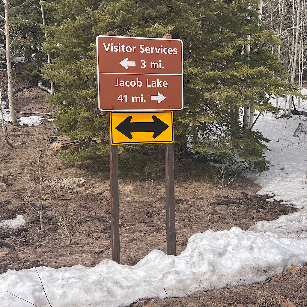
I hop back on trail near Jacob Lake, an ordinary forest again. It’s about 26 miles to the end, so one more night out and (hopefully) an early return home. There are many details to manage and I get distracted by them to the point I don’t pay attention to where I’ve entered.
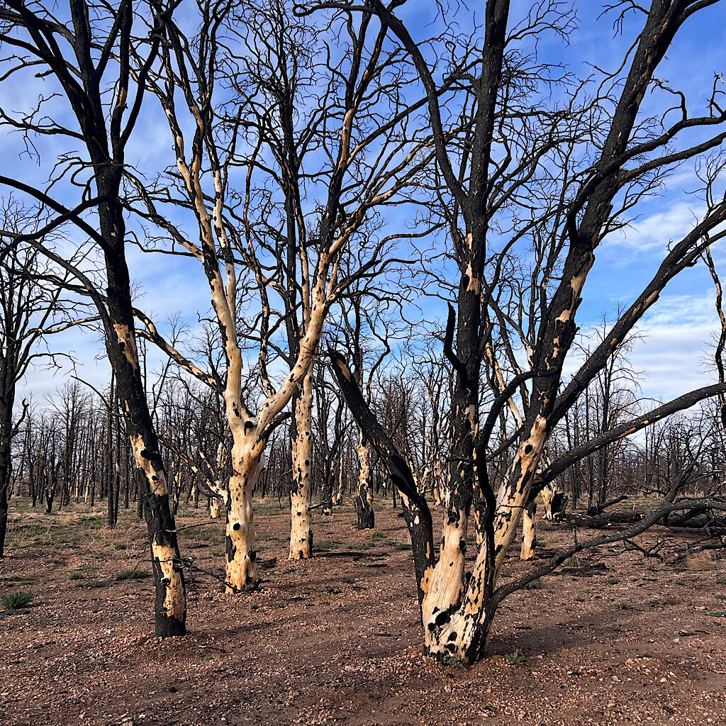
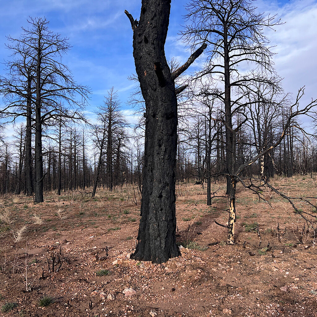
Just when it’s time to look for a camp spot, I walk into a burn zone. Tall trees are charred and make for an unsafe place to pitch a tent. The ground is ashy and everything is charred. I don’t quite have the daylight to walk through, but I push forward hoping to find an unburned area.
No such luck. The sootiness goes on and on. It makes me sad to see this waste, and it emphasizes my own ‘burn out.’ The Grand Canyon was such a charge and this just makes me depressed. It’s exactly why thru-hiking is beginning to seem absurd to me, all that walking through sameness just puts me off.
The trail dips down into a ravine, but rather than exit, it stays down there following a wash with logs reduced to cinders falling in. It’s not easy walking in gravelly sand and it goes on and on in this dark pit a long way.
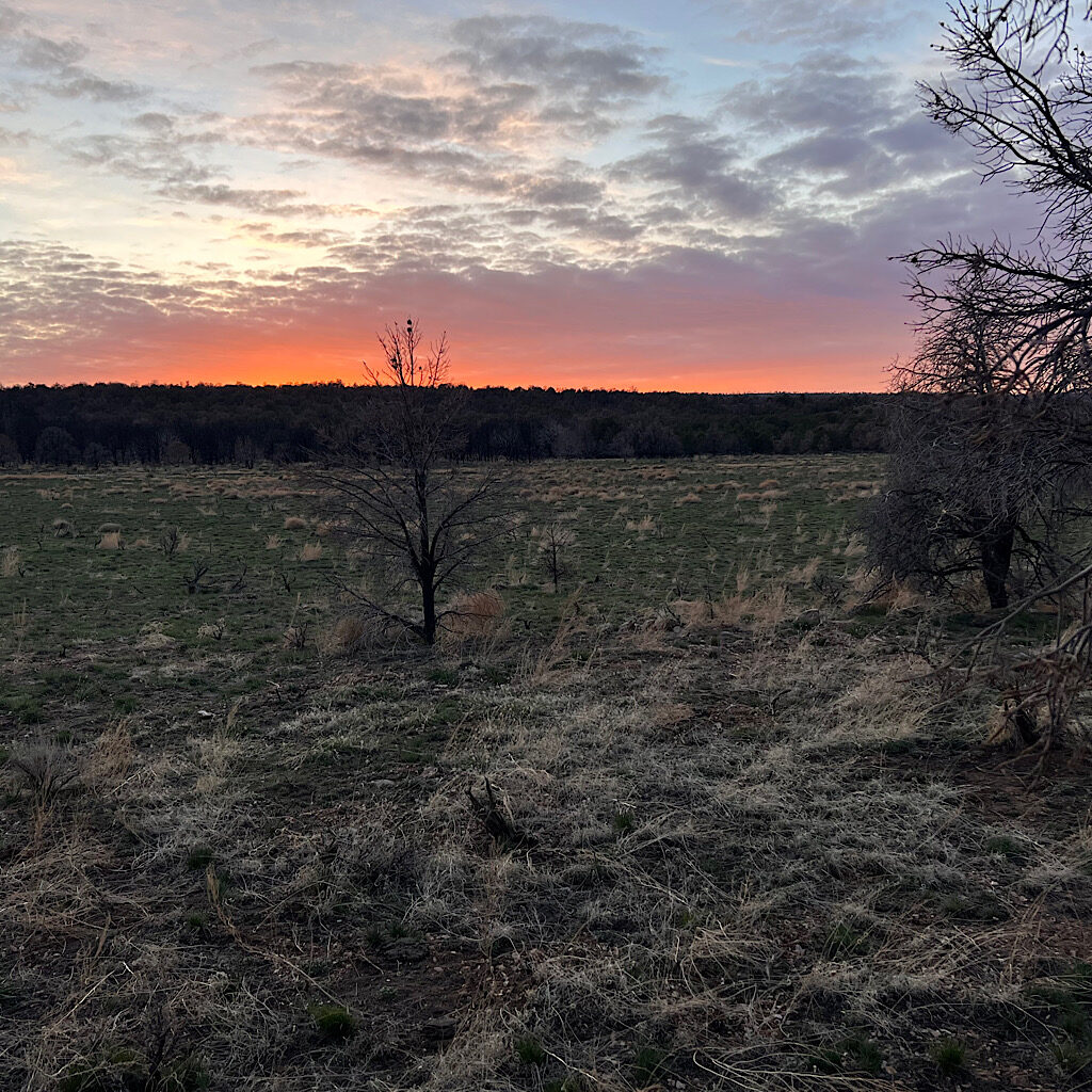
From road walk in a frigid forest to a ashy burn zone to a wash in a dark ravine, how is this fun? I can’t camp in here so keep walking seeing the contours flatten on the map. It’s a huge meadow of dried mud, lumpy from cattle’s footsteps. I follow the perimeter looking and looking as mountains appear ahead and the sun sets in pink and purple.
I finally choose a flattish spot and dive in quickly as it’s getting cold. This may very well be my worst camp site of the hike. It’s flat enough and absolutely silent, so perhaps I’ll sleep well. I’m tired from the climb and I’ll close my eyes now conjuring up the beauty and excitement of that moment, letting the bits that came after to act in service of simply getting me closer to putting this hike to bed.